More Than 100,000 Historic Maps for Classroom Use
Credit: David Rumsey Map Collection, David Rumsey Map Center, Stanford Libraries. Source 1. Source 2. In this week’s Practical Ed Tech Newsletter I mentioned that digital mapping tools is one of the areas of educational technology that I’m still passionate about after sixteen years and 17,000 blog posts. And making comparisons through the use of […]
Big Mistakes in Cartography

When I taught geography one of the first topics that I covered was map projections and how some of them can distort how we view the world. Of course, a good bit of attention was paid to the Mercator projection. Mercator’s world map is one of a handful featured in a new TED-Ed lesson titled […]
Create Animated Maps on Mult Dev – One of My New Favorites in 2021

I’m taking this week to recharge and get ready for the next session of the Practical Ed Tech Virtual Summer Camp. For the next few days I’m going to highlight some of my favorite new and new-to-me tools so far this year. Mult Dev is a free tool that lets you quickly create animated maps. In the time […]
800+ Persuasive Maps – And a Tool for Making Your Own

About a week ago Open Culture published an article about Cornell University’s Persuasive Cartography collection. I hadn’t seen that collection before so I went down a rabbit hole looking at map after map for a good 45 minutes. Persuasive maps aren’t maps that you would use to teach a classic geography lesson. That’s because persuasive […]
An Interactive Cartogram of News
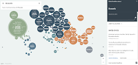
Unfiltered News is a new site that uses an interactive cartogram to help you find trending news stories from around the world. To find stories through Unfiltered News simply open the website and click on a topic listed within one of the circles on the map. Once you’ve made a selection a list of stories […]