How to Create Map Overlays
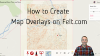
Felt was one of my favorite new tools in 2022. In fact, I liked it so much that I included it in my Best of the Web for 2022. Felt is a free multimedia mapping tool that I think is easier for first-time users to use than Google’s My Maps or ESRI’s mapping tools. Right […]
Three Tools for Creating Custom Maps Without a Google Account

Google’s My Maps is a great tool for designing custom maps. The problem with it is that students can only save their work if they have Google accounts. If your school uses G Suite for Education that’s probably not a problem, but it is a problem for students who don’t have G Suite accounts. If […]
10 Ways to Use Google Earth in Your Classroom
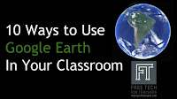
A couple of weeks ago Google released the new web-based version of Google Earth (take a tour of it here). The older desktop version of Google Earth is still available for free as well. The advantage of the web-based version is that anyone with a Chromebook or laptop can use it. The disadvantage to it […]
Global Forest Change Explorer – Trends in Deforestation
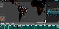
The Global Forest Change Explorer is a new Google Maps product that provides visualizations of patterns in global deforestation. The Global Forest Change Explorer was developed in conjunction with Science in the Classroom and Dr. Matt Hansen of the University of Maryland. On the Global Forest Change Explorer you can view patterns in deforestation and […]