
How to Create Custom Coloring Maps

There are plenty of places on the Internet to find free outline maps of states, provinces, countries, and regions of the world. Finding blank outline maps of cities, small towns, or neighborhoods is a little harder to do. If you’re looking for a blank map of a city, town, or neighborhood for your students to […]
Free Wall Maps for Your Classroom
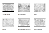
Like good manners and flannel shirts, wall maps never go out of style. If you need some new maps to put on the walls of your classroom, take a look at the free maps that National Geographic offers. Nat Geo Map Maker kits provide teachers with files for printing wall maps, table top maps, and […]
Free Printable Maps from the USGS and National Geographic
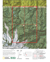
The United States Geological Survey creates topographical maps of the United States. The USGS maps can be downloaded for free from the USGS website. The USGS website can be a little tricky to use. Another option is to use National Geographic’s USGS map portal to find, download, and print maps. On that site you can […]
PAT – Free, Open Source, Portable Atlas

PAT is a free collection of maps developed by Ian Macky. The collection includes maps of every country in the world.The collection also includes maps of U.S. states, maps of Canadian provinces, Australian states, and regional maps. You can download any and all of these detailed maps for free. Applications for Education PAT is an excellent resource for geography and […]