Peaks and Valleys – An Interactive Story Map
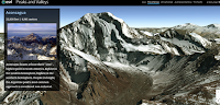
Peaks and Valleys is an interactive story map produced on the ESRI platform. As you scroll through the story map the highest peaks and lowest valleys on each continent are revealed in 3D renderings. As you scroll through the 3D imagery a sidebar pops-up. That sidebar contains a photograph of the peak or valley and […]