Five Tools for Telling Stories With Maps

One of my favorite alternatives to traditional book report assignments is having students create multimedia maps based on books they’ve read. Google Lit Trips first made that idea popular more than a decade ago. Of course, creating a multimedia map is also an excellent way for students to summarize and geo-locate a series of related […]
Acoustic Atlas – Sounds of the Wild West

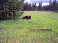
Acoustic Atlas is a Montana State University Library project that features an ArcGIS Storymap. The Acoustic Atlas storymap is an audio and visual tour of Montana’s four ecosystems. As you scroll through Acoustic Atlas you will see read text and see pictures of the four ecosystems. While scrolling you will also hear the sounds of birds, […]
Mapping Books

Yesterday I published a post about creating multimedia timelines as an alternative form of a book report. Later in the day I was walked past the little book store next to my favorite coffee shop and saw a copy of Louise Dickinson Rich’s book, We Took to the Woods. This is a classic in the […]
Mapping the Ingredients in Thanksgiving Meals

Last year on Thanksgiving I discovered an ESRI Storymap titled Where Does Your Thanksgiving Dinner Come From? Of course, having discovered it on Thanksgiving Day it was a bit too late to be useful so I’m sharing it again this year in advance of Thanksgiving. Where Does Your Thanksgiving Dinner Come From? displays where eight […]
Mapping the Thanksgiving Harvest

Where Does Your Thanksgiving Dinner Come From? is the title of an Esri Storymap. The storymap displays where eight popular Thanksgiving foods are grown and harvested in the United States. The storymap includes a map for each ingredient. Each map shows the locations of commercial producers. Fun facts are included in the storymap too. For […]

