10 Google Earth and Maps Activities for Math Lessons
I’m taking the week off to do a bunch of fun things with my kids. While I’m away the most popular posts of the year so far will reappear. Last week I shared directions for measuring perimeter and area in Google Earth. Doing that is one of many ways to incorporate Google Earth into mathematics […]
How to Install Google Earth Pro on a Mac

A few weeks ago I shared directions for adding Google Drive videos to Google Earth tours. The demonstration that I gave was done with Google Earth Pro on my Mac. That demo prompted an email from a viewer who needed some help installing Google Earth Pro on her Mac. To answer that email I made […]
57 Google Earth & Maps Tutorials for Teachers and Students
Upon the publication of my latest video about how to add Google Drive videos to Google Earth Pro my playlist of tutorials on using Google Earth and Google Maps grew to 57. In my playlist of 57 Google Earth and Maps tutorials you’ll find directions for everything from the basics of navigation to creating historic […]
How to Create Around the World With Google Earth Tours
The Amazing Race is the only reality game show that I’ve watched with interest for as long as it has been on television. Years ago I created a classroom game based on the same premise of the show. This spring I updated that game with some new graphics and new challenges and then published it […]
How to Add Google Drive Videos to Google Earth Pro Placemarks
Last week a reader emailed me to ask for help inserting videos into placemarks in Google Earth Pro. His students had recorded videos and saved them in Google Drive. They wanted to use them in their Google Earth Pro placemarks. I was happy to help. Before giving you the directions for how to add Google […]
48 Digital Mapping Tutorials
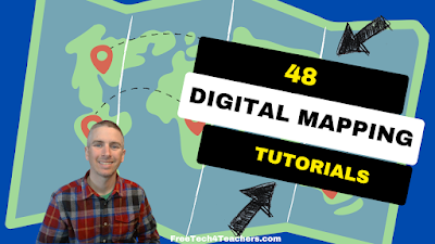
Even though I write a lot about Google Earth and Google Maps, there is more to digital mapping than just using those tools. In fact, there are some great digital mapping tools not made by Google that students can use to create things like historic map overlays, map and timeline combinations, and map-based stories. In […]
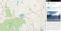
GE Teach – Make Side-by-Side Map Comparisons in One Browser Tab
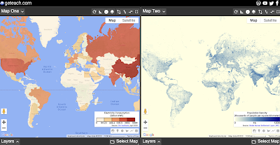
GE Teach is a great map tool that is developed and maintained by a high school teacher in Texas named Josh Williams. GE Teach has gone through a bunch of iterations over the years and the latest version is better than ever. On GE Teach students can compare two maps side-by-side. Students can select from gallery […]
Ten Google Earth and Maps Activities for Math Lessons

Last week I shared directions for measuring perimeter and area in Google Earth. Doing that is one of many ways to incorporate Google Earth into mathematics lessons. Making that video prompted me to make a list of ways to use Google Earth and Maps (which has similar measuring tools) in mathematics lessons. Here’s my list […]
How to Measure Perimeter and Area in Google Earth
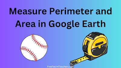
As I mentioned in this week’s Practical Ed Tech Newsletter, Google Earth and digital mapping is an area of ed tech that I still get excited about after all these years. Google Earth is a tool that people often think of as being something that’s only useful for social studies lessons. However, there are many […]
Create Historic Map Overlays With These Free Tools
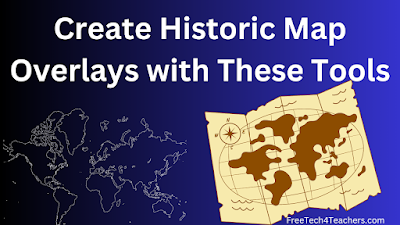
Yesterday morning I shared a collection of more than 100,000 historic maps for classroom use. In that post I mentioned using those maps to create digital overlays on current maps. Google Earth provides a couple of ways to do that. Felt.com is another digital mapping tool that can be used for the same purpose. In […]
How to Record a Google Earth Tour
The Amazing Race is the only reality game show that I’ve watched with interest for as long as it has been on television. Years ago I created a classroom game based on the same premise of the show. Last spring I updated that game with some new graphics and new challenges and then published it […]
How to Measure in 2D and 3D in Google Earth
More than a decade ago Tom Barrett’s Maths Maps inspired me to start thinking about how Google Maps and Google Earth can be used in mathematics lessons. Since then I’ve developed some of my own math activities that incorporate measuring in Google Earth. If you’d like to create your own math lessons that incorporate measuring […]
45 Digital Mapping Tutorials

This month I’ve been spending some time organizing the tutorial videos on my YouTube channel. To that end I’m creating playlists that are organized thematically. The latest playlist that I’ve created is titled Digital Mapping. The playlist currently contains 45 tutorial videos covering more than just Google Maps. In the playlist you’ll find tutorials on […]
I’m Feeling Lucky – Around the World With Google Earth

Google Earth is one of my all-time favorite tools for teaching geography and history lessons. Two of my favorite ways to use Google Earth in the classroom are outlined below. From voyages to games to simple measuring tools, the web version of Google Earth has a lot of neat features that can help students learn […]
Five Digital Mapping Tools That Aren’t Made by Google

Google Earth and Google’s My Maps are great tools for students to use to create multimedia maps. But Google isn’t the only game in town when it comes to digital map creation tools. In fact, there are some good ones that are freely available to you and your students outside of what Google offers. Here’s […]
Plate Tectonics and a Search Lesson

This is a post from my archives that fits with the theme of Geography Awareness Week. This morning I responded to a Tweet from someone who was looking for “plate tectonics virtual experiences for students.” My mind immediately went to using Google Earth. A quick search in my archives and I found this lesson plan […]
A Google Earth Lesson With the “I’m Feeling Lucky” Button
Since it is Geography Awareness Week I thought I’d pull a lesson plan from my archives to share with you. From voyages to games to simple measuring tools, the web version of Google Earth has a lot of neat features that can help students learn about the world. One of those neat features is the […]
Math and Geography

Over the weekend a Tweet from Thomas Petra reminded me of a great Google Earth resource that he developed years ago. That resource is Real World Math. And though he stopped updating it a couple of years ago, there are still many Google Earth files on it that you can download to use as the […]
Record a Tour in Google Earth

The Amazing Race is the only reality game show that I’ve watched with interest for as long as it has been on television. Years ago I created a classroom game based on the same premise of the show. This spring I updated that game with some new graphics and new challenges and then published it […]
My Top Ten Tools for Social Studies Teachers and Students

A few years ago I published a list of my favorite tools for social studies teachers and students. Since then a few things have changed, namely Google has shuttered a couple of cool tools, so I think it’s time to update the list. In no particular order, here are my top ten tools for social […]
How to Create an Around the World With Google Earth Tour

The Amazing Race is the only reality game show that I’ve watched with interest for as long as it has been on television. Years ago I created a classroom game based on the same premise of the show. This spring I updated that game with some new graphics and new challenges and then published it […]
Timelapse and Virtual Field Trip – The Great Salt Lake

This morning my attention was grabbed by a BBC video titled Utah’s Great Salt Lake is Running Out of Water. It’s a fascinating video about the conditions that have contributed to the Great Salt Lake shrinking by nearly two-thirds in this century. Spoiler alert: drought isn’t the biggest contributor to the shrinkage. Watching the BBC’s […]
How to Change Map Styles in Google Earth – And Why

The web version of Google Earth has improved a lot since its launch five years ago. One of those improvements is found in the number of ways that you can customize the map style displayed when you are viewing and creating projects in Google Earth. In this new video I demonstrate how to change the […]
A Google Maps and Earth Activity for Art Classes

When I conduct workshops on Google Maps and Google Earth I always point out that the uses for those tools extend beyond the realm of geography and history. One example of using Google Maps and Earth outside of the typical geography setting is using Google Maps and Earth to have students place art and artists on an interactive […]
My Three Favorite Google Tools for Social Studies Teachers and Students

As longtime readers of this blog know, my background is largely in social studies with a smattering of teaching computer science and doing some corporate training. It’s teaching social studies that will always be my first professional love. I’ve also been using Google Workspace tools with students (previously G Suite, previously Google Apps, previously Google […]
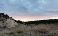
Five Google Earth Activities to Get Kids Interested in the Outdoors

In last week’s Week in Review I mentioned a new book titled Outdoor Kids in an Inside World. In the book Steven Rinella presents a lot of ideas for getting kids interested and involved in learning about nature. In the first chapter he presents a big list of ideas for things that you can do […]
How to Create a Custom Map on an iPad

Yesterday morning I answered an email from a reader who wanted to know if it was possible to create Google Earth projects on an iPad. Unfortunately, the iPad version of Google Earth allows you to view existing projects, but doesn’t allow you to create new projects. Fortunately, there are other ways to create custom maps […]
Ten Fun Things for Students to Map

Last week I published a video about how to record a Google Earth tour in your web browser. That’s just one of many tools that students can use to create multimedia maps. A few other options include using Scribble Maps, Padlet maps, and Google’s My Maps tool. Creating a map with one of these tools […]
How to Record a Google Earth Tour in Your Web Browser

The online version of Google Earth has improved a lot since it was first launched back in 2017. Unfortunately, it still doesn’t have a built-in recording tool like the one found in the desktop version of Google Earth. The solution to that problem is to create a project in the web version of Google Earth […]
How to Add Videos to Google Earth Projects
I’m currently developing a lesson plan that is loosely based on the reality television show, The Amazing Race. In my lesson students have to use a series of clues to find locations in Google Earth and then complete a task or challenge before adding a placemark to their Google Earth projects (tours). They have to […]
How to Link Within Google Earth Projects

Google Earth in all its forms has been one of my favorite educational technology tools for well over a decade. The web version of Google Earth has improved significantly since its launch five years ago. One of the relatively new features of the web version of Google Earth is the ability to link to places […]
Three Great Google Maps Features for Teachers

Google Maps is one of my favorite tools to use in history and geography lessons. I’ve been using it for at least as long as I’ve been writing this blog (15 years). Like all Google products it has evolved over time and some features have gone away while others have been added. And there are […]
My Big List of Activities and Resources for Geography Awareness Week
This week is Geography Awareness Week. It’s one of my favorite weeks of the year! Every year at this time I publish an updated list of some of my favorite games, activities, tools, and lessons to promote geography awareness. Here’s my updated list for 2021. The first place to start a search for geography awareness […]
How to Overlay Historical Maps on Current Maps
Next week is Geography Awareness Week. Google Earth is my favorite educational technology tool to use to teach history and geography lessons. And one of my favorite things to do with Google Earth is to overlay historic maps onto current maps. It’s a great way for students to see how borders have changed over time, […]
How to Share Specific Google Earth Views and Turn Them Into Assignments

Google Earth has a lot of great little features that sometimes get overlooked. One of those features is the ability to share a specific location and view of that location. In fact, you can share a specific location and view directly into your Google Classroom. When you share it you can share it as an […]
I’m Feeling Lucky – A Google Earth Lesson

From voyages to games to simple measuring tools, the web version of Google Earth has a lot of neat features that can help students learn about the world. One of those neat features is the “I’m Feeling Lucky” button that is found on the left hand toolbar in Google Earth. Clicking that button will take […]
Five Google Earth Features for Teachers

Google Earth has been one of my favorite ed tech tools for more than a decade. Over the years it has evolved as a desktop application and as a browser-based application. The web browser version of Google Earth seems to be getting the bulk of development attention from Google these days so I’ve created a […]
Five Ideas for Using Google Earth & Maps for More Than Social Studies Lessons

Later this week I’m conducting an online professional development workshop about Google Earth and Maps. One of my goals for the workshop is to help participants develop ideas for using Google Earth and Google Maps for more than just geography and history lessons. To that end I’ve put together a short list of ideas and […]
Five Activities for Teaching and Learning With Primary Sources

As a history teacher one of my favorite yet challenging things to do was introduce my students to primary sources. It’s great because it reveals to them a whole new world of research opportunities. There’s nothing better than a student saying, “wow! Mr. Byrne, look at this!” At the same time learning to read, evaluate, […]
A Handful of Resources for Learning About the Start of the American Revolution

Tomorrow is Patriots’ Day here in Maine, in Massachusetts, and in a handful of other states. It’s a day to mark the anniversary of the Battles of Lexington and Concord, the first battles of the American Revolutionary War. As a good New Englander with an appreciation of history, every year at this time I like […]
How to View Timelapse Imagery in Google Earth

This week Google made a big announcement about the introduction of new timelapse imagery to the web version of Google Earth. The imagery is part of the “Voyages” section of Google Earth. Within Voyages you’ll find the new timelapse imagery arranged into stories and collections. You can also just browse through it on your own. […]
Tour Creator is Closing – Here Are Some Alternatives

Like thousands of other people, this week Google sent me a reminder that Tour Creator is shutting down at the end of June. I’ve enjoyed making virtual reality tours with it since the first day it was available. I’m disappointed that Google is shutting it down, but there’s no sense crying over spilled milk so […]
A Video Tour of 17th Century London in 3D

This morning I read a BBC article about the rediscovery of the oldest 3D map in Europe. The map is a roughly 5 x 6.5 foot slab of carved rock. Reading that article prompted me to start looking in my archives for collections of historical maps. While doing that I came across a video that […]
A Crash Course in Google Earth & Maps

Last week I held a webinar titled 5 Google Earth & Maps Projects for Social Studies. After the webinar I realized that there was a lot more that people wanted to know about using Google Earth and Google Maps in social studies lessons. That’s why I put together a new on-demand course titled A Crash […]
Webinar Tomorrow – Google Earth & Maps Projects for Social Studies

One of the primary ways that I’ve been able to keep Free Technology for Teachers going for the last couple of years is through the registration fees for my Practical Ed Tech webinars and courses. I haven’t held one in 2021. That will change tomorrow when I host Five Google Earth & Maps Projects for […]
Some of my Favorites – Historic Maps in Google Earth

This week is school vacation week here in Maine. I usually take this week off to go ice fishing on Moosehead Lake. Unfortunately, that’s not happening this year. Instead I’ll be “staycationing” and working on some projects around home. While on my staycation I’ll be sharing some of my personal favorite tools and blog posts. […]
Vintage Travel Posters and Google Earth
The Library of Congress offers thousands of historical images and maps that students can download and reuse for free. Most of the images and maps are found in these digital collections. Some of those images are arranged in collections on the LOC site in a section appropriately titled Free to Use and Reuse Sets. It’s […]
How to Move Google Tour Builder Files Into Google Earth

Last week Google announced that support for Google Expeditions and Google Tour Builder would end in July 2021. I’ve already published a preliminary list of alternatives to Google Expeditions. If you’re looking for alternatives to Google Tour Builder you don’t need to look much further than to Google Earth. Google Tour Builder includes two options […]
How to Find Google Earth Files Without Endless Browsing

This morning I responded to a Tweet from someone who was looking for “plate tectonics virtual experiences for students.” My mind immediately went to using Google Earth. A quick search in my archives and I found this lesson plan calling for using Google Earth to teach plate tectonics and I found this Google Map filled […]
Ten Ideas for Using Google Earth in Your Classroom

In this week’s Practical Ed Tech Tip of the Week newsletter I mentioned that in my free handbook I have a list of ideas for using Google Earth in your classroom. If you’re not subscribed to the newsletter or you are and you didn’t have a chance to scroll through the handbook, here’s an excerpt […]
A New Collection of 17,000+ Historical Maps and Images

Flickr’s The Commons is a great place to find all kinds of interesting historical photographs from museums and libraries all over the world. Recently, The British Library added a new collection of maps to Flickr’s The Commons. The new collection is called the King’s Topographical Collection and it contains more than 17,000 historical maps and images […]
5 Digital Mapping Activities

On Monday I shared a couple of tutorials about measuring distances in Google Maps and Bing Maps. Yesterday, I shared a few resources for helping students understand map projections. This morning, I have some more tutorial videos that might help or inspire you to create digital mapping activities to use in your geography or history […]
Lessons on Map Projections

The maps pages and education pages of the USGS should be bookmarked by anyone who teaches geography. One of my go-to pages within the USGS education site is this collection of 27 ideas for teaching with topographic maps. In the list of lesson ideas you will find suggestions for lessons about typical geography topics like […]
10 Fun & Challenging Geography Games for Students of All Ages

We’re halfway through 2020. This week I’m taking some time off from the blog to work on some other projects. The rest of this week I’m going to re-run some of the most popular posts and videos of the year so far. Making lists like this isn’t my favorite thing to do nor is it […]
An Easy Way to Overlay Historical Maps on Google Earth

Last fall I published a video about how to find historical maps and overlay them on Google Earth. That method works for any historical map that you have the rights to re-use whether because it’s in the public domain or because of Creative Commons licensing. There is another method that you can use. That method […]
5 Things Students Can Do in Google Earth Without Google Accounts

Google Earth has many handy little features that your students can use even if they don’t have Google accounts. Without a Google account your students can customize the appearance of Google Earth, measure distances and areas, change the units of measurement, and share locations and Street Views with you. Of course, they can also use […]
Five Tools for Telling Stories With Maps

One of my favorite alternatives to traditional book report assignments is having students create multimedia maps based on books they’ve read. Google Lit Trips first made that idea popular more than a decade ago. Of course, creating a multimedia map is also an excellent way for students to summarize and geo-locate a series of related […]
Webinar Recording – Intro to Teaching History With Technology

Yesterday afternoon I hosted a free webinar titled Intro to Teaching History With Technology. This webinar featured my Discovery, Discussion, Demonstration framework in the context of history and geography lessons. As the name implies, the webinar provides an introduction to some of the key topics in my online course, Teaching History With Technology. If you […]
Two Great Sets of Historic Maps to Use and Reuse

The Library of Congress offers a collection of images that are free to use and reuse. The LOC blog recently featured a subset of that collection called Maps of Cities. Maps of Cities is one of two sets of historic maps available through the Free to Use and Reuse collection. The other set of maps […]
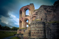
The Geometry of Castles – A Math Lesson in Google Earth

In the web browser version of Google Earth there is a section called Voyager. Within the Voyager section you’ll find lots of pre-made tours, quizzes, and activities. One of those activities is called The Geometry of Castles. The Geometry of Castles is a Google Earth Voyage that you can use to teach short lessons on […]
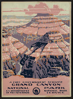
National Parks Games and Challenges – Try Virtual National Parks Bingo

I love the National Parks service that we have here in the U.S. One of the things I’m looking forward to doing with my kids when they’re a little older is to help them explore some of the places in National Parks and National Forests that I’ve enjoyed in my life. My love of the […]
USGS Offers Online and Hands-on Learning from Home Resources
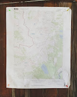
Since I was in elementary school I have enjoyed looking at maps and day dreaming about the places those maps depict. I like maps so much I have a couple of USGS topographical maps on the wall in my office. So whenever the USGS emails me with something new, I immediately investigate it. The latest […]
Google Earth Now Works in Firefox, Edge, & Opera!

I shared this news in my podcast earlier today, but just in case my podcast isn’t the first thing you listen to in the morning, I’m excited about the web version of Google Earth finally being available in Firefox, Edge, and Opera. The Tech Lead Manager and a software engineer for the Google Earth announced […]
7 Google Product Updates to Note from November
The end of November is here. During the last month Google announced a bunch of updates to many of the products frequently used by teachers and students. I covered many of them during the month, but there were a few that I missed. And there are few updates to the original updates from earlier this […]
Three Ways to Collaboratively Create Multimedia Maps
With Padlet’s new multimedia mapping tool and the recent update to the web version of Google Earth there are more ways than ever for students to collaborate on creating multimedia maps. The three collaborative multimedia mapping tools that I’m going to recommend to most people for the foreseeable future are Google’s My Maps, Padlet, and […]
5 Google Product Updates for Teachers to Note This Weekend

As I mentioned in this week’s episode of The Practical Ed Tech Podcast, Google released a handful of updates to products that teachers and students frequently use. A few of those I reported on earlier in the week and a couple I haven’t mentioned except on the podcast. If you missed the podcast or the […]
How to Create a Google Earth Tour – Updated Web Version

The web version of Google Earth has been available for more than two years now. Over those two years it has lagged behind the desktop version in terms of feature availability. That is starting to change now that Google has finally added the option to create tours in the web version of Google Earth. This […]
How to Create Image Overlays in Google Earth

Google Earth is one of my favorite tools to use in history and geography lessons. Google Earth enables students to see and explore places in ways that printed maps and images never could. One of the features of Google Earth that I love to use in history lessons is the image overlay function. In the […]
More Than 30,000 Historical Maps for Student Projects

This morning I was looking for a historical map of Mount Vernon to overlay onto Google Earth imagery. (I’m publishing a video about that later this week). I was able to find exactly what I was looking for in the historical map collection available through the Library of Congress. LOC’s online historical map collection has nearly […]
topoView – View and Download Thousands of Historical Maps

topoView is a free service that anyone can use to find and download historical topographic maps produced by the USGS since 1880. The process of finding maps through topoView is rather easy. Simply open the map viewer then click on a part of the United States. Once you’ve selected an area you can use the […]
The Globe of Extremes – An Interactive Map
The Globe of Extremes is an interesting interactive map of the extremes of the Earth. On the map you’ll find things like the deepest spot on Earth, the point furthest from any ocean, and the highest permanent settlement in the world. When you open The Globe of Extremes it immediately starts to slowly spin to […]
Google Forms Features You Should Know How to Use – Video

After Google Earth, Google Forms is the Google product that I get the most excited about helping other teachers use. From gathering survey data to organizing event registration to creating online quizzes there are lots of things that can be done efficiently if you know how to use Google Forms. That said, Google Forms has […]
My Top 5 Google Tools for Social Studies Teachers and Students

As longtime readers of this blog know, my background is largely in social studies with a smattering of special education and corporate training thrown in for good measure. It’s teaching social studies that will always be my first professional love. That’s why I always get excited when readers send me questions like the one I […]
Sharks in Street View!

On Friday morning I shared a few good resources for learning about sharks. Another neat way for students to learn about sharks is through the Google Earth voyage titled Searching for Sharks in Street View. This is a seven part voyage created with imagery captured by The Ocean Agency. The voyage takes viewers to seven […]
Three Ways to Create a Virtual Tour of the Tour de France

Every July the Tour de France winds through the countryside before arriving in Paris. Every year the course takes a different route. One of the things that I always enjoy about watching the race is seeing all of the historic places the riders pass. NBC Sports is usually pretty good about sharing some history of […]
My Ten Most Watched How-to Videos

Every month I make a dozen or more tutorial videos and publish them on my YouTube channel and on my Practical Ed Tech Facebook page. I’ve been doing this regularly for the last five years. My YouTube channel now has more than 1,000 videos on it. The following were the tutorial videos that were watched […]
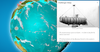
The Third “Where on Google Earth is Carmen Sandiego?” Game is Now Available
Back in March Google launched “Where on Google Earth is Carmen Sandiego?” for use in the web and mobile versions of Google Earth. Then in May a second Carmen Sandiego game was added to Google Earth. Today, Google added a third Carmen Sandiego game to Google Earth. Just like in the first two games, the […]
Six Google Product Updates Made in May Impacting Teachers and Students

Google is constantly making updates to the services that they offer. Some of the updates are only affect the administrative side of G Suite for Education. I rarely write about those updates. Then there are updates that have a direct impact on teachers and students. Those are the ones that I usually write about. Here […]
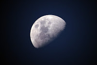
How to View the Moon and Mars in Google Earth

This morning I answered an email from a reader who wanted to know how to view the solar system in Google Earth. While you can’t view the entire solar system in Google Earth, you can view Mars, the moon, and some constellations in Google Earth Pro. Google Earth Pro is the free desktop version of […]
How to Find Games & Quizzes in Google Earth

This week Google added a new round of Where in Google Earth is Carmen Sandiego? The new game follows up on the popularity of the first Where in Google Earth is Carmen Sandiego? that was launched in March. The new game has players help Carmen Sandiego find Tutankhamun’s Mask. That’s not the only game that […]
5 Google Earth Pro Tips for Teachers and Students
Google Earth is currently available in a few different versions. There is the web browser version that was built for use in Chrome and Chromebooks. There is an iOS version and an Android version for use on tablets and phones. And then there is the original version made for use as desktop software on Windows, […]
Google Earth Timelapses and Historical Imagery

Google Earth Pro (the desktop version of Google Earth) has offered historical imagery for many years. You can access that imagery by selecting the timeslider icon in the menu at the top of Google Earth when it is open on your desktop. Today, Google unveiled some updates to their Google Earth Engine Timelapse website that […]
How to Measure Distances & Share Google Earth Views

Thanks to YouTube’s “on this day” feature last night I was reminded that two years ago I published a video overview of what was then the new browser-based version of Google Earth. As I shared on my YouTube channel last night, Google has added a couple of features to Google Earth since I published my […]
Google Earth and Maps Lessons for Five Subject Areas

Google Earth and Google Maps are two of my favorite educational technology tools that often are seen as only being useful for geography or history lessons. While they are good for lessons in those subjects, Google Earth and Google Maps can be used for lessons in other subject areas. Here are some ideas and resources […]
How to Measure Distance in Google Earth

Last year Google added a measuring tool to the web browser version of Google Earth (the desktop version always had one). While it worked, it didn’t have as many options as the measuring tool in the desktop version. Since then Google has added some more options for measuring distance in the browser version of Google […]
Where On Google Earth is Carmen Sandiego? – A Great Geography Game

The theme song for Where in the World is Carmen Sandiego? is an earworm for those of us who grew up in the 80’s or early 90’s. And thanks to Google’s new partnership with Houghton Mifflin Harcourt, we can now share the fun of Where in the World is Carmen Sandiego? with our kids. This […]
Best of 2018 – 250+ Google Tools Tutorial Videos for Teachers

This week is a vacation week for the vast majority of readers of this blog. As I do at this time every year, I’m going to republish some of the most popular posts of 2018. Here’s one from August. A few years ago I decided to start making video tutorials for the many Google tools […]
GeoGreeting – Send Messages Using Google Earth Imagery

Years ago I wrote about a service called GeoGreeting. This morning I got an email that reminded me of the service so I decided to see if it still works. Sure enough GeoGreeting still works as well as ever. It’s a free service that spells out your greetings using satellite images of buildings found in […]
How to Import Files Into Google Earth

In my previous post I shared the steps that I took to find a Google Earth file that contains more than 550 ancient locations in ancient Greece. At the end of the video in that post I demonstrated how I was able to display those locations in Google Earth. That method can be used for […]
How I Found a Google Earth File of 550+ Ancient Greek Places

Last night on Twitter Wes Fryer asked me if I knew of any Google Earth files that displayed ancient Greek locations. I didn’t have anything within my own bookmarks so I did a quick Google search that I filtered according to file type. I first filtered by file type .KMZ but that didn’t get me […]
250 Google Tools Tutorials for Teachers

A few years ago I decided to start making video tutorials for the many Google tools that I write about on this blog and feature in some of my professional development workshops. This week I created my 250th Google tools tutorial. All of my Google tools tutorial videos can be found in this YouTube playlist. […]
An Animated Shark Tracking Map – How Far Do Sharks Roam?

Years ago I included a shark tracking Google Earth layer in my workshop about Google Earth. It provided a good example of how Google Earth can be used in science classes. Unfortunately, I haven’t been able to find that file for a couple of years now and even if I did find the data is […]
More Than 5,000 Historical Maps for Teachers and Students
Florida’s Educational Technology Clearinghouse has a collection of more than 5,000 historical maps. The maps are licensed for free download and reuse by teachers and students. The collection is organized by continent and country. The US category is further broken down and organized by state and by historical theme. Some of the maps in this collection are […]
Join Me on Tuesday at 4pm for a Webinar on Google Earth, Maps, and VR Tours

Tomorrow, July 24th, at 4pm Eastern Time I am hosting a Practical Ed Tech webinar all about Google Earth, Google Maps, and Google’s VR Tour Creator. During Tuesday’s webinar you will learn: 1. How to create multimedia maps. 2. How to build virtual tours. 3. How to collaboratively create multimedia maps. 4. How to map […]
Practical Ed Tech Webinar – Google Earth, Maps, and VR in Your Classroom

Next Tuesday I’m hosting a Practical Ed Tech webinar titled Google Earth, Maps, and VR Tours. The webinar will introduce you to how to use these powerful tools in your classroom. While social studies is the obvious fit for these tools, they can be used in many other subject areas. In the webinar you will […]
How to Share Specific Google Earth Views in Google Classroom

The development of the browser-based version made Google Earth accessible to students who use Chromebooks as their primary classroom computers. One way that I like to use Google Earth is to create sets of inquiry questions based upon a specific location and or a specific view of a place. You can tell students the location […]
How to Measure Distances in Google Earth

The addition of a measurement tool in the Chrome (browser) and Android versions of Google Earth was one of the many things that Google announced yesterday. I’m not sure what took them so long to add this because it was always a feature in the desktop version of Google Earth. In the following video I […]
The Web Version of Google Earth Finally Gets a Measuring Tool

Distance measurement has been a feature of the desktop version of Google Earth for as long as I have been using it. So I was surprised when it wasn’t included in the browser-based version of Google Earth that was launched last year. This morning Google announced that a measuring tool has finally been added into […]
Identifying Cities from Historic Maps – A Geography Game

Late last year The Guardian published a challenging geography quiz. The quiz presents historic maps of ten cities. You have to identify the city by examining the map. The quiz is multiple choice so you do have a little bit of hint as there are only three choices for each map. The quiz gives instant […]
A Google Maps and Earth Activity for Art Classes

When I conduct workshops on Google Maps and Google Earth I always point out that the uses for those tools extend beyond the realm of geography and history. One example of using Google Maps and Earth outside of the typical geography setting is using Google Maps and Earth to have students place art and artists on an interactive […]
NASA’s Interactive Guide to the Solar System

I have been reviewing and sharing sharing resources from NASA for almost as long as this blog has existed. Somehow, I missed NASA’s Solar System Exploration until it was mentioned last week on Maps Mania. NASA’s Solar System Exploration website contains interactive displays of the planets, dwarf planets, and moons of our solar system. To […]
Monet Was Here – Take a Google Earth Tour of Monet’s Works

Monet Was Here is a new exhibit on Google Arts & Culture. The exhibit coincides with the opening of a new Monet exhibit at the National Gallery London. The Monet Was Here online exhibit features works that are on display at National Gallery London and other museums around the world. Monet Was Here includes a […]
Three Earth Day Resources

Earth Day is coming up in a few weeks. Here are a few resources that you might consider incorporating into your Earth Day lesson plans. I’ll be sharing more resources later this week. Google offers tours in its Explore Climate Change series. The tours explore the actions of organizations to prevent or adapt to climate change in […]
An Updated Version of Google Earth Released

Thanks to the Google Earth Blog I just learned about the release of an updated version of Google Earth Pro. Google Earth Pro (it’s free despite the “pro” designation) is the desktop version or “classic” version of Google Earth. The latest version includes thirteen improvements to Google Earth Pro. You can see the full list […]
5 Ed Tech Tools Social Studies Teachers Should Try This Year

On a regular basis I receive emails from teachers that go something like this, “we recently got new (insert hardware here) for our students and I was hoping you could tell me which tools I should try in my (academic area X) class.” To answer that request for social studies teachers I put together the […]
10 Ways to Use Google Earth in Your Classroom – Best of 2017

As I do during this week every year, I am taking some time off to relax and prepare for the new year. Every day this week I will be featuring the most popular blog posts of the year. This one of the most popular posts in May. A couple of weeks ago Google released the […]
Social Studies Teachers, This Is For You!

Back in November I released my popular Teaching History With Technology course in an on-demand format. It has proven to be a popular format as more people have participated in the on-demand course in December than in all of the combined live versions of the course offered earlier in the year. If you would like […]
Use Google Earth & Maps for More Than Social Studies
Last week was Geography Awareness Week. All across social media there were lots of references made to ways to use Google Earth and Google Maps to teach geography. That makes perfect sense. But Google Earth and Google Maps can be used for much more than just geography lessons. That’s a large part of what I […]
Google Tour Builder
Google Tour Builder allows users to tell stories using Google maps, images, videos, and text. It is a fantastic tool for students to use to show what they know about different topics. Maybe students are summarizing the chapters of a book and each placemark represents a different chapter. Or perhaps students create a tour to share […]
Earth View from Google Earth
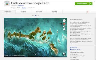
The Earth View from Google Earth Chrome extension allows you to view a different vibrant image from Google Earth each time you open a new tab. Each of the 1500 images in the gallery are unique and incredible. You have the option of sharing the image to Google+, Facebook, or Twitter or grabbing the link […]
To Geography and Beyond With Google Maps & Earth

I loved Google Earth since the first time I used it. And I have enjoyed teaching it to many teachers over the last decade. That’s why I’m excited to offer To Geography and Beyond With Google Maps & Earth. This course will meet on three Thursday afternoons starting on November 30th. In addition to social […]
5 Ways to Use Google Earth & Maps Outside of Social Studies Lessons
When most teachers hear “Google Earth” or “Google Maps” they immediately think of history and geography lessons. While Google Earth and Google Maps are great for history and geography lessons, Earth and Maps are also powerful tools in other areas. Here are some ways that you can use Google Earth and Maps outside of social […]
Top Posts on Google Maps, MyMaps and Earth from Free Technology for Teachers
Google Maps, Google Earth, and Google My Maps are three of my favorite tools to use in the classroom. They allow us to see the world from a completely different perspective and explore places that we might never see in real life. Here are some of the top posts about how to use these awesome tools […]
Navigating Google Maps Using Pegman
Recently, I introduced you to Pegman, the little icon who lives in Google Maps and Google Earth and helps us explore imagery of places all over the world at street view level. The video below shows you how to use Pegman to navigate in Google Maps, including how to use it to visit museums from around […]
Meet Pegman
Google Maps and Google Earth have a very special feature and his name is Pegman. This little guy allows us explore places around the world at Street View level. You can find him near the bottom right corner of Google Maps or in Google Earth once you select a location to explore. Pegman is yellow in […]
Google Earth for iPad Now Equal to Android Version
Back in April Google introduced a completely new version of Google Earth for Android and for use in your web browser. This week that new version finally arrived for iPhone and iPad users. Like the Android version of Google Earth, the iOS version features a “voyager” mode for taking virtual tours of places around the […]
The Google Earth Blog is Ending Daily Posts
For most of the last decade The Google Earth Blog founded by Frank Taylor has been one of my go-to places for Google Earth tips, tricks, and tutorials. This morning I read Frank Taylor’s announcement that he was ending daily updates. The archive of the blog will remain online. In his announcement Frank Taylor cites […]
The Five Most Popular Ed Tech Tutorial Videos of 2017 So Far
Every week I publish a couple of tutorial videos on my YouTube channel. As we’re now more than half way through the year, I thought it would be good to take a look back the the most viewed ed tech tutorial videos that I have produced this year. 1. A Tour of the New Google […]
Live Nature Webcams In Google Earth
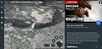
When the new version of Google Earth was released in April, it signaled the beginning of more things to come for Google Earth on Chromebooks. Since then Google has steadily added new features to Google Earth for Chromebook users. The latest update brings a new Voyage that features live nature webcams from Explore.org. The Explore.org […]
Ten Ways to Use Google Earth In Your Classroom – Handout
This week Google announced that Google Earth can now be integrated into your school’s G Suite for Education services. Which means that your students can use their G Suite account credentials to use the web version of Google Earth. The newer web version of Google Earth can be used on a Chromebook. In the PDF […]
Google Earth Is Now a Component of G Suite for Education
Earlier this year Google released a Chromebook-friendly, browser-based version of Google Earth. This week at ISTE 17 Google announced that the new version of Google Earth is now a component of G Suite for Education. This means that your students will be able to use Google Earth with the same account that they use for […]
Mapping Local Art – A Google Maps and Earth Activity

Winslow Homer [Public domain] via Wikimedia Commons. Whenever I conduct workshops on Google Maps and Google Earth I always point out that there are uses for those tools beyond the realm of geography and history. A recent, popular, example of this is found in the Google Arts & Culture Institute’s Street View imagery of museums. While the Google […]
How to Find Old Maps Online

In yesterday’s Practical Ed Tech Live episode I answered a question about where to find old maps to layer in Google Earth. One of the resources that I suggested was Old Maps Online. Old Maps Online is a map that you can browse and search to find historical maps to view online, to download, and […]
10 Ways to Use Google Earth in Your Classroom

A couple of weeks ago Google released the new web-based version of Google Earth (take a tour of it here). The older desktop version of Google Earth is still available for free as well. The advantage of the web-based version is that anyone with a Chromebook or laptop can use it. The disadvantage to it […]
7 Google Product Updates You Might Have Missed in April

Every month Google rolls out updates to the products that teachers know and love. Some of those updates are significant and others are just minor tweaks that make life a little easier. Here are some of the more significant product updates that occurred in April. 1. A completely new version of Google Earth was unveiled. […]
GE Teach Tour Builder – Create Google Earth Tours for the Web

GE Teach is a fantastic project developed by Josh Williams. Josh and his students were some of the first to use the new version of Google Earth in a classroom. In fact they used it before it was available to the public. (Click here for a video overview of the new Google Earth). The new […]
How to Create Your Own Placemarks in the New Google Earth

A new version of Google Earth was released yesterday. In my initial review of it I was excited that it now works in your web browser while also being disappointed by the lack of creation tools that it contains. Fortunately, you can still put your own multimedia placemarks on Google Earth by importing a KML […]
A Tour of the New Google Earth – Google Earth in Your Browser
This morning Google released a completely new version of Google Earth. The new version is designed to be used in the Chrome web browser or in a new Google Earth Android app (iOS version coming eventually). I spent about an hour trying out the new web version of Google Earth. Then I recorded the video […]
Explore National Parks for Free In Person or Online
Entry to national parks in the United States is free each of the next two weekends. If there is a national park near you, go out and explore. Bring your phone to take some pictures. Otherwise put it down and take in the experience. Better yet, skip the phone all together and use a good […]
To Geography and Beyond With Google Maps
When we hear “Google Maps” we often think that it is only useful for social studies lessons. In addition to social studies Google Maps can be used in physical education, mathematics, science, and language arts lessons. Tomorrow afternoon at 4pm EST I will teach you to use Google Maps in a variety of subject areas. […]
Creating and Telling Stories With Maps
For as long as I can remember I have loved to look at maps. I distinctly remember looking at the maps in my third grade social studies book and wondering what people in the middle of the Soviet Union were like. And as I got older I would look at maps of northern Canada and […]
193 Short Timelapse Videos of Our Changing World
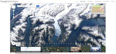
On Tuesday Google announced the publication of new Google Earth timelapse imagery. The new imagery shows the how the physical geography of the Earth has changed over the last 32 years. You can see this imagery on the Google Earth Engine website or you can view it as a series of 193 short videos on […]
Create Narrated Map Tours on a Chromebook
On Sunday and Monday I shared a couple of videos about making narrated Google Earth tours. Unfortunately, Google Earth doesn’t work on a Chromebook. So if you want your students to create narrated map tours, the best thing to do is to have them map a series of placemarks in Google’s My Maps tool then […]
Use Google Earth to Create Narrated Tours of Mars & the Moon
Last night I published a video about how to make simple Google Earth tours. This morning I was greeted by an email in which a reader asked me if it was possible to create tours of Mars by using Google Earth. The answer to that question is yes. You can use Google Earth to create […]
How to Create a Google Earth Tour
Google Earth can be used for all kinds of lessons in math (see Real World Math), science (try these resources), and language arts (try Google Lit Trips) in addition to the obvious social studies applications. One of the best ways to use Google Earth in social studies and in language arts is to have your […]
An Easy Way to Find Google Earth Tours
In my presentation To Geography & Beyond With Google Maps & Earth I always share some tips on how to locate Google Earth tours. One of those tips is to refine your Google search by file type and select .KMZ. In the video embedded below I provide a demonstration of how to quickly find, open, […]
How to Create, Share, and Print Thematic Maps
Google’s My Maps and Google Earth tools can provide a great way to create thematic maps. Unfortunately, those tools are quite limited if your students don’t have Google Accounts to use at school. National Geographic’s Mapmaker Interactive is a free map creation tool that doesn’t require students to have any kind of registered account in order to […]
A Variety of Ways for Students to Explore National Parks Online
Last week the edublog-o-sphere was buzzing with the news of Google’s publication of new National Parks virtual tours available in the Google Arts & Culture apps for Android and iOS. At the same time Google also published new Expeditions virtual tours of the “hidden treasures” of National Parks. Both of those releases do provide students […]
Exploring Marine Science in Google Earth
Google Earth is a great tool for exploring many aspects of geography. One of the features of Google Earth that seems to be frequently overlooked is the ocean imagery. Using Google Earth tours can be a good way for students to learn about marine life and habitats. The following organizations host excellent Google Earth files […]
Three Geography Games Based on Google Maps and Google Earth
One of the things that I emphasize to students before they embark on any kind of research or problem-solving task is to take a good long look at the information that they already have before them. To that end, I’ll often request that they construct a list of what they know about a topic or […]
Geopedia – A Map & Wikipedia Mashup
Geopedia is a nice combination of a map and Wikipedia entries. Search for a location on the Geopedia map and you will be shown a bunch of map placemarks around that location. Click on any of the displayed placmarks and you will see a corresponding image and Wikipedia entry. To change locations you can either […]
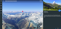
Exploring Mount Everest – Street View and More
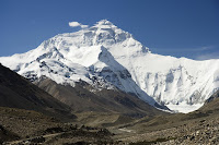
The spring climbing season on Mount Everest and the surrounding peaks of the Himalaya is now upon us. As long-time readers of this blog may recall, one of my bucket list items is seeing Mount Everest in person. Until then I have to entertain myself with books, videos, and imagery of the mountain. Here are […]
How to Find Google Earth Files That Aren’t in the Google Earth Gallery

Yesterday, during my workshop on Google Earth and Google Maps someone asked me if I knew of any files about Rome. I did know about a couple, but I couldn’t find them in the Google Earth gallery. So I turned to Google and did a search by file type. My search was refined to .KMZ […]
The US Presidents in Google Earth
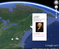
Monday is President’s Day in the United States. In celebration of that day, Google has published a kmz file containing images and links to information about each former President of the United States. You can download the file and launch it in Google Earth or preview it here. The file shows where each president was […]
How to Compare Maps Side-by-Side in GE Teach
Last week I wrote a post in which I featured using GE Teach to compare maps side-by-side. GE Teach can be a powerful tool when you dive into the features hidden within it. In the video embedded below I demonstrate how to access and use the features of GE Teach.
5 Good Google Tools for Social Studies Students
This evening I gave a short webinar presentation on my five favorite Google tools for social studies teachers and students. The webinar was hosted by the New England ISTE group. The content of key elements of the webinar are outlined below. Besides what you see featured below we also looked at Google’s Ngram Viewer. 1. […]