A Good Tool for Mapping Census Data
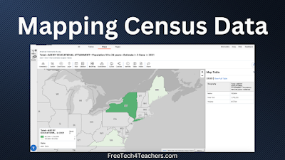
Earlier today I was looking for a dataset that I could use in a new data visualization tool that I’m testing out. That quest took to me the website of the U.S. Census Bureau. It was there that I went down a rabbit hole of looking at data. Eventually, I stumbled into a mapping tool […]
How to Install Google Earth Pro on a Mac

A few weeks ago I shared directions for adding Google Drive videos to Google Earth tours. The demonstration that I gave was done with Google Earth Pro on my Mac. That demo prompted an email from a viewer who needed some help installing Google Earth Pro on her Mac. To answer that email I made […]
Three Good Ways to Map Spreadsheet Data
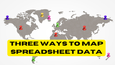
In my previous post about how to create a story map I featured a tool called StoryMap JS. That tool is great for making story maps that have no more than about twenty scenes. Any more than that and the process becomes a bit cumbersome and tedious. Fortunately, there are tools that you can use […]
How to Create a Story Map

A couple of days ago I published a post about a story map titled 1,001 Novels: A Library of America. That post is already one of the most popular things I’ve published this year! Viewing 1,001 Novels: A Library of America reminded me of a free tool that students can use to create story maps. […]
1,001 American Novels Mapped
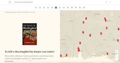
1,001 Novels: A Library of America is an ESRI story map developed by Susan Straight. The story map features short reviews of 1,000 American novels. Each novel is geolocated on a map of the United States. The story map is divided into geographic regions. You can also view the entire map at once. Susan is […]
Turn Pictures Into Digital Map Pins
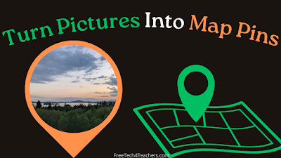
Felt.com is a digital mapping tool that launched late last year and has since impressed me with both its ease of use and its plentiful features. The latest feature added to Felt that I really like is the option to take any of your pictures and use them as placemarkers or pins on your maps. […]
An Acoustic Atlas of the Wild West
Acoustic Atlas is a Montana State University Library project that features an ArcGIS Storymap. The Acoustic Atlas storymap is an audio and visual tour of Montana’s four ecosystems. As you scroll through Acoustic Atlas you will see read text and see pictures of the four ecosystems. While scrolling you will also hear the sounds of birds, […]
57 Google Earth & Maps Tutorials for Teachers and Students
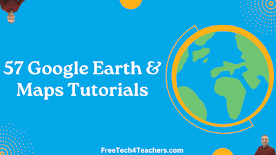
Upon the publication of my latest video about how to add Google Drive videos to Google Earth Pro my playlist of tutorials on using Google Earth and Google Maps grew to 57. In my playlist of 57 Google Earth and Maps tutorials you’ll find directions for everything from the basics of navigation to creating historic […]
How to Create Around the World With Google Earth Tours
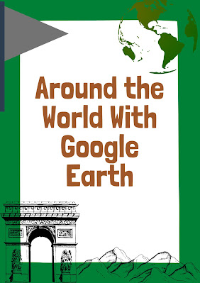
The Amazing Race is the only reality game show that I’ve watched with interest for as long as it has been on television. Years ago I created a classroom game based on the same premise of the show. This spring I updated that game with some new graphics and new challenges and then published it […]
How to Add Google Drive Videos to Google Earth Pro Placemarks
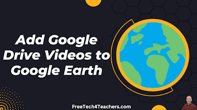
Last week a reader emailed me to ask for help inserting videos into placemarks in Google Earth Pro. His students had recorded videos and saved them in Google Drive. They wanted to use them in their Google Earth Pro placemarks. I was happy to help. Before giving you the directions for how to add Google […]
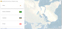
A Good Way for Students to Visually Compare the Sizes of Countries and States
My students here in Maine always think of our state as being a big place and it is big in relation to the rest of New England. Compared to our friends in the west, Maine is a small place. Similarly, they sometimes have trouble understanding the size of the lower 48 states compared to Canada. […]
A World of Musical Explorers
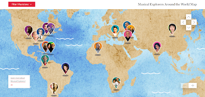
I wrote about this neat resource a couple of years ago. A recent post on the Maps Mania blog prompted me to revisit it. Carnegie Hall hosts some excellent online instructional resources for music teachers. One of those resources is called Musical Explorers Around the World. Musical Explorers Around the World is an interactive map […]
A Geography Lesson About Strange Borders
Belgian Farmer Accidentally Moves French Border is a fun little story and geography lesson in one. It’s almost exactly what the title says. A farmer moved a stone that was in his way when plowing a field. It just happened that the stone he moved is a marker for the border between two small towns in […]
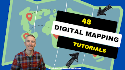
48 Digital Mapping Tutorials
Even though I write a lot about Google Earth and Google Maps, there is more to digital mapping than just using those tools. In fact, there are some great digital mapping tools not made by Google that students can use to create things like historic map overlays, map and timeline combinations, and map-based stories. In […]
GE Teach – Make Side-by-Side Map Comparisons in One Browser Tab
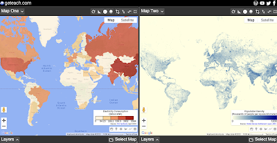
GE Teach is a great map tool that is developed and maintained by a high school teacher in Texas named Josh Williams. GE Teach has gone through a bunch of iterations over the years and the latest version is better than ever. On GE Teach students can compare two maps side-by-side. Students can select from gallery […]
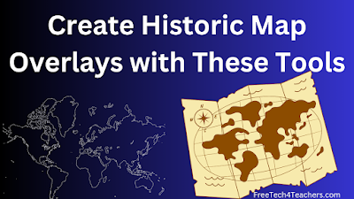
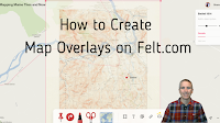
Create Historic Map Overlays With These Free Tools
Yesterday morning I shared a collection of more than 100,000 historic maps for classroom use. In that post I mentioned using those maps to create digital overlays on current maps. Google Earth provides a couple of ways to do that. Felt.com is another digital mapping tool that can be used for the same purpose. In […]
More Than 100,000 Historic Maps for Classroom Use
Credit: David Rumsey Map Collection, David Rumsey Map Center, Stanford Libraries. Source 1. Source 2. In this week’s Practical Ed Tech Newsletter I mentioned that digital mapping tools is one of the areas of educational technology that I’m still passionate about after sixteen years and 17,000 blog posts. And making comparisons through the use of […]
Five Things You Can Teach Through Geocaching
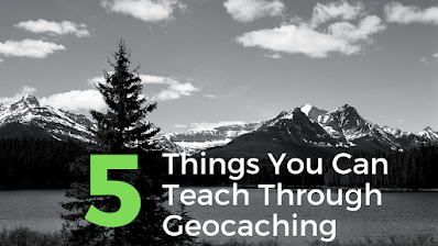
Geocaching is one of the things that I spend a good bit of time talking about in both my workshop and in my webinar about blending technology into outdoor learning. Geocaching is a great activity to do to get kids outside for hands-on learning experiences. Here are five things that you can teach through geocaching […]
Projection Wizard – See How Maps Distort the World

Projection Wizard is an interesting tool developed by Bojan Šavrič at Oregon State University. The purpose of Projection Wizard is to help cartographers select the best map projections for their projects. To use the Projection Wizard select a distortion property from a menu appearing to the left of the map. Then use the highlighting tool […]
How to Use Street View Imagery in Canva Presentations
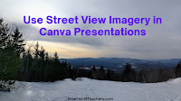
Earlier this week I published a tutorial for making your first presentation in Canva. After you and or your students feel comfortable with the basics, you may want to start exploring some of the advanced features available within Canva. One of those is the ability to embed interactive Google Maps and Google Street View imagery […]
Three Ways to Share Google Maps Views in Google Classroom
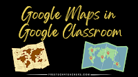
Google Maps is one of the tools that I always list as a must-have for history and geography teachers. It provides an easy way to show students multiple, detailed views of the significant natural and human-made landmarks they’re learning about in your classroom. Projecting them on a big screen in the front of your classroom […]
Three Ways to Quickly Map Spreadsheet Data
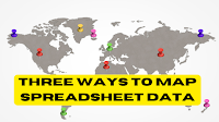
I recently came across an older Towards Data Science article about ten ways to represent data on maps. Reading the article reminded me of something that I’ve tried to share with social studies teachers and students over the years. That thing is that a great data set can tell you a lot. A great map can tell […]
How to Map Spreadsheet Data on Felt
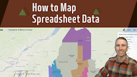
Felt is a multimedia mapping tool that I started using late last year and it has quickly become one of my favorite mapping tools. With Felt you can create everything some simple directions maps to maps that have historic overlays to maps of animal migrations and much more. The latest update to Felt makes it […]
45 Digital Mapping Tutorials

This month I’ve been spending some time organizing the tutorial videos on my YouTube channel. To that end I’m creating playlists that are organized thematically. The latest playlist that I’ve created is titled Digital Mapping. The playlist currently contains 45 tutorial videos covering more than just Google Maps. In the playlist you’ll find tutorials on […]
A New Felt Mapping Tool
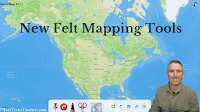
A few days ago I shared a neat map of gray whale migration patterns. That map was created on the Felt mapping platform. Felt was one of my favorite new tools of 2022 and is only getting better at the start of 2023. The most recent update to Felt introduced an easier way to access […]
Gray Whale Migration and More Felt Mapping Ideas

Felt is a multimedia mapping tool that I started using late last year. It has quickly become one of my preferred tools for creating multimedia maps. In fact, at this point I think I like more than Google’s My Maps. The aesthetics of Felt are great and it has a great selection of easy-to-use features. […]
I’m Feeling Lucky – Around the World With Google Earth

Google Earth is one of my all-time favorite tools for teaching geography and history lessons. Two of my favorite ways to use Google Earth in the classroom are outlined below. From voyages to games to simple measuring tools, the web version of Google Earth has a lot of neat features that can help students learn […]
How to Include Google Maps in Your Google Documents and Canva Documents

Canva’s new documents tool has a bunch of great features that I highlighted in a video last month. One of those features is the ability to embed just about anything into the body of your document. In the demonstration that I gave last month I embedded videos and presentations. You can also embed Google Maps […]
How to Create Map Overlays
Felt was one of my favorite new tools in 2022. In fact, I liked it so much that I included it in my Best of the Web for 2022. Felt is a free multimedia mapping tool that I think is easier for first-time users to use than Google’s My Maps or ESRI’s mapping tools. Right […]
Best of 2022 – A Fun Map Puzzle
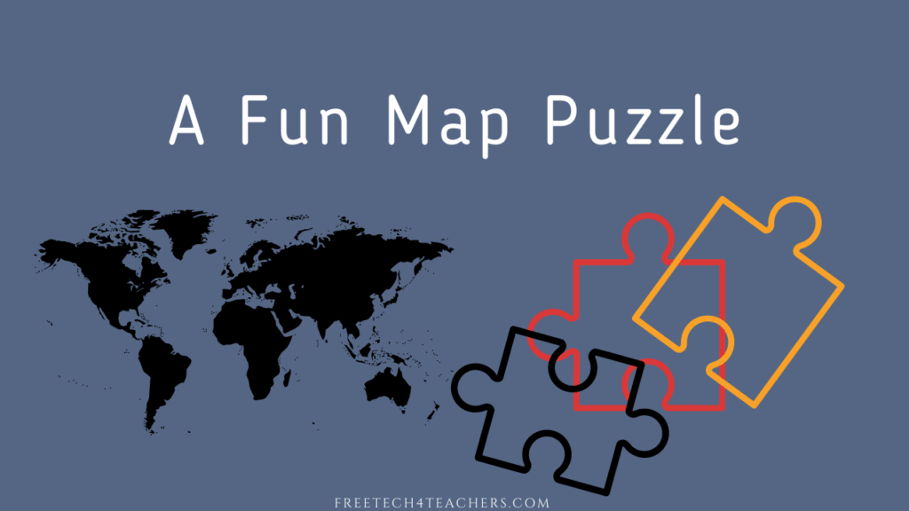
As I do at this time every year, I’m taking the week off to ski and play with my kids, shovel snow, and generally not think about work. I have some of the most popular posts of the year scheduled to republish this week. New posts will resume in the new year. MapPuzzle is a […]
Best of 2022 – A Big List of Geography Resources
As I do at this time every year, I’m taking the week off to ski and play with my kids, shovel snow, and generally not think about work. I have some of the most popular posts of the year scheduled to republish this week. New posts will resume in the new year. This week is […]
New Base Map Options on Felt

Felt is a new digital mapping tool that I’ve featured a few times in the last month because I think it is fantastic alternative to Google’s My Maps and the web version of Google Earth for creating custom maps. In fact, I like it so much that I demonstrated it in my Best of the […]
Two Cool Mapping Tools in the Felt Mapping Platform

A couple of weeks ago I published an introductory overview of a new digital mapping platform called Felt. As I said in that introduction, I’ve only begun to scratch the surface of all of the things that students can do and make on Felt. One of those things is the ability to quickly and easily […]
Five Digital Mapping Tools That Aren’t Made by Google

Google Earth and Google’s My Maps are great tools for students to use to create multimedia maps. But Google isn’t the only game in town when it comes to digital map creation tools. In fact, there are some good ones that are freely available to you and your students outside of what Google offers. Here’s […]
How to Create a Story Map

StoryMap JS is a tool that I’ve been using and recommending for many years. It’s a free tool that students can use to create a story map in a manner similar to Google’s My Maps or the old Google Tour Builder. The difference between those tools and StoryMap JS is that StoryMap JS is much […]
Where I’d Like to Go – A Geography Lesson With Google Drawings

I originally wrote this blog post and recorded the video in 2021 while thinking about icebreaker activities for the start of the school year. The activity is also great for Geography Awareness Week. As the new school year starts many you may find yourself looking for some new ideas to break the ice and get […]
A Google Earth Lesson With the “I’m Feeling Lucky” Button
Since it is Geography Awareness Week I thought I’d pull a lesson plan from my archives to share with you. From voyages to games to simple measuring tools, the web version of Google Earth has a lot of neat features that can help students learn about the world. One of those neat features is the […]
An Overview of Five Fun Geography Games for Students

Today is the first day of Geography Awareness Week. In the following videos I provide an overview of five map-based geography games that your students can play this week or any other time they need to practice identifying places around the world. All five games are featured in this compilation video. Read on for descriptions […]
Felt – A New Way to Create Multimedia Maps

About a week ago Larry Ferlazzo mentioned a new mapping tool in one of his blog posts. That tool is called Felt. I tried it a few days ago and I have to say that I like it a lot. Felt offers a lot of easy-to-use tools for creating custom maps. Some of the features […]
Making and Leading Virtual Tours With Expeditions Pro

Many of us lamented the loss of Google Expeditions because it was a great tool for leading students on virtual reality tours of all kinds of interesting places around the world. Similarly, many of us were disappointed when Google shuttered Tour Creator because it was a great tool for students to use to create their […]
GeoQuiz History Edition – A Fun and Challenging Geography Game

The start of Geography Awareness Week is nine days away. It’s probably my favorite academically-themed week of the year. (Yes, that’s my social studies teacher background coming through). Over the next week or so I’ll be sharing a bunch of great resources for teaching and learning about geography. To start things off I have a […]
How to Make Multimedia Maps on Padlet

Geography Awareness Week is coming up in a couple of weeks. In preparation for my favorite academic week of the year, I’ve recorded an updated tutorial on how to make multimedia maps with Padlet. Padlet is one of the most versatile tools you can put in your digital toolbox. Creating multimedia maps is just one of […]
How to Create a Digital Map Collection in Wakelet

Wakelet is a free, collaborative bookmarking and file organization tool that puts things into a nice visual display. So when a former colleague emailed me a couple of days ago to ask for help creating a collection of digital maps Wakelet was one of the first tools to come to mind (Padlet was the other). […]
Finding and Exploring 15 Minute Cities

City Access Map is an interactive map that anyone can use to find and explore the walkability of cities around the world. Specifically, City Access Map lets you explore cities in which residents can access needed services within a fifteen minute walk. City Access Map calls these cities 15 Minute Cities. You can explore City Access […]
How to Play GeoGeek AR

Last week I wrote a brief overview of a fun geography app called GeoGeek AR. The “AR” in the app’s name stands for augmented reality. The use of AR makes it possible to put a digital globe right into your classroom or anywhere else that your students are standing when holding an iPad or Android […]
GeoGeek AR – An Augmented Reality Geography Game
GeoGeek AR is a fun app for testing and developing your knowledge of world geography. As its name and icon imply, the app uses augmented reality to put a virtual globe in any space that you choose. You can spin the globe with your fingers or simply move around the room to see different parts […]
How to Create Green Screen Videos in Canva

A couple of weeks ago Canva held an event to announce a bunch features that were going to be added over the coming months. One of those features is now available in the form of a background remover for video clips. Just like you can use Canva to remove image backgrounds you can now use […]
How to Create an Around the World With Google Earth Tour

The Amazing Race is the only reality game show that I’ve watched with interest for as long as it has been on television. Years ago I created a classroom game based on the same premise of the show. This spring I updated that game with some new graphics and new challenges and then published it […]
Worldle Daily – A Street View Game

The Wordle craze seems to have settled down a bit since its height earlier this year (or at least fewer people are sharing their scores on social media). That hasn’t stopped developers from creating many variations on the game. One such variation that I recently tried is Worldle Daily. Worldle Daily is a combination of […]
Create and Share Collections in Bing Maps

Google Maps is one of my favorite tools for geography lessons and for some elementary school math lessons. In fact, next month I’m hosting a webinar all about using Google Maps in your classroom. That said, there are some alternatives to Google Maps that I do use from time-to-time. Bing Maps is one of those […]
How to Change Map Styles in Google Earth – And Why

The web version of Google Earth has improved a lot since its launch five years ago. One of those improvements is found in the number of ways that you can customize the map style displayed when you are viewing and creating projects in Google Earth. In this new video I demonstrate how to change the […]
Best of 2022 So Far – Custom USGS Maps

I’m taking the weekend off. While I’m gone I’ll be republishing some of the most popular posts of the year so far. Earlier this year I highlighted the galleries of free to use and re-use media that the USGS hosts. Earlier this week I was back on the USGS site looking in those galleries when […]
My Three Favorite Google Tools for Social Studies Teachers and Students

As longtime readers of this blog know, my background is largely in social studies with a smattering of teaching computer science and doing some corporate training. It’s teaching social studies that will always be my first professional love. I’ve also been using Google Workspace tools with students (previously G Suite, previously Google Apps, previously Google […]
Five Concepts You Can Teach Through Geocaching

Geocaching is one of the things that I spend a good bit of time talking about in both my workshop and in my webinar about blending technology into outdoor learning. Geocaching is a great activity to do to get kids outside for hands-on learning experiences. Here are five things that you can teach through geocaching […]
Big Mistakes in Cartography

When I taught geography one of the first topics that I covered was map projections and how some of them can distort how we view the world. Of course, a good bit of attention was paid to the Mercator projection. Mercator’s world map is one of a handful featured in a new TED-Ed lesson titled […]
Five Google Earth Activities to Get Kids Interested in the Outdoors

In last week’s Week in Review I mentioned a new book titled Outdoor Kids in an Inside World. In the book Steven Rinella presents a lot of ideas for getting kids interested and involved in learning about nature. In the first chapter he presents a big list of ideas for things that you can do […]
An Interactive Map of the Roman Empire

A few years ago I wrote about a must-bookmark resource from Stanford University for history teachers and students. That resource is called ORBIS and it has been updated since the last time that I wrote about it. ORBIS is Stanford University’s Geospatial Network Model of the Roman Empire. On ORBIS students can calculate the distance and travel times between […]
How to Use Google Maps and Street View in Canva Presentations

This blog post and video is the result of my failure to get another service, that won’t be named, to do what I hoped it would. I was trying to come up with a way for students to create online, interactive atlases. After banging my head against my keyboard for a while I finally said […]
A Good Place to Find Old Maps Online

Old Maps Online is an online map that you can browse and search to find historical maps to view online, to download, and to print. You can search the map by entering a location or you can just pan and zoom around the world to find historical maps. In the video embedded below I demonstrate […]
How to Create Your Own Virtual Reality Tours

A couple of weeks ago I wrote about and gave a video demonstration of how to lead students on virtual reality tours with Expeditions Pro. In that video I mentioned that Expeditions Pro can also be used to create your own virtual reality tours. This morning I recorded a video about how do that. Watch […]
How to Create a Custom Map on an iPad

Yesterday morning I answered an email from a reader who wanted to know if it was possible to create Google Earth projects on an iPad. Unfortunately, the iPad version of Google Earth allows you to view existing projects, but doesn’t allow you to create new projects. Fortunately, there are other ways to create custom maps […]
Ten Fun Things for Students to Map

Last week I published a video about how to record a Google Earth tour in your web browser. That’s just one of many tools that students can use to create multimedia maps. A few other options include using Scribble Maps, Padlet maps, and Google’s My Maps tool. Creating a map with one of these tools […]
How to Record a Google Earth Tour in Your Web Browser

The online version of Google Earth has improved a lot since it was first launched back in 2017. Unfortunately, it still doesn’t have a built-in recording tool like the one found in the desktop version of Google Earth. The solution to that problem is to create a project in the web version of Google Earth […]
Create Your Own USGS Maps

Earlier this year I highlighted the galleries of free to use and re-use media that the USGS hosts. Earlier this week I was back on the USGS site looking in those galleries when I noticed something new to me. That something is the USGS National Map Viewer. Don’t the name fool you, the USGS National […]
How to Add Videos to Google Earth Projects
I’m currently developing a lesson plan that is loosely based on the reality television show, The Amazing Race. In my lesson students have to use a series of clues to find locations in Google Earth and then complete a task or challenge before adding a placemark to their Google Earth projects (tours). They have to […]
Library of Congress Resources About Ukraine

Over the last couple of weeks I’ve received quite a few requests for resources for teaching and learning about the Russia/ Ukraine conflict. In response to those requests I’ve been directing people to Larry Ferlazzo’s frequently updated list of resources. Today, I found one resource that isn’t on Larry’s list, yet. That is the a […]
How to Link Within Google Earth Projects

Google Earth in all its forms has been one of my favorite educational technology tools for well over a decade. The web version of Google Earth has improved significantly since its launch five years ago. One of the relatively new features of the web version of Google Earth is the ability to link to places […]
Three Great Google Maps Features for Teachers

Google Maps is one of my favorite tools to use in history and geography lessons. I’ve been using it for at least as long as I’ve been writing this blog (15 years). Like all Google products it has evolved over time and some features have gone away while others have been added. And there are […]
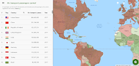
A Neat Site for Comparisons of Economic Information Between Countries
Seven years ago I wrote about a neat site called If It Were My Home. I came across it again while looking for something else in my archives earlier this week. It still works and still does the same interesting thing that it did when I first tried it. If It Were My Home will show you […]
The USGS Multimedia Gallery Offers Excellent Public Domain Images and Videos
The USGS Multimedia Gallery contains large collections of educational videos, animations, audio recordings, pictures, and slideshows. As you might expect, you’ll also find lots of maps in the USGS multimedia gallery. You can browse and search the gallery according to media type, year of publication, and keyword. In addition to the videos in the USGS Multimedia Gallery you can […]
StoryMap JS – A Nice Alternative to Tour Builder
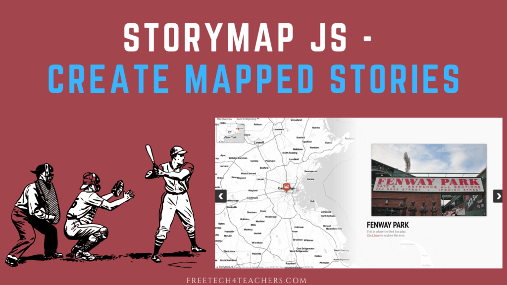
Like many teachers, I was disappointed when Google deprecated Tour Builder and Tour Creator last year. Since then in my webinar series with Rushton Hurley and on social media I’ve answered a lot of questions from teachers about alternatives to Tour Builder. StoryMap JS is one of the tools that I’ve been suggesting when asked […]
Finding a Geographic Opposite

One evening last week my daughters were playing with the globe pillow that is featured in this blog post. They started asking questions about what each place is called and where it is relative to where we live. Answering their questions reminded me of the concept of an earth sandwich. The idea of an earth […]
A Good Collection of Resources for Teaching the Five Themes of Geography

C-SPAN Classroom is known for offering great resources for teaching civics and government lessons. What you might not know is that C-SPAN Classroom also offers a good collection of resources for teaching geography lessons. C-SPAN Classroom hosts a collection of bell ringers and lesson plans aligned to the five themes of geography. Bell ringers are […]
Scribble Maps – Draw on Google Maps and More Without an Account

To close out Geography Awareness Week 2021 I have one more cool tool to share. Scribble Maps is a tool that I’ve used and recommended for years. As the name implies, you can use it to draw on maps. You can also use it to create multimedia map markers. The best part is that you […]
The Suprising Origins of Thanksgiving Foods
Yesterday morning I published blog post in which I shared an ESRI Story Map of where traditional Thanksgiving foods are grown today in the United States. That story map covers where food comes from today, but it doesn’t cover the historical origins of traditional Thanksgiving foods. That’s an interesting topic of its own. It’s Okay […]
Mapping Where Food Comes From

Where Does Your Thanksgiving Dinner Come From? is an interactive storymap that I’ve shared in the past and still find to be a neat resource. The map displays where eight popular Thanksgiving foods are grown and harvested in the United States. The storymap includes a map for each ingredient. Each map shows the locations of commercial […]
My Big List of Activities and Resources for Geography Awareness Week

This week is Geography Awareness Week. It’s one of my favorite weeks of the year! Every year at this time I publish an updated list of some of my favorite games, activities, tools, and lessons to promote geography awareness. Here’s my updated list for 2021. The first place to start a search for geography awareness […]
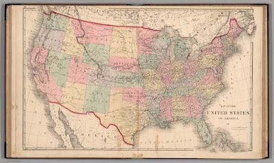
How to Overlay Historical Maps on Current Maps
Next week is Geography Awareness Week. Google Earth is my favorite educational technology tool to use to teach history and geography lessons. And one of my favorite things to do with Google Earth is to overlay historic maps onto current maps. It’s a great way for students to see how borders have changed over time, […]
How to Create Multimedia Maps in Padlet

Padlet is one of the most versatile ed tech tools you can put in your digital toolbox. Creating multimedia maps is one of the many things that you can do with Padlet. In fact, there are two ways that you can create multimedia maps in Padlet. The first method is to use the built-in base […]
NatGeo MapMaker – Create, Share, and Print Custom Maps

National Geographic MapMaker is a nice mapping tool that I’ve been using and recommending for years. It was recently updated with an improved user interface, additional data sets, and more annotation tools. With NatGeo MapMaker you can create custom maps to display datasets, to compare datasets, to illustrate collerelations, and to illustrate points. National Geographic […]
How to Use Canva’s Image Background Remover

It’s not a secret that I really like the many ways that Canva can be used to create graphics, videos, presentations, and simple websites. Within any Canva template there are lots of neat editing tools including an image background remover. It’s available to anyone who has a free Canva for Education account. Canva’s image background […]
The Living Atlas of the World

The ArcGIS Living Atlas of the World is a collection of thousands of online, interactive maps representing all kinds of data. The contents of the collection range from relatively simple displays of historical map imagery to complex, displays of data updated nearly live. For example, this map displays active hurricanes, cyclones, and typhoons. Another good […]
How to Share Specific Google Earth Views and Turn Them Into Assignments

Google Earth has a lot of great little features that sometimes get overlooked. One of those features is the ability to share a specific location and view of that location. In fact, you can share a specific location and view directly into your Google Classroom. When you share it you can share it as an […]
An Interactive Land Use Map

WorldCover Viewer is a new interactive land use map produced by the European Space Agency. The map lets visitors see how land is used worldwide and in specific places. Visitors can pan and zoom to see land use for an area or use the statistics explorer tools built into the map to see land use […]
The United Nations Explained for Kids

A couple of weeks ago I discovered CBC Kids News and I shared a great video that explains what the word indigenous means when referring to people. This afternoon I browsed through CBC Kids News again and found a nice animated video that explains the United Nations to kids. United Nations Explained is a short […]
I’m Feeling Lucky – A Google Earth Lesson

From voyages to games to simple measuring tools, the web version of Google Earth has a lot of neat features that can help students learn about the world. One of those neat features is the “I’m Feeling Lucky” button that is found on the left hand toolbar in Google Earth. Clicking that button will take […]
How to Share Google Arts & Culture Experiences in Google Classroom
Last week Google Arts & Culture published a great online exhibit titled Walk the Great Wall. It’s a fantastic colleciton of Street View imagery and multimedia stories about the Great Wall of China. As I wrote last week, Walk the Great Wall includes detailed imagery of the bricks of the wall, short lessons about the […]
City Guesser 3.0 – More Maps and More Modes
About six months ago City Guesser 2.0 was released. The big news then was a switch from being based on street-level imagery to street-level video clips. Now City Guesser 3.0 is out and it still uses street-level video clips but now offers more games and more game modes than before. City Guesser 3.0 is played […]
How to Create Custom Coloring Maps

There are plenty of places on the Internet to find free outline maps of states, provinces, countries, and regions of the world. Finding blank outline maps of cities, small towns, or neighborhoods is a little harder to do. If you’re looking for a blank map of a city, town, or neighborhood for your students to […]
An Interactive Map of Historical Sites in Every U.S. State

The Traveling Salesman Problem is a website developed by William Cook at the University of Waterloo. The site features interactive maps that chart the short distance between a series of places. One of those maps is of all of the places in the United States National Register of Historic Places, all 49,603 of them.You can […]
Create Animated Maps on Mult Dev – One of My New Favorites in 2021

I’m taking this week to recharge and get ready for the next session of the Practical Ed Tech Virtual Summer Camp. For the next few days I’m going to highlight some of my favorite new and new-to-me tools so far this year. Mult Dev is a free tool that lets you quickly create animated maps. In the time […]
All About the Tour de France
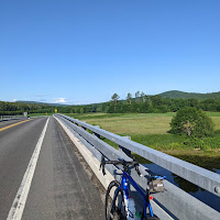
The Tour de France begins at the end of this week. As an avid cyclist I enjoy watching it and I find that it provides some neat opportunities for science, health, and physical education lessons. Here are some of my go-to resources for teaching and learning about the Tour de France. The Science of Bicycles […]
Roadside America in a Story Map

The Library of Congress houses the John Margolies Roadside America Photograph Archive. That archive contains nearly 12,000 photographs of interesting roadside attractions all over the United States and eastern Canada. The collection includes pictures of things like gas stations shaped like a dinosaur, windmills that serve as ice cream stands, funky miniature golf courses, and […]
How to Quickly Create Animated Maps

A couple of weeks ago I wrote about new mapping tool called Mult Dev. It’s a free tool that lets you quickly create animated maps. In the time since I wrote about Mult Dev a couple of updates were made to it. The most notable of those being that you now need to sign into […]
Mult.dev – A New Way to Quickly Make an Animated Map

Mult.dev is a new mapping tool that I recently learned about through Maps Mania. Mult.dev does just one thing but does it very well. That thing is create animated maps illustrating the connections and travel distance between two or more places. To create an animated map on Mult.dev you do not need an account. You […]
Three Good Options for Drawing on Digital Maps

Creating layers and tours in Google Earth and Google My Maps can be a great way for students to assemble collections of geolocated information to summarize research, create a book tour, or even develop safe walking and biking routes. But sometimes you just need to quickly draw or pin things to a digital map. In […]
Strange Borders – A Geography Lesson

Yesterday afternoon I read an interesting article titled Belgian Farmer Accidentally Moves French Border. The whole story is almost exactly what the title says. A farmer moved a stone that was in his way when plowing a field. It just happened that the stone he moved is a marker for the border between two small […]
How to View Timelapse Imagery in Google Earth

This week Google made a big announcement about the introduction of new timelapse imagery to the web version of Google Earth. The imagery is part of the “Voyages” section of Google Earth. Within Voyages you’ll find the new timelapse imagery arranged into stories and collections. You can also just browse through it on your own. […]
12 Good Resources for Learning About National Parks

Tomorrow is the start of National Parks week here in the United States. So I’ve put together the following list of resources to help students learn about individual National Parks as well as the park system on the whole. A Great Book About the Origins of National Parks Years ago I was camped on the […]
ICYMI – Intro to Teaching History With Technology – Webinar Recording

Earlier this week I hosted a free webinar titled Intro to Teaching History With Technology. In the webinar I introduced my Discovery, Discussion, Demonstration framework and how it can be applied to developing interesting history and geography lessons. More than 100 people joined the webinar. If you missed it, you can watch the recording right […]
Five Collections of Historical Maps

As I mentioned in my previous post, reading this new BBC article about the rediscovery of the first 3D map in Europe prompted me to look through my archives for collections of historical maps. Here are some collections of historical maps that I’ve featured in the past and used in my classroom and or in […]
A Video Tour of 17th Century London in 3D

This morning I read a BBC article about the rediscovery of the oldest 3D map in Europe. The map is a roughly 5 x 6.5 foot slab of carved rock. Reading that article prompted me to start looking in my archives for collections of historical maps. While doing that I came across a video that […]
City Guesser 2.0 – Guess City Locations from Video Clips

For years City Guesser has been a popular geography game in which players have to guess the identity and location of a city based on Google Street View imagery. The new version of City Guesser replaces Google Street View imagery with street level video clips. In City Guesser 2.0 players are shown video clips (silent […]
Some of my Favorites – Geocaching!

This week is school vacation week here in Maine. I usually take this week off to go ice fishing on Moosehead Lake. Unfortunately, that’s not happening this year. Instead I’ll be “staycationing” and working on some projects around home. While on my staycation I’ll be sharing some of my personal favorite tools. Geocaching is one […]
Some of my Favorites – Historic Maps in Google Earth

This week is school vacation week here in Maine. I usually take this week off to go ice fishing on Moosehead Lake. Unfortunately, that’s not happening this year. Instead I’ll be “staycationing” and working on some projects around home. While on my staycation I’ll be sharing some of my personal favorite tools and blog posts. […]
My NASA Data Story Maps – Lesson Plans Based on NASA Data

A few weeks ago I published a summary of nine neat NASA resources for teachers and students. Shortly after that I received an email from someone at NASA who pointed me in the direction of My NASA Data. My NASA Data is much more than just a collection of datasets published by NASA. My NASA […]
GeoQuiz – How Many Countries Can You Identify?

GeoQuiz is a new geography game website that was featured on Product Hunt a couple of days ago. GeoQuiz is a simple game that just asks you to try to name as many countries as you can in fifteen minutes. As soon as you enter a country’s name the globe on the screen spins to […]
A Map Projection Game, Video, and Lesson Plans
Last week I shared a new Crash Course about geography. One of the first videos in that course tackles the question “what is a map?” Yesterday, through the Maps Mania blog, I learned about a fun quiz game that could be a good activity for students to complete after watching What is a Map? and […]
What is a Map? – And a New Crash Course in Geography

For as long as I can remember I’ve enjoyed looking at maps. Whether it’s a standard Mercator projection printed on paper or a digital map, looking at maps sparks curiosity in my brain. I’m certain that’s why I always enjoyed teaching geography and why I spend so much time today teaching others how to use […]
Virtually Explore America’s Quietest Roads

America’s Quietest Roads is an interactive map created by a road traffic analytics company called Geotab. The map features the quietest state or federal highway in all fifty states. They define quietest as having the least average number of vehicles traveling the road throughout the year 2015. It’s important to point out to students that […]
City Walks – Hear and See Cities Around the World

City Walks is a neat website that I recently learned about from Larry Ferlazzo. On City Walks you can go for a virtual walk in more than a dozen cities around the world. You can experience the cities with or without sound. You can go for virtual walks in the daytime or at night. At […]
How to Move Google Tour Builder Files Into Google Earth

Last week Google announced that support for Google Expeditions and Google Tour Builder would end in July 2021. I’ve already published a preliminary list of alternatives to Google Expeditions. If you’re looking for alternatives to Google Tour Builder you don’t need to look much further than to Google Earth. Google Tour Builder includes two options […]
Map Quiz – Another Game for Geography Awareness Week
Earlier this week I shared a few games and activities for Geography Awareness Week. Here’s another one that I recently discovered through Maps Mania. Map Quiz is exactly what its name implies. It’s a quiz game in which you’re shown a country or territory on a map and have to identify its name. The questions […]
Five Activities for Geography Awareness Week

This week is Geography Awareness Week. This week is one of the many things that I look forward to every November. (Thanksgiving, football, and the end of the first quarter are some of the other things I look forward to). Even though I now teach computer science instead of social studies, I still enjoy good […]
A Couple of Lessons on the Origins of Thanksgiving Foods

A couple of weeks ago I published a blog post in which I shared an ESRI Story Map of where traditional Thanksgiving foods are grown today in the United States. That story map covers where food comes from today, but it doesn’t cover this historical origins of traditional Thanksgiving foods. That’s an interesting topic of […]
A New Collection of 17,000+ Historical Maps and Images

Flickr’s The Commons is a great place to find all kinds of interesting historical photographs from museums and libraries all over the world. Recently, The British Library added a new collection of maps to Flickr’s The Commons. The new collection is called the King’s Topographical Collection and it contains more than 17,000 historical maps and images […]
Mapping a Thanksgiving Meal

Earlier this week in a blog post about The Great Thanksgiving Listen I mentioned that I love Thanksgiving. So please excuse me if I get carried away with posts about Thanksgiving over the next couple of weeks. Where Does Your Thanksgiving Dinner Come From? is an interactive storymap that I’ve shared in the past and still […]
Learn About Exploration and Compasses by Making Your Own

Today, many of us just use an app on our smart phones when we need to get directions and navigate from point A to point B. Most of our students have never experienced getting directions in any other way. So they may be surprised to learn that we used to use maps and compasses to […]
Ten Resources for Learning About U.S. National Parks

Last week TED-Ed published a new lesson about national parks. The lesson explains the origins of the U.S. National Parks system and concludes with explanations of the challenges facing national parks managers around the world. The lesson also explains how parks managers try to balance access and conservation while also respecting the rights of indigenous […]
Map Lessons from Mathigon

Last spring I wrote about Mathigon’s Map Coloring Challenge. That’s not the only map-based math lesson available from Mathigon. Mathigon’s lesson on spheres, cones, and cylinders incorporates map projections. In Surface Area of a Sphere Mathigon includes an interactive diagram that illustrates the problem that cartographers have when trying to create maps of the world. […]
How to Measure Distances in Bing Maps and Google Maps

This afternoon I received an email from a reader who was frustrated by how slowly Google Earth loaded on her students’ Chromebooks. She had designed some activities about distance that she wanted her students to complete using the measurement tools in Google Earth, but it was loading so slowly for many students that the activity […]
Rank Country – Explore Mapped Demographic Data and More
Rank Country is a website that features datasets about education, healthcare, infrastructure, tourism, weather, and dozens of other topics. It is easy to browse the Rank Country data maps. Simply head to the site and open the “browse” menu in the upper, left corner of the page. That menu will reveal all of the […]
Movies on Map – Discover the World Through a Map & Video Combination

I love maps and I love a good video so I had to explore Movies on Map when I saw it featured on Maps Mania. Movies on Map is a site that features videos about interesting places all over the world. You can search for a video according to location on Movies on Map or […]
Three Ways to Explore the News Through Maps

One of the things that I liked about the old version of CNN Student News is that it almost always included a map to show students where a story is taking place in the world. I tried to do the same whenever I taught current events by showing students a map of where a story […]
A Challenging Battles and Heritage Map Game

Geoquiz History Edition is a fun and challenging history game for history buffs. The game works like similar geography games in which you’re given the name of a place and have to place a marker on a blank outline map as close as possible to the actual location. In Geoquiz History Edition you’re given the […]
How to Create Labeling Activities With Google Drawings and Classroom

Last week I hosted a webinar for a group that I’m working this summer. One part of that webinar included making online activities for students. I included some of the typical things like Kahoot and Wizer but I also included a demonstration on how to use Google Drawings to make online labeling activities. In the […]
10 Fun & Challenging Geography Games for Students of All Ages

We’re halfway through 2020. This week I’m taking some time off from the blog to work on some other projects. The rest of this week I’m going to re-run some of the most popular posts and videos of the year so far. Making lists like this isn’t my favorite thing to do nor is it […]
An Easy Way to Overlay Historical Maps on Google Earth

Last fall I published a video about how to find historical maps and overlay them on Google Earth. That method works for any historical map that you have the rights to re-use whether because it’s in the public domain or because of Creative Commons licensing. There is another method that you can use. That method […]
Expedition Everest – 360 Video from National Geographic

National Geographic has one of my favorite YouTube channels. I’ve been fascinated with Mount Everest for as long as I can remember That’s why I was excited yesterday when Nat Geo published a new 360 video about a scientific expedition to Mount Everest. Expedition Everest: The Mission is a five minute overview and introduction to […]
Story Spheres – Create Audio Tours of Immersive Imagery
Story Spheres is a free tool for adding audio to 360 degree images that you own or have the rights to re-use (Creative Commons licensed or public domain). With Story Spheres you can add audio narration and ambient audio to your 360 images. Once you have a 360 image that you want to use, using […]
5 Things Students Can Do in Google Earth Without Google Accounts

Google Earth has many handy little features that your students can use even if they don’t have Google accounts. Without a Google account your students can customize the appearance of Google Earth, measure distances and areas, change the units of measurement, and share locations and Street Views with you. Of course, they can also use […]
Five Tools for Telling Stories With Maps

One of my favorite alternatives to traditional book report assignments is having students create multimedia maps based on books they’ve read. Google Lit Trips first made that idea popular more than a decade ago. Of course, creating a multimedia map is also an excellent way for students to summarize and geo-locate a series of related […]
Webinar Recording – Intro to Teaching History With Technology

Yesterday afternoon I hosted a free webinar titled Intro to Teaching History With Technology. This webinar featured my Discovery, Discussion, Demonstration framework in the context of history and geography lessons. As the name implies, the webinar provides an introduction to some of the key topics in my online course, Teaching History With Technology. If you […]
Two Great Sets of Historic Maps to Use and Reuse

The Library of Congress offers a collection of images that are free to use and reuse. The LOC blog recently featured a subset of that collection called Maps of Cities. Maps of Cities is one of two sets of historic maps available through the Free to Use and Reuse collection. The other set of maps […]
National Parks Games and Challenges – Try Virtual National Parks Bingo

I love the National Parks service that we have here in the U.S. One of the things I’m looking forward to doing with my kids when they’re a little older is to help them explore some of the places in National Parks and National Forests that I’ve enjoyed in my life. My love of the […]
USGS Offers Online and Hands-on Learning from Home Resources
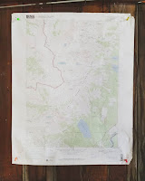
Since I was in elementary school I have enjoyed looking at maps and day dreaming about the places those maps depict. I like maps so much I have a couple of USGS topographical maps on the wall in my office. So whenever the USGS emails me with something new, I immediately investigate it. The latest […]
A Map Coloring Challenge

Last week Maps Mania shared a collection of online and printable map activities for kids and adults. At the bottom of that collection was a link to Mathigon’s map coloring challenge. The challenge is to use as few colors as possible to color in all 50 U.S. states without the same color touching two states […]
Teamimg – Collaborate to Make Interactive Images

Teamimg is a free tool that is a bit like Thinglink and Classtools’ Image Annotator without the hyperlinks. Teamimg lets you upload an image and share it. Once uploaded you can click on the image to write comments and reply to the comments that other people have written. The comment threads can be expanded or collapsed […]
Unscreen – Remove and Replace Video Backgrounds With Just a Click

In the last few months I’ve shared a some good tools for quickly removing the background from images. I even made a video about how to use Canva to remove and replace the background in your images. But until this morning when I read this Tweet from Greg Kulowiec I didn’t know of any tools […]
Google Earth Now Works in Firefox, Edge, & Opera!

I shared this news in my podcast earlier today, but just in case my podcast isn’t the first thing you listen to in the morning, I’m excited about the web version of Google Earth finally being available in Firefox, Edge, and Opera. The Tech Lead Manager and a software engineer for the Google Earth announced […]
Ten Fun and Challenging Geography Games for Students of All Ages

Over the years I’ve tried dozens of online geography games for students of all ages. Many have come and gone over the years but the following geography games are still going strong. WikiWhere is a neat map-based trivia game. The goal of the game is to identify cities based on their descriptions. The descriptions come from […]
Google Publishes 15 Favorite Street View Images
Google Maps turned 15 today. To celebrate, Paddy Flynn (Vice President of Geo Data Operations at Google), published Street View’s 15 Favorite Street Views. Notably, only one of the fifteen actually has a street in it! The rest are images of interesting places around the world and one is from space. My favorite of the […]
Quickly Create Collaborative Maps With Ethermap

Google’s My Maps tool is great for students to use to collaborate on the creation of custom maps. The problem with it is that students must have Google accounts in order to use it. Ethermap solves that problem by not requiring users to have any kind of email account. Ethermap is a new tool that […]
Teaching History With Technology 2020

The primary means through which I’m able to keep this site running is through revenue from speaking engagements and sales of my Practical Ed Tech professional development courses like Teaching History With Technology. For 2020 I’ve updated the course to include new things like making your own history apps, creating green screen videos, and using […]
How to Find, View, and Download Thousands of Historical Maps

There are some good historical map collections available in Google Earth. But you can also import your own historical maps into Google Earth. topoView is a good place to find historical maps that you can import into Google Earth. topoView is a USGS website that provides historical maps dating back to 1880. You can download […]
Dozens of Outline Maps You Can Print for Free

Even with tools like Google Earth and Google Map there is still a need for students to learn some basics of where things are in the world lest they think that Portland, Maine and Portland, Oregon are near each other. To that end, a classic geography activity has kids labeling blank outline maps. You could […]
Three Ways to Collaboratively Create Multimedia Maps
With Padlet’s new multimedia mapping tool and the recent update to the web version of Google Earth there are more ways than ever for students to collaborate on creating multimedia maps. The three collaborative multimedia mapping tools that I’m going to recommend to most people for the foreseeable future are Google’s My Maps, Padlet, and […]
How to Create a Multimedia Map on Padlet

Last week I shared the news that Padlet now includes multimedia map creation options. Like all other Padlet layouts, the map option includes the capability to collaborate. The maps that you create on Padlet can have placemarkers that include pictures, videos, links, text, and audio files. You can even record audio and video within the […]
How to Create a Google Earth Tour – Updated Web Version

The web version of Google Earth has been available for more than two years now. Over those two years it has lagged behind the desktop version in terms of feature availability. That is starting to change now that Google has finally added the option to create tours in the web version of Google Earth. This […]
Collaboratively Create Maps on Padlet

Padlet has been in my list of top collaboration tools for nearly a decade. I started using it with my students back when it was still known as Wallwisher. There are many ways to use Padlet from simply providing a place to share text notes to using it as a place to collect video samples […]
A Classic Geography Tool – Overlap Maps

As I mentioned on the latest episode of The Practical Ed Tech Podcast, last week I was reminded of a great little geography site called Overlap Maps. I hadn’t used it in a long time so I went to see if it was still functioning as it did when I was regularly using it seven […]
The Globe of Extremes – An Interactive Map
The Globe of Extremes is an interesting interactive map of the extremes of the Earth. On the map you’ll find things like the deepest spot on Earth, the point furthest from any ocean, and the highest permanent settlement in the world. When you open The Globe of Extremes it immediately starts to slowly spin to […]
My Top Twelve Tools for Social Studies Teachers and Students

Last week I published a list of my top five Google tools for social studies teachers and my top five non-Google tools for social studies teachers. If you missed either of those lists or you want all of them in one place, I’ve put together the following combined list and added two more items to […]
My Top 5 Google Tools for Social Studies Teachers and Students

As longtime readers of this blog know, my background is largely in social studies with a smattering of special education and corporate training thrown in for good measure. It’s teaching social studies that will always be my first professional love. That’s why I always get excited when readers send me questions like the one I […]
50 Years of Migration Waves

This morning while reading a National Geographic article about animal migrations in national parks I stumbled onto a related feature titled Migration Waves. Migration Waves is a series of graphs depicted the movement of humans between countries between the years 1967 and 2017. The graphs on Migration Waves are grouped according to four factors that […]
27 Birds, 27 States – A Good Nat Geo Series for Kids

A few years ago National Geographic Kids started publishing a series of videos called 50 Birds, 50 States. For some reason they never got beyond 27 states. The 27 videos that were released do present a fun way for students to learn some basic facts about each state. The videos are presented as animated rap […]
Changes Coming to the Popular GeoGuessr Geography Game

GeoGuessr is a fun geography game that I’ve been playing and sharing with others for the last six years. As I wrote back in 2014 GeoGuessr is a great game to have students play to spark their imaginations and lead them to making inquiries about interesting places all around the world. Yesterday, I was preparing […]
Canva Adds New Trifold Design Templates

Canva has been my go-to graphic design tool for the last half decade. It’s a tool that’s easy to use and makes those of us who don’t have an eye for design look like we do have a bit of a clue. I often the use Canva’s blog post graphics, Twitter graphics, and YouTube cover […]
The Third “Where on Google Earth is Carmen Sandiego?” Game is Now Available
Back in March Google launched “Where on Google Earth is Carmen Sandiego?” for use in the web and mobile versions of Google Earth. Then in May a second Carmen Sandiego game was added to Google Earth. Today, Google added a third Carmen Sandiego game to Google Earth. Just like in the first two games, the […]
5 Things You Can Teach Through Geocaching

Geocaching is one of the things that I spend a good bit of time talking about in both my workshop and in my webinar 5 Ways to Blend Technology Into Outdoor Learning. Geocaching is a great activity to do to get kids outside for hands-on learning experiences. Here are five things that you can teach […]
How to Measure Distances in Google Maps

A couple of weeks ago in the Practical Ed Tech newsletter I featured ten ways to use Google Earth in your classroom for more than just social studies lessons. Many of the ideas in that list can also be applied to the web browser version Google Maps. A good example of that is found in […]
8 Options for Making Digital Maps
In yesterday’s post about English Heritage’s Map of Myth, Legend, and Folklore I included a mention of using StoryMap JS to create interactive maps. That prompted a response from Cindy Rudy who suggested the idea of using Thinglink or Google Earth to make similar maps of myths, legends, and folklore. That was my inspiration for this […]
5 Google Earth Pro Tips for Teachers and Students
Google Earth is currently available in a few different versions. There is the web browser version that was built for use in Chrome and Chromebooks. There is an iOS version and an Android version for use on tablets and phones. And then there is the original version made for use as desktop software on Windows, […]
5 Tips for New Google Expeditions Users

Image copyright: Richard Byrne Google Expeditions is often the first educational virtual reality tool that I introduce to teachers who come to one of my workshops. Here are five tips that I frequently pass along to teachers who are preparing to use Google Expeditions for the first time. If you have never used Expeditions, you […]
How to Measure Distances & Share Google Earth Views

Thanks to YouTube’s “on this day” feature last night I was reminded that two years ago I published a video overview of what was then the new browser-based version of Google Earth. As I shared on my YouTube channel last night, Google has added a couple of features to Google Earth since I published my […]
Google Earth and Maps Lessons for Five Subject Areas

Google Earth and Google Maps are two of my favorite educational technology tools that often are seen as only being useful for geography or history lessons. While they are good for lessons in those subjects, Google Earth and Google Maps can be used for lessons in other subject areas. Here are some ideas and resources […]
5 Ways to Tell Stories With Maps
Maps can be great tools for supporting nonfiction and fiction stories. Being able to see the greater context of a location can go a long way toward helping students see the complete overview of a story. This can be helpful for learning about historical events, for supporting biographies, or for seeing the settings of fiction […]
How to Create a Map-based Story With StoryMap JS
StoryMap JS is a free tool that comes from the same people that offer the popular multimedia timeline tool called Timeline JS. On StoryMap JS you can create map-based stories. You create the story by matching slides to locations on a map. In the following video I demonstrate how to use StoryMap JS. Applications for […]
Where On Google Earth is Carmen Sandiego? – A Great Geography Game

The theme song for Where in the World is Carmen Sandiego? is an earworm for those of us who grew up in the 80’s or early 90’s. And thanks to Google’s new partnership with Houghton Mifflin Harcourt, we can now share the fun of Where in the World is Carmen Sandiego? with our kids. This […]
What’s the Difference Between England, Great Britain, and United Kingdom?
Since I’ve just returned from a trip to London, I figure it’s a good time to revisit one of my favorite geography videos. That video is The Difference between the United Kingdom, Great Britain and England Explained. The video explains name refers to, the differences between the three, and why some people incorrectly use them […]
Students Can Create Their Own Tours to Share in Google Expeditions
Googles’ Tour Creator launched last spring and since then has become one of my favorite tools for history and geography classes. One of my few complaints about it was that while students could easily build virtual reality tours, it wasn’t always easy to share those tours with their teachers and classmates. That is about to […]
Remove Image Backgrounds With PhotoScissors

PhotoScissors is a free image editing tool that you can use to remove the background from your images. PhotoScissors is available to use for free online and is available to download as desktop software. To use PhotoScissors online simply go to the site and upload a picture that you want to edit. After you have […]
Picture Yourself in Front of Any Landmark With Remove.BG and Google Slides

Last weekend I published a video about Remove.bg and it has certainly been a hit with many readers. I’ve received a lot of comments and questions about it in my email, Facebook pages, and on Twitter. This morning a reader named Marni sent me a question that was typical of what I’ve been seeing this […]
DuckDuckGo + Apple Maps = Private Map Searches

DuckDuckGo, the search engine that claims to not track your searches, has announced an integration with Apple Maps. According to the announcement this integration will let you search for places without DuckDuckGo or Apple Maps keeping a record of those searches. But in order to get directions from point A to point B you will […]
Best of 2018 – How to Use Google’s VR Tour Creator

This week is a vacation week for the vast majority of readers of this blog. As I do at this time every year, I’m going to republish some of the most popular posts of 2018. Here’s one from May. A few hours ago Google announced the launch of their new VR Tour Creator. This free […]
Kids US Atlas – Learn About Animals of the United States

Kids US Atlas is an iPad app that features an interactive map of the United States. On the interactive map you will find twenty-five animals that are indigenous to the United States. Tap on the animals to read about them, to hear about them, and to watch videos about them. The text passages about the […]
WWF Free Rivers – An Interactive, Augmented Reality Story About Rivers

WWF Free Rivers is a free augmented reality iPad app produced by the World Wildlife Foundation. The app uses augmented reality to present a story about rivers. In the app students learn about the importance of free-flowing rivers in world. The app offers a series of sections or experiences through which students can learn about […]
Three Tools for Creating Custom Maps Without a Google Account

Google’s My Maps is a great tool for designing custom maps. The problem with it is that students can only save their work if they have Google accounts. If your school uses G Suite for Education that’s probably not a problem, but it is a problem for students who don’t have G Suite accounts. If […]
4 Ways to Play Seterra’s Online Geography Games

Geography Awareness Week is a coming up later this month. If you find yourself looking for some geography games for your students to play, take a look at what Seterra has to offer. Seterra offers hundreds of geography games in 34 languages. You can play the games online in your web browser or download the […]
GeoGreeting – Send Messages Using Google Earth Imagery

Years ago I wrote about a service called GeoGreeting. This morning I got an email that reminded me of the service so I decided to see if it still works. Sure enough GeoGreeting still works as well as ever. It’s a free service that spells out your greetings using satellite images of buildings found in […]
How to Import Files Into Google Earth

In my previous post I shared the steps that I took to find a Google Earth file that contains more than 550 ancient locations in ancient Greece. At the end of the video in that post I demonstrated how I was able to display those locations in Google Earth. That method can be used for […]
How I Found a Google Earth File of 550+ Ancient Greek Places

Last night on Twitter Wes Fryer asked me if I knew of any Google Earth files that displayed ancient Greek locations. I didn’t have anything within my own bookmarks so I did a quick Google search that I filtered according to file type. I first filtered by file type .KMZ but that didn’t get me […]
How to Share Your Google VR Tours With Students

Over the last few weeks I have received a lot of emails from readers who had made virtual reality tours in Google’s VR Tour Creator but then ran into difficulty sharing those tours with their students. To answer those questions I made the following video that demonstrates how you can share your VR tours with […]
What is Mystery Skype?
Last week I reTweeted someone’s request to find a partner for a Mystery Skype activity. That generated some new connections, but it also generated a few questions from people who wanted to know what Mystery Skype is and what it entails. What is Mystery Skype? Mystery Skype is an activity in which you connect your […]
The Online Atlas of the Historical Geography of the United States

The Digital Scholarship Lab at the University of Richmond hosts the Atlas of the Historical Geography of the United States. This online atlas contains more than 700 historical maps of the United States. The maps within the atlas are arranged into eighteen sections. As a student and teacher of history I was drawn to the sections […]
More Than 5,000 Historical Maps for Teachers and Students
Florida’s Educational Technology Clearinghouse has a collection of more than 5,000 historical maps. The maps are licensed for free download and reuse by teachers and students. The collection is organized by continent and country. The US category is further broken down and organized by state and by historical theme. Some of the maps in this collection are […]
How to Share Specific Google Earth Views in Google Classroom

The development of the browser-based version made Google Earth accessible to students who use Chromebooks as their primary classroom computers. One way that I like to use Google Earth is to create sets of inquiry questions based upon a specific location and or a specific view of a place. You can tell students the location […]
How to Measure Distances in Google Earth

The addition of a measurement tool in the Chrome (browser) and Android versions of Google Earth was one of the many things that Google announced yesterday. I’m not sure what took them so long to add this because it was always a feature in the desktop version of Google Earth. In the following video I […]
How to Create a Virtual Tour That Includes Audio Narration

One of the many things that Google announced to coincide with the ISTE conference was the addition of an option to add audio to virtual reality tours created with Google’s VR Tour Creator. This is an update to the VR Tour Creator that was launched just a couple of months ago. This update lets you […]
The Web Version of Google Earth Finally Gets a Measuring Tool

Distance measurement has been a feature of the desktop version of Google Earth for as long as I have been using it. So I was surprised when it wasn’t included in the browser-based version of Google Earth that was launched last year. This morning Google announced that a measuring tool has finally been added into […]
Finding Old Maps Online
On Wednesday morning I shared a neat geography quiz that asks students to identify cities by looking at historic maps. In that blog post I suggested having students compare the historic maps shown in the quiz with other historic maps in order to come up with accurate responses on the quiz. Old Maps Online is […]
Identifying Cities from Historic Maps – A Geography Game

Late last year The Guardian published a challenging geography quiz. The quiz presents historic maps of ten cities. You have to identify the city by examining the map. The quiz is multiple choice so you do have a little bit of hint as there are only three choices for each map. The quiz gives instant […]
Map-based Stories from National Geographic
GeoStories are short, map-based stories featured on National Geographic Education. The stories combine text, maps, and pictures to tell a story as a series of slides connected to placemarks on maps. National Geographic Education currently offers twenty-three GeoStories. The current GeoStories cover subjects in the areas of politics, ecology, music, and exploration. Applications for Education Even […]
Great Journeys and Explorations – Stories Told With Interactive Maps and Timelines

Ever since I was an elementary school student I have loved reading about great journeys and explorations like those of Lewis and Clark, James Cook, and Robert Peary. As an adult I still love those stories and recently started reading The River of Doubt for a second time. Picking up that book reminded me of […]
How to Use Google’s New VR Tour Creator

A few hours ago Google announced the launch of their new VR Tour Creator. This free tool lets everyone create their own virtual tours to view in Google Cardboard and or in the Chrome web browser. Tours are created by selecting locations in Google Maps and then selecting 360 degree Street View imagery. There’s also […]
WikiWhere – A Challenging Map Game

WikiWhere is a neat map-based trivia game. The goal of the game is to identify cities based on their descriptions. The descriptions come from Wikipedia entries. You can get up to three clues before you have to answer by clicking on the map to identify the city that you think is described by the excerpts. […]
Open Explorer – Follow Along on National Geographic Expeditions

Open Explorer is a new offering from National Geographic that is designed to let anyone follow along on exploration expeditions around the world. When you visit the site you will see a big “get started” button on the homepage. Scroll down past that to see an interactive map representing the locations of more than 400 […]
National Geographic Publishes Fun Facts About All National Parks
As the weather warms in North America more visitors arrive in the 59 U.S. National Parks. Acadia National Park here in Maine is crowded in the summer so come visit in the winter to see another side of the first national park created from land donated to the federal government. That fun fact is one […]
Three Tools for Combining Maps With Timelines

Creating timelines whose events are directly connected to a map display is a good way for students to see correlations between locations and events. Here are three tools that students can use to create mapped timeline stories. StoryMap JS comes from the same people that offer Timeline JS. On StoryMap JS you can create mapped stories. […]
An Updated Version of Google Earth Released

Thanks to the Google Earth Blog I just learned about the release of an updated version of Google Earth Pro. Google Earth Pro (it’s free despite the “pro” designation) is the desktop version or “classic” version of Google Earth. The latest version includes thirteen improvements to Google Earth Pro. You can see the full list […]
A Fun Geography Game for All – Best of 2017
As I do during this week every year, I am taking some time off to relax and prepare for the new year. Every day this week I will be featuring the most popular blog posts of the year. This was one of the most popular posts in September. Earlier this week Maps Mania published a […]
10 Ways to Use Google Earth in Your Classroom – Best of 2017

As I do during this week every year, I am taking some time off to relax and prepare for the new year. Every day this week I will be featuring the most popular blog posts of the year. This one of the most popular posts in May. A couple of weeks ago Google released the […]
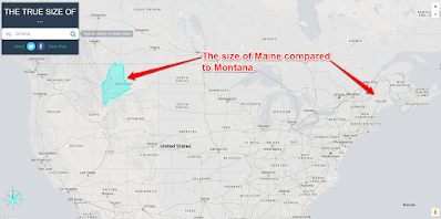
Three Sites That Help Students Compare the Size of Countries and States
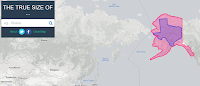
Over the weekend Open Culture featured one of my favorite websites to use in geography classes. That website is called The True Size Of… and it lets you quickly compare the size of two countries or two states within the United States. To compare two countries simply enter one into the search box then enter a […]
Free Wall Maps for Your Classroom
Like good manners and flannel shirts, wall maps never go out of style. If you need some new maps to put on the walls of your classroom, take a look at the free maps that National Geographic offers. Nat Geo Map Maker kits provide teachers with files for printing wall maps, table top maps, and […]
Use Google Earth & Maps for More Than Social Studies
Last week was Geography Awareness Week. All across social media there were lots of references made to ways to use Google Earth and Google Maps to teach geography. That makes perfect sense. But Google Earth and Google Maps can be used for much more than just geography lessons. That’s a large part of what I […]
10 Good Resources for Geography Awareness Week
This week is Geography Awareness Week. As academically-themed weeks go, this ons is my favorite. For as long as I can remember I have enjoyed looking at maps and wondering about far-off places. I hope that I’ve be able to pass on that fascination to some of my students. If you’re looking for some resources […]
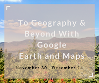
To Geography and Beyond With Google Maps & Earth

I loved Google Earth since the first time I used it. And I have enjoyed teaching it to many teachers over the last decade. That’s why I’m excited to offer To Geography and Beyond With Google Maps & Earth. This course will meet on three Thursday afternoons starting on November 30th. In addition to social […]
Games to Sharpen Geography Skills

These games provide students with fun and engaging ways to learn geography. They are a good way for students to explore new places on their own. Smarty Pins Combines geography and trivia. There are lots of categories to choose from including arts & culture, science & geography, sports & games, entertainment, and history & current events. […]
Teaching History With Technology – On-demand PD
Teaching History With Technology is my most popular Practical Ed Tech course after Getting Going With G Suite. In the last year more than 100 people participated in the course. Previously, I have only offered it as a live course that required participants to join weekly webinars. This fall I’m going to offer it in […]
A Fun Geography Game for All
Earlier this week Maps Mania published a list of ten geography games that are based on Google Street View imagery. Looking through the list reminded me of a geography game that is fun although it is not based on Street View imagery. That game is GameOn World. GameOn World is a multiplayer geography game developed by […]
5 Tutorials on Mapping Stories
In Wednesday’s broadcast of Practical Ed Tech Live I answered a question from a reader who was looking for advice on how to have students create maps based on stories that students read. The person had seen it done at a Google Apps Summit but couldn’t remember the name of the tool(s) that was used. […]
Membit – Augmented Reality Photo Maps

Membit is a neat augmented reality app for use on iPhones. The app lets you place view images superimposed over the current backdrop that you see through your phone’s camera. For example, you could open the app, point your camera at a building, and then see an image of what the building used to look […]
Google Earth for iPad Now Equal to Android Version
Back in April Google introduced a completely new version of Google Earth for Android and for use in your web browser. This week that new version finally arrived for iPhone and iPad users. Like the Android version of Google Earth, the iOS version features a “voyager” mode for taking virtual tours of places around the […]
Explore Street View Imagery With Your Voice
This afternoon at the Practical Ed Tech Chromebook Camp we spent some time exploring and talking about ways that Google Maps, Street View, Google Earth, and virtual reality can be used in classrooms. One of the things that seemed to engage everyone was Speak To Go With Google. Speak to Go is a Google WebVR […]
The Five Most Popular Ed Tech Tutorial Videos of 2017 So Far
Every week I publish a couple of tutorial videos on my YouTube channel. As we’re now more than half way through the year, I thought it would be good to take a look back the the most viewed ed tech tutorial videos that I have produced this year. 1. A Tour of the New Google […]
A Comparison of Historic Journeys
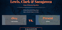
I’m writing this as I zoom through the air at 500+ miles per hour to get home after ISTE 17. Just 100 years ago this trip would have been on a train for days. And 100 years before that the journey would have be counted in weeks and months. That kind of comparison is what […]
World Population Trends – Interactive Map & Guiding Questions
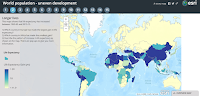
World Population Trends is an interactive story map series produced on the ESRI platform. Fifteen maps in the series show patterns of change in the world’s population from 1960 through 2015. The maps in the series represent population changes due to birth and death rate changes, life expectancy changes, fertility rate changes, and changes in […]
27 Ideas for Teaching With & About Topographic Maps – From the Archive

Due to an injury and some pressing personal matters requiring my attention, posts for the rest of the week will be favorites from the archive. The USGS offers free topographic maps for most of the United States. The maps can be downloaded as PDFs through the USGS store. The maps can be used in the […]
How to Find Old Maps Online

In yesterday’s Practical Ed Tech Live episode I answered a question about where to find old maps to layer in Google Earth. One of the resources that I suggested was Old Maps Online. Old Maps Online is a map that you can browse and search to find historical maps to view online, to download, and […]
10 Ways to Use Google Earth in Your Classroom
A couple of weeks ago Google released the new web-based version of Google Earth (take a tour of it here). The older desktop version of Google Earth is still available for free as well. The advantage of the web-based version is that anyone with a Chromebook or laptop can use it. The disadvantage to it […]
GE Teach Tour Builder – Create Google Earth Tours for the Web
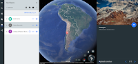
GE Teach is a fantastic project developed by Josh Williams. Josh and his students were some of the first to use the new version of Google Earth in a classroom. In fact they used it before it was available to the public. (Click here for a video overview of the new Google Earth). The new […]
How to Create Your Own Placemarks in the New Google Earth

A new version of Google Earth was released yesterday. In my initial review of it I was excited that it now works in your web browser while also being disappointed by the lack of creation tools that it contains. Fortunately, you can still put your own multimedia placemarks on Google Earth by importing a KML […]
A Tour of the New Google Earth – Google Earth in Your Browser
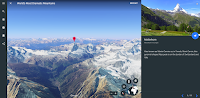
This morning Google released a completely new version of Google Earth. The new version is designed to be used in the Chrome web browser or in a new Google Earth Android app (iOS version coming eventually). I spent about an hour trying out the new web version of Google Earth. Then I recorded the video […]
See California’s Redwoods in Google Street View
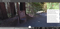
In an earlier post I shared the Google Expeditions virtual tours of national parks. Shortly after publishing that post I discovered Google’s latest additions to their Street View collections. The latest addition features Big Basin Redwoods State Park in California. This imagery lets viewers virtually experience some of the size and scale of California’s redwood […]
Peaks and Valleys – An Interactive Story Map
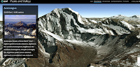
Peaks and Valleys is an interactive story map produced on the ESRI platform. As you scroll through the story map the highest peaks and lowest valleys on each continent are revealed in 3D renderings. As you scroll through the 3D imagery a sidebar pops-up. That sidebar contains a photograph of the peak or valley and […]
Don’t Forget the Greater Context on Your VR Trip

During last week’s Practical Ed Tech Live episode (join me this Thursday at 4pm EDT) I was asked about virtual reality, specifically Google Expeditions. The point that I tried to emphasize in my response was that it’s important that we don’t lost the greater physical geographic context when we take students on virtual reality trips. […]
Hone Geography Skills With These Fun Games
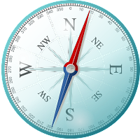
Yesterday, I received an email from Kahoot that featured six games they are promoting along with National Geographic. The games are intended to help students brush-up on their knowledge of U.S. and world geography. You can find those games here in the public gallery in Kahoot. I played a couple of the games and found […]
Duolingo Tinycards – Quick Review Activities

Tinycards is a free service from Duolingo that provides quick review activities in your web browser or on your iPad. Tinycards are essentially multimedia flashcards with a few quiz questions interspersed between them. The idea being that students will flip through a few digital flashcards then answer a question or two to test their recall […]
To Geography and Beyond With Google Maps
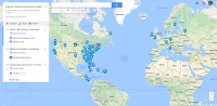
When we hear “Google Maps” we often think that it is only useful for social studies lessons. In addition to social studies Google Maps can be used in physical education, mathematics, science, and language arts lessons. Tomorrow afternoon at 4pm EST I will teach you to use Google Maps in a variety of subject areas. […]
Creating and Telling Stories With Maps
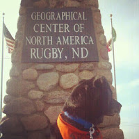
For as long as I can remember I have loved to look at maps. I distinctly remember looking at the maps in my third grade social studies book and wondering what people in the middle of the Soviet Union were like. And as I got older I would look at maps of northern Canada and […]
A Short Lesson About the Great Lakes
In the fall of 2012 I crisscrossed my way across Michigan’s upper peninsula. In doing so I was able to experience some of the magnitude of Lake Superior, Lake Michigan, and Lake Huron. I was along the shore of Lake Superior during a storm that created waves the size of those we see on Maine’s […]
Take a Virtual Tour of Petra In Google Cardboard or In Street View

Last year Google added a virtual tour of Petra to its collection of landmarks that you can see in-depth in Google Maps Street View. This week that tour was updated for viewing in Google Cardboard VR headsets. Much of the imagery used in the tour was captured by a Street View Trekker camera. Take a […]
Track Santa and Learn About Christmas Traditions Around the World

If your family celebrates Christmas and you’re looking for a nice activity to do with young kids at home, take a look Google’s annual Santa Tracker website. The site lets kids see when and where Santa is traveling from his home at the North Pole. The Santa Tracker site shows you where Santa is in […]
Explore Maps of Historical Sites in Every U.S. State
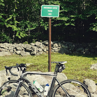
The Traveling Salesman Problem is a website developed by William Cook at the University of Waterloo. The site features interactive maps that chart the short distance between a series of places. One of those maps is of all of the places in the United States National Register of Historic Places, all 49,603 of them.You can […]
Free World and U.S. Map Puzzles for iPads & Android Tablets

Digital Gene offers a variety of educational apps for iPads and for Android tablets. Two of the Digital Gene apps that could be useful for elementary school geography review are Enjoy Learning World Map Puzzle and Enjoy Learning U.S. Map Puzzle. Both of these free iPad apps have the same basic types of puzzle activities. […]
Two Good Sets of Animated Maps for U.S. History Students
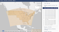
Creating my earlier post about resources for learning about Pearl Harbor prompted me to revisit a couple of animated maps of U.S. History. History Animated is a resource that I first started using with students in 2009. History Animated provides animations of battles of the American Revolution, the War of 1812, the US Civil War, and US Campaign in […]
193 Short Timelapse Videos of Our Changing World
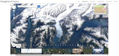
On Tuesday Google announced the publication of new Google Earth timelapse imagery. The new imagery shows the how the physical geography of the Earth has changed over the last 32 years. You can see this imagery on the Google Earth Engine website or you can view it as a series of 193 short videos on […]
Pic4Carto – Find Creative Commons Images Based on Location
There are plenty of places to find public domain and Creative Commons licensed pictures on the web. Some of my favorite places were featured in this post on Practical Ed Tech. Pic4Carto is an interesting site that I will probably add to that list in the future. Pic4Carto is a site that lets you browse […]
5 Fun Geography Games for Geography Awareness Week
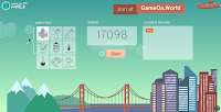
On each of the previous three days I’ve shared some resources and ideas for Geography Awareness Week. Continuing that pattern, here are five fun games that your students can play to test and develop their knowledge of geography. GameOn World is a multiplayer geography game developed by a high school teacher and his student in Portland, […]
These Tools Help Students Compare the Sizes of States & Countries

I’m in Scottsbluff, Nebraska this morning. On Friday I drove from Denver to Cheyenne to Scottsbluff. Making that drive reminds me that Maine is quite small in comparison to western states. While it’s hard to replicate the experience, there are tools that help students see the size of states and countries relative to others. The […]
An Easy Way to Find Google Earth Tours
In my presentation To Geography & Beyond With Google Maps & Earth I always share some tips on how to locate Google Earth tours. One of those tips is to refine your Google search by file type and select .KMZ. In the video embedded below I provide a demonstration of how to quickly find, open, […]
Try Flippity’s Mix & Match Template to Generate Random Story Starters
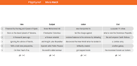
Flippity is a great website that provides templates for creating games, quizzes, and flashcards in Google Sheets. Recently, Flippity published a new template that could be great for creating random story starters. The latest Flippity template is called Mix & Match. Mix & Match lets you create an online grid that features random bits of […]
5 Types of Stories Students Can Tell With Digital Maps
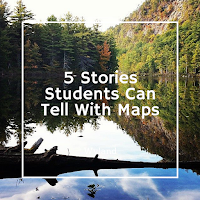
When most teachers hear or read about Google Maps, Google Earth, ESRI, and other digital mapping tools they tend to think about social studies topics. While digital mapping tools are perfectly suited to social studies lessons, they can also be used in other subject areas including math, language arts, and science. Here are five types […]
GameOn World – A Great, Multiplayer Geography Game

GameOn World is a new, multiplayer geography game developed by a high school teacher and his student in Portland, Maine. The game is similar in structure to that of Kahoot. In GameOn World the teacher selects a game category (cities, places, and timeline are three of the nine categories) and starts the game. The students […]
27 Ideas for Teaching With & About Topographic Maps

The USGS offers free topographic maps for most of the United States. The maps can be downloaded as PDFs through the USGS store. The maps can be used in the 27 suggested topographic maps lessons found in the USGS education site. All of the lessons are rated by grade level and time required for completing […]
How to Create, Share, and Print Thematic Maps
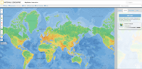
Google’s My Maps and Google Earth tools can provide a great way to create thematic maps. Unfortunately, those tools are quite limited if your students don’t have Google Accounts to use at school. National Geographic’s Mapmaker Interactive is a free map creation tool that doesn’t require students to have any kind of registered account in order to […]
The World of 7 Billion – A Student Video Contest
The World of 7 Billion is an annual video contest designed to get students to think about issues related to population growth. The contest asks middle school and high school students to produce sixty second videos about how population growth impacts one of the following three issues; climate change, ocean health, or rapid urbanization. Students’ videos must […]
A Simple Way to Make Your Own Google Maps Street View Game
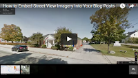
Earlier this week I stumbled upon a local radio station’s blog in which they had posted a little game called How Well Do You Know Maine Roads? That game was nothing more than ten Google Maps Street View images that you had to try to identify. The answers to the game prompts were posted at […]
GPlates Portal – Visualizations of Geophysical and Geological Data
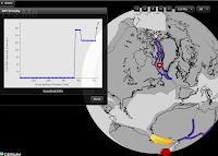
GPlates Portal is a resource that teachers of geology and geography will want to spend some time exploring. GPlates Portal is produced by the School of Geosciences at the University of Sydney. In the GPlates Portal you will find twelve interactive displays of geological and geophysical data. Most of the interactive displays that you will […]
Free Printable Maps from the USGS and National Geographic
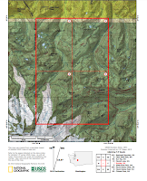
The United States Geological Survey creates topographical maps of the United States. The USGS maps can be downloaded for free from the USGS website. The USGS website can be a little tricky to use. Another option is to use National Geographic’s USGS map portal to find, download, and print maps. On that site you can […]
PAT – Free, Open Source, Portable Atlas

PAT is a free collection of maps developed by Ian Macky. The collection includes maps of every country in the world.The collection also includes maps of U.S. states, maps of Canadian provinces, Australian states, and regional maps. You can download any and all of these detailed maps for free. Applications for Education PAT is an excellent resource for geography and […]
Three Good Ways to Use Word Clouds With Students
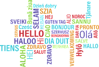
Last week’s Practical Ed Tech Tip of the Week featured two good tools for creating custom word clouds. Throughout the week people have Tweeted suggestions about how to use word clouds with students. Here are three word cloud activities suggested by folks on Twitter. 1. SMS World Geography suggested the following: @rmbyrne love this! “What […]
How Does a Canyon Become Grand? – And Other Lessons on the Shaping of North America
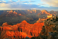
Earlier this month TED-Ed published a new lesson about how the physical geography of North America has changed over time. The lesson, titled How North America Got Its Shape, includes brief explanations of the roles of shifting tectonic plates, erosion, and volcanic activity in shaping North America. The lesson includes the Grand Canyon as an […]
Mission Mapquest – Create a Map Game That Can Be Played on iPads

Mission MapQuest is a great map game creation tool developed by friend Russel Tarr for his ClassTools.net website. The concept behind Mission Mapquest is rather straight-forward one. On Mission Mapquest you create a series of clues that your students need to follow to identify places around the world. You can add as few or as many clues to your MapQuest […]
GeoQuiz – A Talking Map Quiz
There is certainly not a shortage of map quiz on games on the Internet. GeoGuessr and Spacehopper have been two of my favorites for a long time. Now I have another to add to my list of favorites. That addition comes in the form of GeoQuiz. GeoQuiz is a map game that shows you a […]
Three Ways for Students to Compare the Sizes of Countries and States
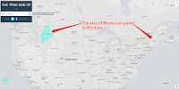
My students here in Maine always think of our state as being a big place and it is relative to the rest of New England. Compared to our friends in the west, Maine is a small place. Similarly, they sometimes have trouble understanding the size of the lower 48 states compared to Canada. The following […]
Geopedia – A Map & Wikipedia Mashup
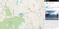
Geopedia is a nice combination of a map and Wikipedia entries. Search for a location on the Geopedia map and you will be shown a bunch of map placemarks around that location. Click on any of the displayed placmarks and you will see a corresponding image and Wikipedia entry. To change locations you can either […]
Another Great Resource for Learning About Mount Everest
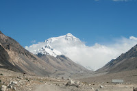
On Wednesday I shared my list of resources for teaching and learning about Mount Everest. This afternoon, thanks to Larry Ferlazzo, I learned about another good resource for learning about Mount Everest. Why is Mount Everest so Tall? is a new TED-Ed lesson in which students learn why the peak of Everest is so high, […]
Exploring Mount Everest – Street View and More
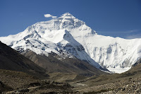
The spring climbing season on Mount Everest and the surrounding peaks of the Himalaya is now upon us. As long-time readers of this blog may recall, one of my bucket list items is seeing Mount Everest in person. Until then I have to entertain myself with books, videos, and imagery of the mountain. Here are […]
Who Owns Antarctica? – A Political Geography Lesson
Who owns Antarctica? That’s an interesting question that many of my geography students wondered and asked over the years. The answer to that question is a clear and simple one. As more people, countries, and companies explore the continent it will become more and more important to define what can or cannot be done in […]
Travel the Iditarod Race in Google Street View
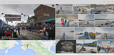
The Iditarod Sled Dog race begins today. It’s one of the events that I would love to see in person some day. While I cannot get there in person this year, I can view it in Google Street View. Earlier this week Google published a new collection of Street View imagery capture along the Iditarod […]
How to Use Google’s My Maps in Your Classroom
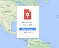
This morning at the NCTIES 2016 conference I facilitated a short workshop on using Google Maps and Google Earth in the classroom. Both tools are so robust that it is hard to cover everything you can or could do with them in just 90 minutes. To support the workshop I have a bunch of additional […]
How to Compare Maps Side-by-Side in GE Teach
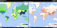
Last week I wrote a post in which I featured using GE Teach to compare maps side-by-side. GE Teach can be a powerful tool when you dive into the features hidden within it. In the video embedded below I demonstrate how to access and use the features of GE Teach.
5 Good Google Tools for Social Studies Students
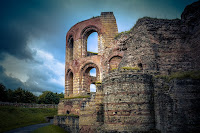
This evening I gave a short webinar presentation on my five favorite Google tools for social studies teachers and students. The webinar was hosted by the New England ISTE group. The content of key elements of the webinar are outlined below. Besides what you see featured below we also looked at Google’s Ngram Viewer. 1. […]
Students Can Compare Maps Side-by-Side in GE Teach

GE Teach is a great map tool that I last featured about 18 months ago. GE Teach is developed and maintained by a high school teacher in Texas named Josh Williams. We had the chance to meet at TCEA this week and chat about GE Teach. GE Teach has gone through a bunch of iterations […]
Three Thematic Mapping Tutorials
This morning on the Free Technology for Teachers Facebook page I received a question from someone seeking a thematic mapping tool that her students can use. My initial thought was to use Google’s My Maps tool. Recognizing that not everyone is in love with Google products, I will also frequently suggest using National Geographic’s Map […]