All About Venice – Another Post Inspired by my Daughters

A few days ago while driving home from seeing a community theater’s musical production of The Little Mermaid one of my daughters asked me “why does Venice have canals instead of roads?” It was a question that I was happy to answer. The question also inspired me to revisit some items on the topic that […]
Ten Books That Shaped America

Just like I do with my weekly newsletter, C-SPAN Classroom sends their weekly newsletter on Sunday evenings (Eastern Time). When I read it last night I learned about a new C-SPAN series that sounds great! It’s called Books That Shaped America and it is presented by C-SPAN in conjunction with the Library of Congress. Books […]
An eBook for History Teachers and History Students

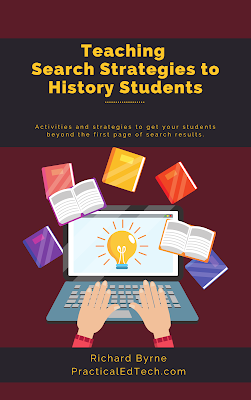
At the start of every school year I like to review search strategies with students. If you like to do the same and want some new ideas to try this fall, take a look at my eBook Teaching Search Strategies to History Students. In Teaching Search Strategies to History Students I outline activities that you can […]
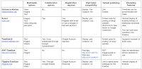
Seven ClassTools Templates to Try This Year
ClassTools has long been a favorite resource of mine for creating all kinds of fun, online activities for social studies classes. As the new school year approaches it’s a good time to take a look at seven of my favorite ClassTools games and activities templates. Play Your Dates Right is one of the templates that […]
Hello History – Have a Chat With Hundreds of Historical Figures

I’m taking the week off to do a bunch of fun things with my kids. While I’m away the most popular posts of the year so far will reappear. Hello History is a new AI app that I wrote about last week. Almost immediately after I published my blog post about Hello History I started […]
Math, Science, History, and Search Lessons Based on Baseball
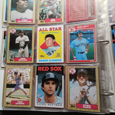
Baseball is my favorite professional sport to watch. The Red Sox have been my favorite team for as long as I can remember which is why I still occasionally look through the baseball cards I collected as a kid. And going to last year’s Hall of Fame induction ceremony for David Ortiz was one of […]
An eBook for History Teachers and Their Students

Earlier this year I listed the educational technology topics that I’m still passionate about after all these years. One of those topics is search strategies and discovery tools for students. To that end, I’ve recently updated my e-book on Teaching Search Strategies to History Students. In my updated e-book Teaching Search Strategies to History Students […]
Short Lessons About the 4th of July

Everywhere I look this weekend I see signs and mentions of 4th of July weekend. My daughters (ages 5 and 6) have noticed them as well. That inspired my oldest to ask while we were driving home from Santa’s Village yesterday afternoon, “what’s 4th of July?” Of course, I was more than happy to explain […]
160 Free Lesson Plans on Teaching With Historic Places
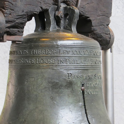
I’m going to Philadelphia next week. I’m going to attend the ISTE Conference, but while I’m there I’m also going to visit a few historic landmarks that I’ve not visited in a long time. One of those landmarks is The Liberty Bell. While looking up the visiting hours for the Liberty Bell visitor center I […]
60,000+ Images of Art and Artifacts to Download and Re-use for Free
The Museum of New Zealand offers more than 60,000 images of art and artifacts to download and re-use for free. The images are a mix of public domain images and images labeled with a Creative Commons license. The museum makes it easy to determine how an image is licensed. To determine the licensing of an […]
4,000+ Pages of Walt Whitman’s Papers

This week the Library of Congress announced the addition of more than 4,000 new primary source documents to the By the People website. Those primary sources are all letters, notes, and manuscripts written by Walt Whitman. The purpose of the By the People project is to enlist the help of the public to transcribe thousands of primary source documents that are […]
An eBook for History Teachers and Their Students

Earlier this spring I listed the educational technology topics that I’m still passionate about after all these years. One of those topics is search strategies and discovery tools for students. To that end, I’ve recently updated my e-book on Teaching Search Strategies to History Students. In my updated e-book Teaching Search Strategies to History Students […]
Digital Collections of 20th Century World History Declassified
The Wilson Center Digital Archive offers many collections of declassified historical documents. The documents contain memos and transcripts of communications between diplomats and country leaders. The collections are arranged into topics and themes. You’ll find collections of documents related to the construction of the Berlin Wall, the origins of the Cold War, Sino-Soviet relations, and diplomatic efforts […]
Play Your Dates Right – A History Timeline Game

ClassTools.net has many great online game templates for history teachers to use. Play Your Dates Right is one of the templates that I like to use to create a game that is focused on helping students recall the sequence of historical events. In the video embedded below I demonstrate how to create a simple timeline-based […]
Breaking News With ClassTools

Breaking News is one of the many great tools available on Russel Tarr’s ClassTools.net. Breaking News is a template for creating fake breaking news screens like those that you might see on CNN or BBC News. Through the template you can add a news headline, a ticker, a location, and custom background image. After completing the […]
Create Animated Timelines in Google Slides
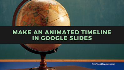
One of my most popular Google Slides tutorials is a video about how to use Google Slides to create a timeline. A follow-up to that video demonstrates how to use the animation tools in Google Slides to add animations to a timeline. In the following video I demonstrate how to create an animated timeline in Google […]
A Geography Lesson About Strange Borders
Belgian Farmer Accidentally Moves French Border is a fun little story and geography lesson in one. It’s almost exactly what the title says. A farmer moved a stone that was in his way when plowing a field. It just happened that the stone he moved is a marker for the border between two small towns in […]
Join Me for a Search Strategies Webinar Tomorrow
Do you teach middle school or high school social studies classes? Have you ever had a student say to you, “Google has nothing on this” or “I can’t find any information about this?” If you answered “yes” to either of those questions, you’ll want to join me in a webinar tomorrow evening (Eastern Time) that […]
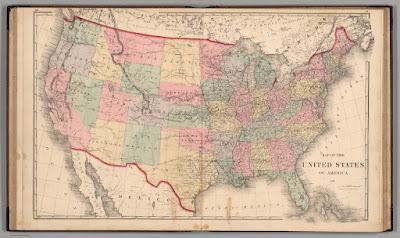
Five Good Collections of Historic Maps for Classroom Use

Last week I wrote a blog post featuring the newly published historic map collection hosted by the Internet Archive. That collection, the David Rumsey Historical Map Collection, is the latest of the historic map collections that I’ve featured on this blog over the last fifteen years. Here are some others that I’ve featured and used […]
Search Strategies Webinar Next Tuesday

Do you teach middle school or high school social studies classes? Have you ever had a student say to you, “Google has nothing on this” or “I can’t find any information about this?” If you answered “yes” to either of those questions, you’ll want to join me for next Tuesday’s webinar all about teaching search […]
New eBook – Teaching Search Strategies to History Students

Earlier this week I listed the educational technology topics that I’m still passionate about after all these years. One of those topics is search strategies and discovery tools for students. To that end, I’ve recently updated my e-book on Teaching Search Strategies to History Students. In my updated e-book Teaching Search Strategies to History Students […]
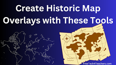
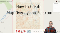
Create Historic Map Overlays With These Free Tools
Yesterday morning I shared a collection of more than 100,000 historic maps for classroom use. In that post I mentioned using those maps to create digital overlays on current maps. Google Earth provides a couple of ways to do that. Felt.com is another digital mapping tool that can be used for the same purpose. In […]
More Than 100,000 Historic Maps for Classroom Use
Credit: David Rumsey Map Collection, David Rumsey Map Center, Stanford Libraries. Source 1. Source 2. In this week’s Practical Ed Tech Newsletter I mentioned that digital mapping tools is one of the areas of educational technology that I’m still passionate about after sixteen years and 17,000 blog posts. And making comparisons through the use of […]
Lesson Plans and Videos About Patriots’ Day and the American Revolution
As I wrote in my previous post, there are two things that I write about at this time every year. One of those is income taxes. The other is Patriots’ Day and the American Revolution. That’s what this post is about. Patriots’ Day here in Maine, in Massachusetts, and in a handful of other states […]
Have a Chat With Hundreds of Historical Figures

Hello History is a new AI app that I wrote about last week. Almost immediately after I published my blog post about Hello History I started to get questions about it. To address a bunch of those questions, I created the short video overview that is embedded below. Video – How to Use Hello History […]
All About Explorers – It’s Still a Great Site
All About Explorers is a site that Russel Tarr told me about many years ago. I was recently going through my archives to remove links to sites that no longer exist when I came across All About Explorers again. I was pleased to see that it’s still going. All About Explorers developed by Gerald Aungst and […]
Hello History – An AI App for Chatting With Historical Figures

Hello History is a new iPhone and Android app that lets you chat with historical figures. The list of characters with whom you can chat ranges from pop culture icons to artists, politicians, and civil rights activists. Hello History uses AI in a manner similar to that found when using AI tools like ChatGPT. You […]
Short Lessons on Rome and Life as a Roman Teenager

National Geographic has a great series of YouTube videos called National Geographic 101 which include videos like Ancient Rome 101. The video provides an excellent introduction to the origin, rise, and fall of the Roman Empire. The length and substance of the video makes it an ideal candidate for inclusion in an EDpuzzle lesson. TED-Ed has […]
How to Use Street View Imagery in Canva Presentations
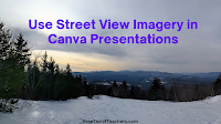
Earlier this week I published a tutorial for making your first presentation in Canva. After you and or your students feel comfortable with the basics, you may want to start exploring some of the advanced features available within Canva. One of those is the ability to embed interactive Google Maps and Google Street View imagery […]
Three Ways to Share Google Maps Views in Google Classroom
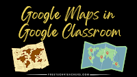
Google Maps is one of the tools that I always list as a must-have for history and geography teachers. It provides an easy way to show students multiple, detailed views of the significant natural and human-made landmarks they’re learning about in your classroom. Projecting them on a big screen in the front of your classroom […]
Great Art Explained
Despite the efforts of my friend Maggie, I don’t always understand what makes one work of art great and a similar-looking one fit for display in a Hilton Garden Inn. I thought about that last weekend when I came across a YouTube channel called Great Art Explained. The channel seems to have been made for […]
Three Ways to Quickly Map Spreadsheet Data
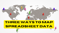
I recently came across an older Towards Data Science article about ten ways to represent data on maps. Reading the article reminded me of something that I’ve tried to share with social studies teachers and students over the years. That thing is that a great data set can tell you a lot. A great map can tell […]
Lesson Plans for The State of Union Address

Tomorrow night President Biden will give the annual State of the Union Address. C-SPAN Classroom offers more than one hundred resources for teaching and learning about The State of the Union Address in historical and current contexts. If you don’t have time to review all of the resources that C-SPAN Classroom offers (honestly, who does?), […]
Gray Whale Migration and More Felt Mapping Ideas

Felt is a multimedia mapping tool that I started using late last year. It has quickly become one of my preferred tools for creating multimedia maps. In fact, at this point I think I like more than Google’s My Maps. The aesthetics of Felt are great and it has a great selection of easy-to-use features. […]
I’m Feeling Lucky – Around the World With Google Earth

Google Earth is one of my all-time favorite tools for teaching geography and history lessons. Two of my favorite ways to use Google Earth in the classroom are outlined below. From voyages to games to simple measuring tools, the web version of Google Earth has a lot of neat features that can help students learn […]
How to Include Google Maps in Your Google Documents and Canva Documents

Canva’s new documents tool has a bunch of great features that I highlighted in a video last month. One of those features is the ability to embed just about anything into the body of your document. In the demonstration that I gave last month I embedded videos and presentations. You can also embed Google Maps […]
StudentCam 2023 – Only Three Weeks Left

When it was announced back in September the entry deadline for the 2023 C-SPAN StudentCam contest seemed so far away. Now that 2023 is here, the deadline feels very close. That’s because it is close! The entry deadline for the 2023 C-SPAN StudentCam contest is January 20, 2023. Every year C-SPAN hosts the StudentCam video contest for middle […]
How to Create Map Overlays
Felt was one of my favorite new tools in 2022. In fact, I liked it so much that I included it in my Best of the Web for 2022. Felt is a free multimedia mapping tool that I think is easier for first-time users to use than Google’s My Maps or ESRI’s mapping tools. Right […]
Best of 2022 – A Big List of Geography Resources
As I do at this time every year, I’m taking the week off to ski and play with my kids, shovel snow, and generally not think about work. I have some of the most popular posts of the year scheduled to republish this week. New posts will resume in the new year. This week is […]
New Features of the LOC’s By the People

By the People is a Library of Congress project that I’ve written about and featured in my Teaching History With Technology courses since 2018. On By the People teachers and students can contribute to crowd-sourcing transcriptions of thousands of primary source documents. Some of the collections that I’ve featured over the years have been campaigns […]
Color Our Collections – National Portrait Gallery Coloring Pages

Color Our Collections is a feature of the Smithsonian Learning Lab. Within the collection you will find coloring pages based on some of the art work housed by the Smithsonian. One of the sets of coloring pages that was recently featured in a Smithsonian Learning Lab email was this collection of coloring pages based on […]
New Base Map Options on Felt

Felt is a new digital mapping tool that I’ve featured a few times in the last month because I think it is fantastic alternative to Google’s My Maps and the web version of Google Earth for creating custom maps. In fact, I like it so much that I demonstrated it in my Best of the […]
Biographies in Infographic Form

Last week while looking for a Canva template to create the copyright guide that I distributed in my Practical Ed Tech newsletter I came across an interesting template titled George Washington’s Biography. It’s a relatively simple template that students could easily modify to create a visual-heavy biography of just about anyone including themselves. Applications for […]
Ten Good Tools for Making Multimedia Timelines

Last week I read a Book Widgets blog post about fun ways to use timelines in your lessons. Reading that post inspired me to make a new video about making timelines with Adobe Express. It also prompted me to update my list of good tools for making multimedia timelines. Timeline JSTimeline JS is still my favorite […]
A Free Smithsonian Webinar Tomorrow

Some of my high school history students often took a while to understand the idea that just because a document is an old primary source it doesn’t automatically mean that source is infallible or even an accurate representation of events. They still needed to account for context and the potential for an author’s bias among […]
Two Ways to Make Timelines With Adobe Express

A couple of days ago I read a Book Widgets blog post about fun ways to use timelines in your lessons. Reading that blog post inspired me to create a new video about another tool that students can use to create timelines. That tool is Adobe Express. In Adobe Express there are two ways that […]
A Google Earth Lesson With the “I’m Feeling Lucky” Button
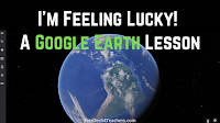
Since it is Geography Awareness Week I thought I’d pull a lesson plan from my archives to share with you. From voyages to games to simple measuring tools, the web version of Google Earth has a lot of neat features that can help students learn about the world. One of those neat features is the […]
An Overview of Five Fun Geography Games for Students

Today is the first day of Geography Awareness Week. In the following videos I provide an overview of five map-based geography games that your students can play this week or any other time they need to practice identifying places around the world. All five games are featured in this compilation video. Read on for descriptions […]
A Small Collection of Resources for Teaching and Learning About Veterans Day

This Friday is Veterans Day. If you find yourself looking for some quick lessons to review with your students, here’s a small collection for you. ReadWorks ReadWorks is one of my favorite places to go when I need information texts about a holiday to share with students. ReadWorks has a good collection of Veterans Day articles that […]
GeoQuiz History Edition – A Fun and Challenging Geography Game

The start of Geography Awareness Week is nine days away. It’s probably my favorite academically-themed week of the year. (Yes, that’s my social studies teacher background coming through). Over the next week or so I’ll be sharing a bunch of great resources for teaching and learning about geography. To start things off I have a […]
Get Ready for The Great Thanksgiving Listen 2022

During Tuesday night’s episode of Two EdTech Guys Take Questions the topic of audio recording came up. That prompted me to go on a little bit of a tangent (as I’m prone to doing) about The Great Thanksgiving Listen hosted by StoryCorps. The Great Thanksgiving Listen hosted by StoryCorps is back for the eigth year in […]
A New Primary Source Crowd-sourcing Project from the Library of Congress

By the People is a crowd-sourcing project that enlists the help of the public to transcribe thousands of primary source documents that are housed by and have been scanned by the Library of Congress. Over the years there have been collections of documents from the American Civil War, papers from the American Revolution, presidential papers, documents […]
How to Create a Digital Map Collection in Wakelet

Wakelet is a free, collaborative bookmarking and file organization tool that puts things into a nice visual display. So when a former colleague emailed me a couple of days ago to ask for help creating a collection of digital maps Wakelet was one of the first tools to come to mind (Padlet was the other). […]
Webinar – Engage and Investigate With the Ken Burns Classroom Collection

As a student and teacher of U.S. History, I’ve enjoyed many of the documentaries produced by Ken Burns (even if my students didn’t always enjoy them). That’s why I’m excited about a new webinar from the National Council for the Social Studies. The webinar is titled Engage and Investigate With Resources from the Ken Burns […]
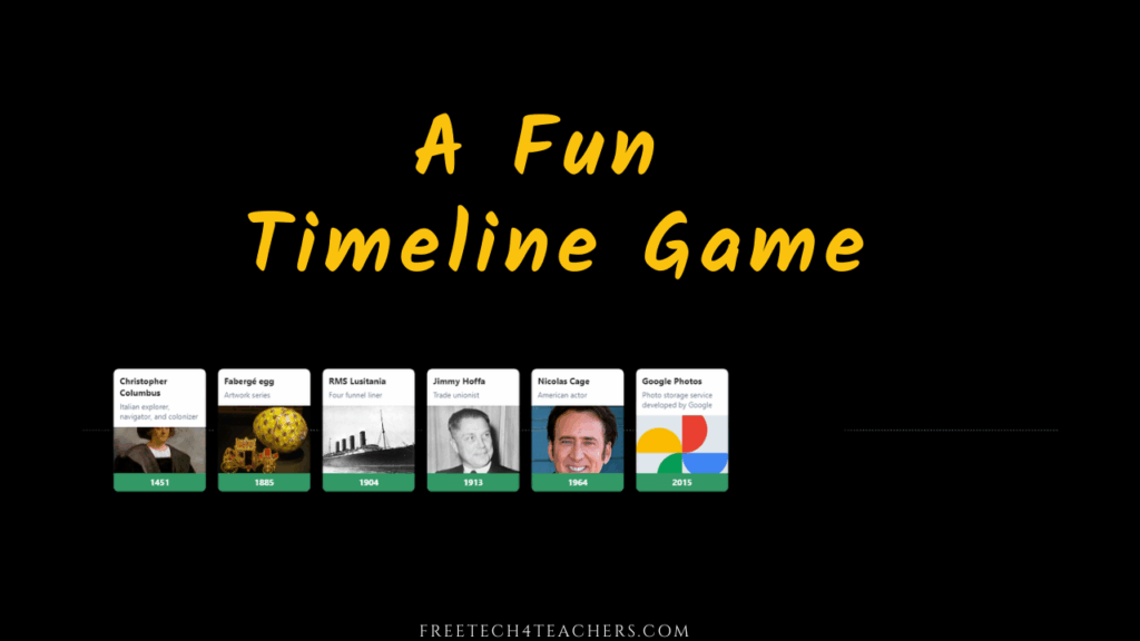
A Fun Timeline Game for History Students

Play Your Dates Right is another great game template developed by Russel Tarr at ClassTools.net. The concept of Play Your Dates Right is that students have to pick the correct sequence of three historical events. The event in the middle of the game template is always the event that actually did come second. Students have […]
Read and Help Transcribe Walt Whitman’s Notebooks and Diaries

A handful of years ago the Library of Congress launched a crowd sourcing project called Crowd which has since been renamed as By the People. The purpose of the project is to enlist the help of the public to transcribe thousands of primary source documents that are housed by and have been scanned by the […]
Animations of Historical Movements and Patterns
Some of my favorite social studies lesson plans include having students use maps to analyze data and identify patterns in history. Over the years I’ve done this with paper maps and digital maps. Mapping History, produced by the University of Oregon, features lots of animated maps illustrating problems, patterns, and events throughout history. Mapping History […]
Eight Good Tools for Creating and Publishing Timelines

Having students create timelines has been a standard in the playbooks of history teachers since the beginning of history. Writing a timeline is a good way for students to chronologically summarize sequences of events and see how the events are connected. When I was a student and when I started teaching timelines were made on […]
Brief Explanations of Indigenous Peoples’ Day and Why Some States No Longer Have Columbus Day

Monday is Indigenous Peoples’ Day here in Maine. In other states it is still referred to as Columbus Day. The Daily Bellringer offers a good video that explains the history of Columbus Day and why some cities and states are now celebrating Indigenous Peoples’ Day instead. Watch the video on YouTube and open the description to find […]
Tutorials for Getting Started With the Smithsonian Learning Lab

The Smithsonian Learning Lab allows teachers to create and search for documents, images, videos, interactive animations, and lesson plans from a wide range of Smithsonian-hosted resources. It also lets you create collections to share with others as well as create assignments to give to your students. To start the new school year The Smithsonian published a collection […]
The Descent of the Serpent – A New Google Arts and Culture Game

This week Google Arts and Culture released a new game for students. The game is called The Descent of the Serpent and it’s available to play in your web browser or in the Google Arts and Culture apps for Android and iOS. The Descent of the Serpent is a game through which students can learn […]
My Top Ten Tools for Social Studies Teachers and Students

A few years ago I published a list of my favorite tools for social studies teachers and students. Since then a few things have changed, namely Google has shuttered a couple of cool tools, so I think it’s time to update the list. In no particular order, here are my top ten tools for social […]
The Differences Between England, Great Britain, United Kingdom, and the Commonwealth Explained

Queen Elizabeth II died yesterday. The news broke after most on the east coast of the U.S. were out of school for the day. If you find your students asking questions about about her passing, the monarchy, or Great Britain in general, here are some videos that you might find helpful. The Washington Post published […]
Free Webinar and 5 Posters to Help Students Learn to Read Like a Historian
Stanford History Education Group offers lots of great resources for history teachers. They’re hosting a couple of free webinars next week including one designed to help you help your students learn to read like a historian. If you can’t make it to the webinar or webinars just aren’t your thing (after two+ years of virtual […]
A Few Short Lessons About Labor Day

This coming weekend is Labor Day Weekend in the United States and Canada. For most of us it is a three day weekend. It is the traditional “end of summer” in the minds of many of us. If you’re planning to answer questions about Labor Day or teach any lessons about it, here are some […]
Spot the Differences – Another Founder’s Day Lesson

As I mentioned in a blog post yesterday, I’m spending today helping with one of our community’s Founder’s Day events. The event that I’m helping with is the car show. I’m doing it because I’m friends with care-taker of the collection and because it gives me a chance to look at the cars up close. […]
A Founder’s Day Search Lesson – A Classic from my Archives

Tomorrow I am spending the day helping at one of our local Founder’s Day events. Our Founder’s Day is in celebration of Hannibal Hamlin. Hamlin was one of Abraham Lincoln’s Vice Presidents. The picture in this blog post is of his house. If you have followed my blog for a long time and or participated in […]
Best of 2022 So Far – Custom USGS Maps

I’m taking the weekend off. While I’m gone I’ll be republishing some of the most popular posts of the year so far. Earlier this year I highlighted the galleries of free to use and re-use media that the USGS hosts. Earlier this week I was back on the USGS site looking in those galleries when […]
Best of 2022 So Far – Smithsonian Canvas
I’m taking the rest of the week off. While I’m gone I’ll be republishing some of the most popular posts of the year so far. This week the Smithsonian Learning Lab released a new tool that could be very helpful to history and art teachers. The tool is simply called Canvas (no connection to the […]
Short Lessons About American Independence Day

American Independence Day, the Fourth of July, is one week away. Most of you reading this aren’t in school right now. That said, I can’t help sharing a few video lessons about the Declaration of Independence the celebration of Independence Day. Take a look then bookmark these for your U.S. History lessons in the fall. […]
My Three Favorite Google Tools for Social Studies Teachers and Students

As longtime readers of this blog know, my background is largely in social studies with a smattering of teaching computer science and doing some corporate training. It’s teaching social studies that will always be my first professional love. I’ve also been using Google Workspace tools with students (previously G Suite, previously Google Apps, previously Google […]
The Essays and Madness of King George III

I recently started reading The Last King of America by Andrew Roberts. It is an extensively detailed biography of King George III. I’m about fifty pages into as I write this blog post. So far it has been an enjoyable read although not one that I would deem a “quick read” or “light reading.” I […]
Use Google Drive to Comment on PDFs, Images, and Videos

Google Drive can be used to store just about any kind of file that you have. What a lot of people overlook is that you can use Google Drive to comment on those files without converting them into Google Docs or other Google Workspace formats. For example, you can upload a PDF to your Google […]
Ten Topics in Teaching History With Technology

My popular Teaching History With Technology course begins next week. There is still time to register right here. There are ten big topics that will be covered in the course. All of the lessons in the course can be applied to elementary, middle, and high school settings. These are the ten big topics in the course: Search Strategies […]
Big Mistakes in Cartography

When I taught geography one of the first topics that I covered was map projections and how some of them can distort how we view the world. Of course, a good bit of attention was paid to the Mercator projection. Mercator’s world map is one of a handful featured in a new TED-Ed lesson titled […]
Videos for Teaching and Learning About Memorial Day

Next Monday is Memorial Day. Students often confuse the origin and purpose of Memorial Day with those of Veterans Day. The following videos can help students understand the origins and meanings of Memorial Day and Veterans Day. The Meaning of Memorial Day is a two minute video covering the origins of the holiday in the […]
An Interactive Map of the Roman Empire

A few years ago I wrote about a must-bookmark resource from Stanford University for history teachers and students. That resource is called ORBIS and it has been updated since the last time that I wrote about it. ORBIS is Stanford University’s Geospatial Network Model of the Roman Empire. On ORBIS students can calculate the distance and travel times between […]
The National Archives to Host Online Professional Development This Summer

The National Archives offers many excellent resources for history teachers. For example, they recently published a new guide to understanding perspectives in primary sources. And this summer the National Archives will be hosting free online professional development events for teachers. The first event is on July 12th through the 14th. It is the Truman Library […]
A Good Place to Find Old Maps Online

Old Maps Online is an online map that you can browse and search to find historical maps to view online, to download, and to print. You can search the map by entering a location or you can just pan and zoom around the world to find historical maps. In the video embedded below I demonstrate […]
Understanding Perspectives in Primary Sources – A New National Archives Resource

Once they understood the difference between a primary and secondary source, helping students understand the context, meaning, and purpose of primary source documents was one of the things that I enjoyed the most when I taught U.S. History. To that end, I often used resources from the National Archives Daily Document RSS feed to spark […]
How to Create a Custom Map on an iPad

Yesterday morning I answered an email from a reader who wanted to know if it was possible to create Google Earth projects on an iPad. Unfortunately, the iPad version of Google Earth allows you to view existing projects, but doesn’t allow you to create new projects. Fortunately, there are other ways to create custom maps […]
A Good Source of U.S. History Lesson Starters

When I taught U.S. History one of my go-to methods for starting classroom conversations about a new topic or unit was to give my students an interesting image or a short primary source document to review and ask questions about. A great place to find those conversation starters is the National Archive’s Today’s Document website. […]
This Could be a Great Opportunity for a History Teacher

The Library of Congress has a program called Innovator in Residence that provides funding for one person to develop innovative tools that incorporate artifacts housed by the Library of Congress. Over the last few years I’ve featured a couple of tools that were developed through the Innovator in Residence program. Those are Citizen DJ and […]
Chronicling America – A Great Place to Find Historic Newspapers

Chronicling America is digitized newspaper archive hosted by the Library of Congress. The Chronicling America collection contains millions of copies of newspaper pages printed in the United States between 1789 and 1963. You can search through the collection according to date, state in which the newspaper was published, and keyword. You can read, download, and print […]
Take Your Students on the American Ideals Virtual Field Trip Hosted by Discovery Education

Disclosure: Discovery Education is an advertiser on FreeTech4Teachers.com Discovery Education hosts some fantastic virtual field trips throughout the year. These are open to all teachers who want to have their classes attend them, not just those who subscribe to Discovery Education. I’ve featured many of Discovery Education’s virtual field trips over the course of the […]
A Short Overview of the Wayback Machine

In yesterday’s blog post about unraveling an email scam I mentioned that I used the Internet Archive’s Wayback Machine as a part of that process. The Wayback Machine is a useful tool for finding out what a website looked like a given point in time over the last 25 years. The Wayback Machine can be […]
An Interactive Map of Surnames in Ireland

Mapping the Emerald Isle: a geo-genealogy of Irish surnames is an interactive map depicting the distribution of Irish surnames across Ireland according to the 1890 census. To use the same simply select a name from a drop-down menu in the list and the map will change to show you in which counties people with that […]
A Short Overview of Library of Congress Digital Collections
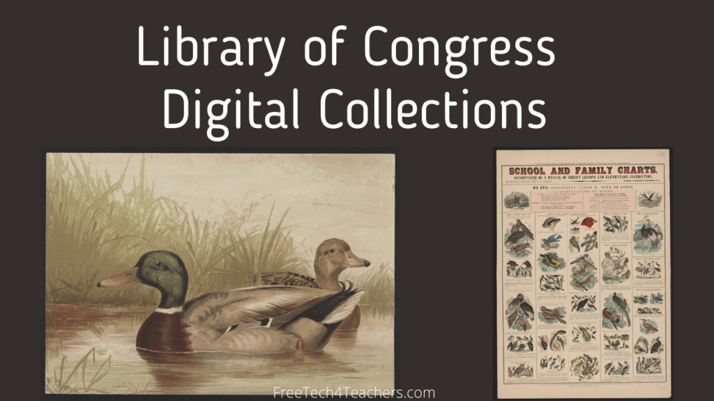
I reference the Library of Congress nearly every time that I talk or write about searching for historical maps and images. If you know where to look on LOC.gov and how to filter a search, you can find some amazing resources to use in all kinds of history lessons including overlaying historical maps onto current […]
eStory – A New Multimedia Timeline Creation Tool

Whenever I see a new timeline creation tool appear on the Internet, I can’t resist giving it a try. So when eStory appeared on Product Hunt a few days ago, I had to sign-up and test it out. eStory is a free tool that you can use to quickly create multimedia timelines. There are some […]
MHDL Lantern – Media History and Lesson Plans

The Media History Digital Library is a huge archive of books and magazines about the history film, television, and radio. The Lantern is the name of the search engine that lets you search through more than 2,000,000 pages of scanned copies of the books and magazines in the MHDL. In those books and magazines you will find reviews […]
NASA From Hidden to Modern Figures

NASA’s From Hidden to Modern Figures is an excellent resource for teaching about the women who made significant contributions to the development of NASA’s space program. The site features written and video biographies of Katherine Johnson, Mary W. Jackson, and Dorothy Vaughan who were instrumental in many of NASA’s missions including the first orbit of […]
How to Link Within Google Earth Projects

Google Earth in all its forms has been one of my favorite educational technology tools for well over a decade. The web version of Google Earth has improved significantly since its launch five years ago. One of the relatively new features of the web version of Google Earth is the ability to link to places […]
Three Great Google Maps Features for Teachers

Google Maps is one of my favorite tools to use in history and geography lessons. I’ve been using it for at least as long as I’ve been writing this blog (15 years). Like all Google products it has evolved over time and some features have gone away while others have been added. And there are […]
Take a Virtual Tour of the National Museum of Computing
98% of the press releases that are sent to me are completely worthless. Then every once in a while I get one that’s actually kind of helpful. That was the case when earlier this week I got a press release about The National Museum of Computing. The National Museum of Computing documents and celebrates the […]
Take Flight With This Library of Congress Image Collection

The Library of Congress is a great place to find historical pictures, drawings, and maps to use in lesson plans and classroom projects. Finding things on the Library of Congress’ website isn’t always easy if you only use the search function. But the LOC’s Free to Use and Reuse Sets make it much easier to find […]
Join Me on Tuesday for Search Strategies for History Students and Teachers
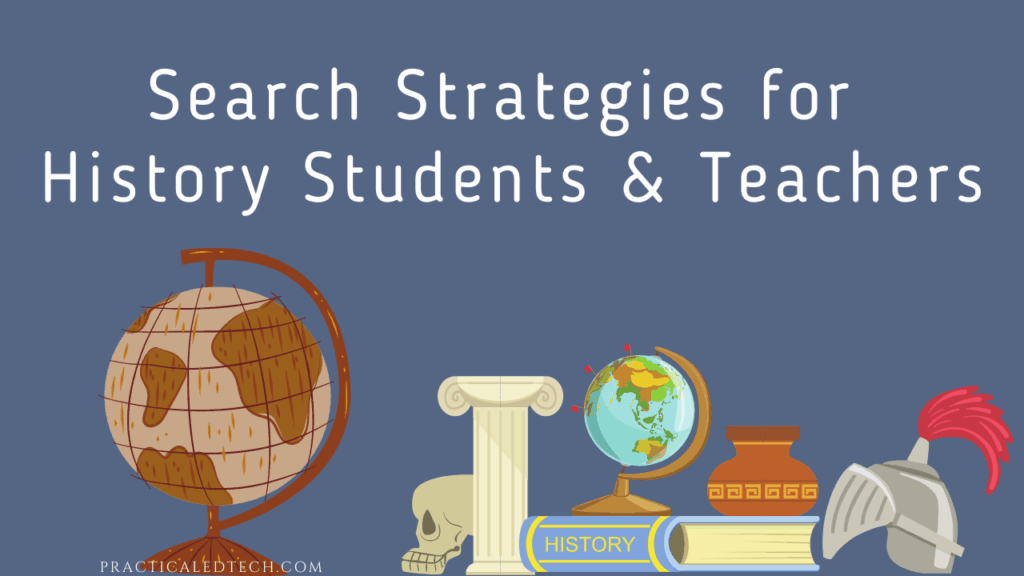
This Tuesday at 4pm ET I’m hosting a Practical Ed Tech webinar titled Search Strategies for History Students and Teachers. If a student has ever said to you, “I can’t find anything about this,” this webinar is for you! In this one hour webinar I’ll share the strategies and techniques that I’ve used with my […]
New Lesson Plans from DocsTeach
DocsTeach is one of my favorite resources for U.S. History teachers and students. The platform makes it easy to find curated collections of primary source documents and offers great templates for creating online lessons based on those documents. And if you don’t have time to make a new activity, DocsTeach offers hundreds of premade primary […]
How to Create VR Tours of Local Landmarks
I live near a little ski mountain called Mount Abram that is totally geared toward being family-friendly, affordable (seriously, my kids ski the whole season for $20!), and community-oriented. During the weekends when my kids are in lessons I like to skin up the mountain. By skinning I burn a lot calories and I get […]
Wiki History Game – A Fun Timeline Game
Wiki History Game is a free timeline game based on Wikipedia entries. I discovered it on Product Hunt last week and immediately lost about 30 minutes of my day playing the game. The game is a simple one, but an addictive one for history buffs. The premise of the game is to sort events into […]
A New Smithsonian Learning Lab Tool for History and Art Teachers

This week the Smithsonian Learning Lab released a new tool that could be very helpful to history and art teachers. The tool is simply called Canvas (no connection to the LMS of the same name). Smithsonian Learning Lab’s Canvas tool lets you build colllections of Smithsonian digitized artifacts and arrange the display of those artifacts […]
About Primary Sources
As a U.S. History teacher one my primary goals was to help students understand the past to understand where we (Americans) came from to understand how we got here and to, hopefully, avoid mistakes of the past. To that end, I frequently had students read excerpts from primary source documents. Sometimes that meant confronting language […]
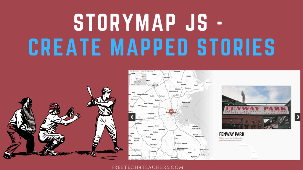
StoryMap JS – A Nice Alternative to Tour Builder
Like many teachers, I was disappointed when Google deprecated Tour Builder and Tour Creator last year. Since then in my webinar series with Rushton Hurley and on social media I’ve answered a lot of questions from teachers about alternatives to Tour Builder. StoryMap JS is one of the tools that I’ve been suggesting when asked […]
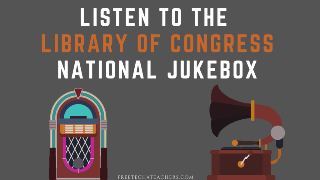
The National Jukebox – 16,000+ Early Music Recordings
The Library of Congress offers many interesting collections of digital archives including one called the National Jukebox. I first wrote about it more than a decade ago. Since then the size of the collection has expanded because more recordings have entered the public domain and because the Library of Congress has digitized more recordings. The […]
Mark Your Calendar for Three Free Smithsonian Learning Lab Webinars in January

The Smithsonian Learning Lab is a great resource that I’ve featured dozen or more times over the years. Later this month the Smithsonian Learning Lab is hosting three free webinars for teachers who want to learn more about how to use it for online and in-person instruction. All of the webinars will be livestreamed on […]
Add Comments to Word Docs to Spark Discussion

Last Monday I shared directions for using Google Drive to add comments to PDF and directions for using Formative to add questions into primary source documents. The idea in both cases is to use those tools to spark dicussion and inquiry when reading primary source documents with students. This can also be done by adding […]
Use Google Drive to Add Questions and Comments to PDFs
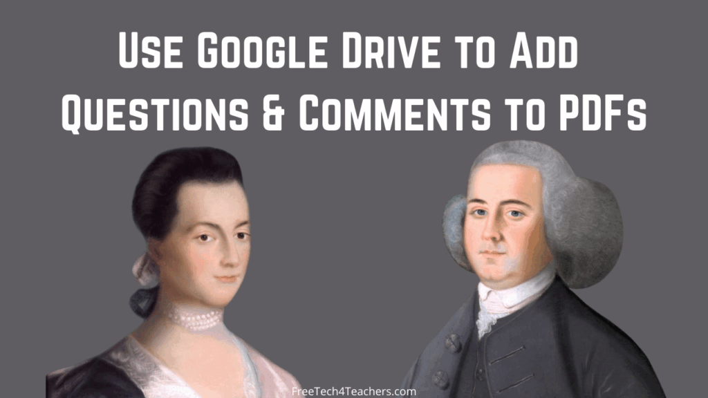
In my previous post I shared directions for using Formative to add questions to PDFs. Another option is to use Google Drive to add questions and comments to PDFs. Adding comments to PDFs in Google Drive is one of those little features that is quite handy but is often overlooked. To add a comment to […]
Use Formative to Build Questions Into Primary Source Documents
Formative is a great tool for creating all kinds of online activities from simple multiple choice quizzes to in-depth examinations for documents. One of the ways that I like to use it is to upload a document and then build questions into the document for students to answer while reading. In this new video I […]
The Story Behind QWERTY – Why Keyboards Aren’t in Alphabetical Order

Thinking back to my middle school typing class (done on electric typewriters, not computers) I remember wondering why the keyboard wasn’t arranged in alphabetical order. I was recently reminded of that when my five-year-old asked me the same question. I knew that the answer was related to the frequency of use of certain letters and […]
How to Use Seesaw to Annotate Historical Images
In my previous post I wrote about and shared a video about using Jamboard to annotate historical images. Another way have students annotate historical images is by adding their voice comments to the images. That can be done through the use of Seesaw. In Seesaw students can upload images then draw and type on the […]
How to Annotate Historical Images on Jamboard
From magnetic poetry to collaborative brainstorming sessions to mapping activities, there are lots of ways to use Google’s Jamboard in online and in-person classes. One way that I like to use Jamboard is to have students annotate images that I share with them. In particular, I like to do this to have them add commentary […]
The Future of Flickr’s The Commons
Flickr’s The Commons has been one of my go-to resources for historical imagery since I first wrote about it nearly fourteen years ago. That’s why my heart sank a little bit when I visited The Commons earlier this week and saw a note that read “learn more about the future of Flickr Commons.” Whenever I […]
Seven Ideas for Crafting Comics in History Classes
My first teaching position was as a mid-year replacement for a literature teacher who left to become the head of an ESL/ELL program in another school district. That teacher left behind a stack of comic book versions of Romeo and Juliet along with a note along the lines of “these might help with your reluctant […]
Create and Publish a Multimedia Timeline With Canva

Last week a reader emailed me looking for a suggestion for making multimedia timelines with her middle school students. My usual suggestion of Timeline JS was ruled out because her school use Office 365 and the kids can’t access Google Sheets with school accounts. My other suggestion was to try using Canva to create multimedia […]
My Big List of Resources for Teaching & Learning About American Thanksgiving

American Thanksgiving is later this week. All month long I’ve been sharing Thanksgiving-themed resources and ideas. This post combines all of them into one place. If you have school this week and you’re looking for some last-minute Thanksgiving resources, take a look through this list. The Science of Thanksgiving Foods The Reactions YouTube channel, produced […]
The Suprising Origins of Thanksgiving Foods

Yesterday morning I published blog post in which I shared an ESRI Story Map of where traditional Thanksgiving foods are grown today in the United States. That story map covers where food comes from today, but it doesn’t cover the historical origins of traditional Thanksgiving foods. That’s an interesting topic of its own. It’s Okay […]
My Big List of Activities and Resources for Geography Awareness Week

This week is Geography Awareness Week. It’s one of my favorite weeks of the year! Every year at this time I publish an updated list of some of my favorite games, activities, tools, and lessons to promote geography awareness. Here’s my updated list for 2021. The first place to start a search for geography awareness […]
Resources for Teaching and Learning About Veterans Day

Veterans Day is this Thursday. If you find yourself looking for some quick lessons to review with your students, here’s a small collection for you. ReadWorks ReadWorks is one of my favorite places to go when I need information texts about a holiday to share with students. ReadWorks has a good collection of Veterans Day […]
Unfolding History – A New Library of Congress Blog

The Library of Congress has started a new blog called Unfolding History. The blog is written by the staff of the Manuscript Division of the Library of Congress. The purpose is to highlight interesting manuscripts and their backstories or greater historical context. The first Unfolding History blog post features a couple of 1972 documents […]
How to Share Google Arts & Culture Experiences in Google Classroom

Last week Google Arts & Culture published a great online exhibit titled Walk the Great Wall. It’s a fantastic colleciton of Street View imagery and multimedia stories about the Great Wall of China. As I wrote last week, Walk the Great Wall includes detailed imagery of the bricks of the wall, short lessons about the […]
Tour the Great Wall of China – A New Google Arts & Culture Experience

After Google announced the closure of Google Expeditions earlier this year Google Arts & Culture became the place to go to find much of the virtual imagery that was available in Expeditions. The library of imagery and stories in Google Arts & Culture has steadily grown throughout the year. The latest big addition to that library […]
Transcribing Early Copyright Applications

By the People is the Library of Congress project that was formerly known as the Crowd project. The name changed at some point in the last year, but the purpose of the project remains the same. That purpose is to enlist the help of the public to transcribe historical documents housed the by the Library […]
What Does Indigenous Mean? – And Why Some States No Longer Celebrate Columbus Day

While I was reviewing videos about Canadian Thanksgiving YouTube displayed a suggested video from CBC Kids News. The video is simply titled The Word Indigenous and it provides an animated explanation of what the word indigenous means when referring to people. The video also does a great job of explaining why the word indigenous is preferrable […]
Short Lessons on Canadian v. American Thanksgiving

Monday is Thanksgiving Day in Canada. It’s about six weeks earlier than it is here in the United States. I’ve celebrated both versions of Thanksgiving and I can tell you that there are a lot of similarities between the two. There are also some differences between them. The following videos provide a humorous look at […]
Influenza Archives – A History Lesson
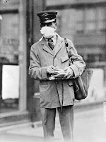
Monday’s featured artifact on Today’s Document from the National Archives was “Nurse wearing a mask as protection against influenza. September 13, 1918.” As is often the case with items in the daily feed there was a link to additional information about the image. In this case the additional information was a National Archives collection of […]
The Way of a Ship – Historical Math Problems

A couple of weeks ago I picked up an interesting book at my local library. It’s titled The Way of a Ship and it follows the journey of Benjamin Lundy as he sails around Cape Horn in 1885 in one of the last square-rigged commercial sailing boats. The Way of a Ship is full of […]
US News Map – A Great Way to Explore Newspaper Archives

Earlier this summer I shared some ideas for encouraging students to do research in digital archives. The U.S. News Map produced by Georgia Tech and the University of Georgia offers another interesting way to encourage students to explore digital archives. The U.S. News Map is based on the Chronicling America newspaper collection hosted by the […]
Three Short Lessons About Labor Day

Next Monday is Labor Day in the U.S. For most of us it is a three day weekend. It is the traditional “end of summer” in the minds of many of us. If you’re planning to answer questions about Labor Day or teach any lessons about it, here are some short videos to add to […]
Five Ways to Use Comics in Your Classroom This Fall

Disclosure: Make Beliefs Comix is a new advertiser on this site. Creating comics is one of my favorite creativity exercises.When I was a kid I loved flipping through books of Peanuts comics. Unfortunately, I could never draw as well as Charles Schultz. Today, thanks to tools like Make Beliefs Comix, you don’t have to be […]
Five Ideas for Using Comics in Social Studies Lessons

Creating cartoons and comic strips can be a fun way for students to show their understanding of events and concepts. For the student who is intimidated (or bored) by the idea of writing yet another essay or making another PowerPoint presentation, creating a comic strip is a welcome change. Here are five ideas for using […]
An Interactive Map of Historical Sites in Every U.S. State

The Traveling Salesman Problem is a website developed by William Cook at the University of Waterloo. The site features interactive maps that chart the short distance between a series of places. One of those maps is of all of the places in the United States National Register of Historic Places, all 49,603 of them.You can […]
12 Good Places to Find Historical Images to Spark Inquiry

Historical photographs, paintings, sketches, and maps can inspire all kinds of history questions. That is why for more than a decade I’ve used and recommended images from Today’s Document from the National Archives to prompt classroom discussion as the introduction to U.S. and World History lessons. There are dozens, perhaps hundreds, of other similar galleries […]
15 New Primary Source Activities from DocsTeach

DocsTeach has been one of my go-to places for U.S. History lessons since the day that I first discovered it years ago. Not only does DocsTeach host a large, curated collection of primary source documents it also offers templates for developing online activities about those documents. Additionally, DocsTeach offers hundreds of premade primary source lesson […]
How to Use Google Scholar to Learn About Inventions and Inventors

Last week I published a blog post outlining five things that students should know about using Google Scholar. One of those things is the option to search for U.S. Patent Office filings. When you locate a patent filing through Google Scholar you can read the details of the patent application, look at drawings that accompany […]
Using Google Books in History Classes

As the name implies, Google Books is a search engine for locating books. Through Google Books you’ll find books that you can read in their entirety for free and books that you can preview for free. Most importantly, Google Books lets you search for keywords within books. Searches on Google Books can be refined according […]
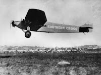
What Car Did Harry Lyon Drive? – The Answer to Tuesday’s Search Challenge
On Tuesday I shared a search challenge and wrote that you could email me if you wanted the answers to the questions in the challenge. I got a lot more emails than I thought I would. And some people I emailed the answers to wrote back asking for more details about the process of finding […]
A Timeline of Mathematics and Gödel’s Incompleteness Theorem
This week TED-Ed published a new video about Gödel’s Incompleteness Theorem. This is the latest in a long list of mathematics video lessons produced by TED-Ed. The timing of the video was perfect for me as I had planned on writing about Mathigon’s Timeline of Mathematics this week. That timeline includes an entry about Gödel’s […]
Primary vs. Secondary Sources

A couple of times this week I have written about using primary sources in history lessons and or research lessons. That has reminded me of a couple of good videos that can help students understand the differences between primary and secondary sources. The Minnesota Historical Society offers a fantastic video on the topic of primary v. […]
World History Commons – Annotated Primary Sources for Students

World History Commons offers a free collection of more than 1700 primary sources covering a wide array of themes and events in world history. The best part is that all of the primary sources in the collection are annotated with helpful notes for students. World History Commons also offers a collection of free teaching guides […]
Three Ideas for Encouraging Students to do Research in Digital Archives

Yesterday morning I wrote about the challenge of getting students to use resources like academic databases and digital archives in their research. This morning I received an email from a reader who asked if I could share an example or ideas of how to encourage students to use digital archives in their research. The following […]
Four Short Lessons About American Independence Day

American Independence Day, the Fourth of July, is tomorrow. I realize that most of you reading this aren’t in school right now, but I thought I’d share a few video lessons about the Declaration of Independence the celebration of Independence Day. Bookmark these for your lessons when school resumes in the fall. History offers the […]
Roadside America in a Story Map

The Library of Congress houses the John Margolies Roadside America Photograph Archive. That archive contains nearly 12,000 photographs of interesting roadside attractions all over the United States and eastern Canada. The collection includes pictures of things like gas stations shaped like a dinosaur, windmills that serve as ice cream stands, funky miniature golf courses, and […]
Read and Transcribe Walt Whitman’s Notebooks and Diaries

A few years ago the Library of Congress launched a crowd sourcing project called Crowd. The purpose of the project is to enlist the help of the public to transcribe thousands of primary source documents that are housed by and have been scanned by the Library of Congress. Over the years there have been collections […]
Five Activities for Teaching and Learning With Primary Sources

As a history teacher one of my favorite yet challenging things to do was introduce my students to primary sources. It’s great because it reveals to them a whole new world of research opportunities. There’s nothing better than a student saying, “wow! Mr. Byrne, look at this!” At the same time learning to read, evaluate, […]
Seven Good Tools for Creating and Publishing Online Timelines

Creating timelines has been a staple in history teachers’ playbooks since the beginning of history. Writing a timeline is a good way for students to chronologically summarize sequences of events and see how the events are connected. When I was a student and when I started teaching timelines were made on large pieces of paper. […]
Short Lessons About Memorial Day

Next Monday is Memorial Day. Students often confuse the origin and purpose of Memorial Day with those of Veterans Day. The following videos can help students understand the origins and meanings of Memorial Day and Veterans Day. The Meaning of Memorial Day is a two minute video covering the origins of the holiday in the […]
How to View Timelapse Imagery in Google Earth

This week Google made a big announcement about the introduction of new timelapse imagery to the web version of Google Earth. The imagery is part of the “Voyages” section of Google Earth. Within Voyages you’ll find the new timelapse imagery arranged into stories and collections. You can also just browse through it on your own. […]
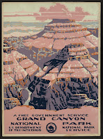
12 Good Resources for Learning About National Parks

Tomorrow is the start of National Parks week here in the United States. So I’ve put together the following list of resources to help students learn about individual National Parks as well as the park system on the whole. A Great Book About the Origins of National Parks Years ago I was camped on the […]
Spark Interest in Local History With These Digital Newspaper Archives

When I was a kid I did yard work for an elderly widow who had stacks of old newspapers magazines that she and her husband collected. Knowing that history was my strongest subject in school, she always had a new, old newspaper (and a glass of fruit juice) for me whenever I came over to […]
Ten Topics Covered in Teaching History With Technology

The next session of my popular Teaching History With Technology course begins tomorrow. There is still time to register right here. There are ten big topics that will be covered in the course. All of the lessons in the course can be applied to elementary, middle, and high school settings. These are the ten big […]
ICYMI – Intro to Teaching History With Technology – Webinar Recording

Earlier this week I hosted a free webinar titled Intro to Teaching History With Technology. In the webinar I introduced my Discovery, Discussion, Demonstration framework and how it can be applied to developing interesting history and geography lessons. More than 100 people joined the webinar. If you missed it, you can watch the recording right […]
Five Collections of Historical Maps

As I mentioned in my previous post, reading this new BBC article about the rediscovery of the first 3D map in Europe prompted me to look through my archives for collections of historical maps. Here are some collections of historical maps that I’ve featured in the past and used in my classroom and or in […]
A Video Tour of 17th Century London in 3D

This morning I read a BBC article about the rediscovery of the oldest 3D map in Europe. The map is a roughly 5 x 6.5 foot slab of carved rock. Reading that article prompted me to start looking in my archives for collections of historical maps. While doing that I came across a video that […]
Some of my Favorites – Historic Maps in Google Earth

This week is school vacation week here in Maine. I usually take this week off to go ice fishing on Moosehead Lake. Unfortunately, that’s not happening this year. Instead I’ll be “staycationing” and working on some projects around home. While on my staycation I’ll be sharing some of my personal favorite tools and blog posts. […]
ClassTools Wikipedia Timeline Generator – Create and Edit Timelines

Russel Tarr, a history teacher and developer of ClassTools.net, recently released a new template called the Wikipedia Timeline Generator. This free tool will take a Wikipedia article and generate a timeline based on that article. That’s not all it does. You can edit the entries on the timeline to correct dates, to edit the information […]
Three Good Resources for Teaching With Primary Sources

I’m currently developing a new version of my popular online course, Teaching History With Technology (you can see a preview last year’s course here). Part of that process has been revisiting collections of primary sources and some of the tools that I recommend for teaching lessons based on primary sources. Here are three of the many […]
How to Create a Multimedia Timeline With Padlet

Yesterday morning I published a list of my recommended tools for creating multimedia timelines. Padlet is one of the tools that I included in that list. The timeline templates are relatively new in Padlet so I decided to make a short video tutorial on how to use them. One of the things that I like […]
Six Good Tools for Making Multimedia Timelines

Creating timelines has been a staple in history teachers’ playbooks since the beginning of history. Writing a timeline is a good way for students to chronologically summarize sequences of events and see how the events are connected. When I was a student and when I started teaching timelines were made on large pieces of paper. […]
Wolfram Alpha for Social Studies

Trying search tools besides Google is one of the ideas that I feature in Ten Search Strategies Students Need to Know. Wolfram Alpha is one of those alternatives to Google that I frequently mention to teachers and students. Wolfram Alpha is best known as a computational search engine that can help students with questions related […]
Every U.S. Election Through 2012 Explained

The events of the last 24 hours in Washington DC have stirred emotions in nearly all of us. This morning my students wanted to talk about it in my computer science class (they know that I used to teach social studies). One of my students had heard a reference to the election of 1876 in […]
Virtually Explore America’s Quietest Roads

America’s Quietest Roads is an interactive map created by a road traffic analytics company called Geotab. The map features the quietest state or federal highway in all fifty states. They define quietest as having the least average number of vehicles traveling the road throughout the year 2015. It’s important to point out to students that […]
Vintage Travel Posters and Google Earth
The Library of Congress offers thousands of historical images and maps that students can download and reuse for free. Most of the images and maps are found in these digital collections. Some of those images are arranged in collections on the LOC site in a section appropriately titled Free to Use and Reuse Sets. It’s […]
A Virtual Tour and Videos for Learning About Breaking the Sound Barrier

Chuck Yeager died yesterday at the age of 97. He was the first person to fly an airplane faster than the speed of sound. The BBC’s article about Chuck Yeager’s passing included some archival footage of his flight in the Bell X-1 that he flew. Watching that footage reminded me of the Smithsonian Air & […]
A New Collection of 17,000+ Historical Maps and Images

Flickr’s The Commons is a great place to find all kinds of interesting historical photographs from museums and libraries all over the world. Recently, The British Library added a new collection of maps to Flickr’s The Commons. The new collection is called the King’s Topographical Collection and it contains more than 17,000 historical maps and images […]
Short Lessons on the History of Veterans Day

Veterans Day is this Wednesday. If you find yourself looking for some quick lessons to review with your students tomorrow, here’s a small collection for you. ReadWorks is one of my favorite places to go when I need information texts about a holiday to share with students. ReadWorks has a good collection of Veterans Day […]
Mapping a Thanksgiving Meal

Earlier this week in a blog post about The Great Thanksgiving Listen I mentioned that I love Thanksgiving. So please excuse me if I get carried away with posts about Thanksgiving over the next couple of weeks. Where Does Your Thanksgiving Dinner Come From? is an interactive storymap that I’ve shared in the past and still […]
Two Short Lessons on Checks & Balances

Today is election day in the United States. While the election is fresh in our students’ minds, it is a good day to review how the three branches of federal government work in a system of checks and balances. In addition to voting for President we’ll also be voting for members of the House of […]
Story Spheres – Create Immersive Audio Tours of Interesting Places

Story Spheres is a neat tool for adding audio recordings to 360 imagery. Story Spheres lets you upload short audio recordings in which you describe to viewers what they’re seeing, the history of what they’re seeing, and the significance of what’s in the scene they’re seeing. It’s possible to upload multiple recordings. When you’re done […]
Research Starters from the National WWII Museum

Last week at the end of one of my classes we were talking about how everyone was adjusting to wearing masks all day and social distancing in school. A couple of my students grumbled about it. That grumbling was met by a reply from another student who said, “Guys, it’s not that big a deal! […]
Cronobook – A Map of Historical Photographs

Cronobook is a new-to-me website that features a searchable map of historical photographs. The premise of the site is simple and using it is easy. Just head to the site, search for a location, and click on the small images to see them in full size. A little bit of information including location and […]
Good Sets of Primary Source Documents About the American Revolution and More
The Massachusetts Historical Society has a great website that hosts collections of primary sources related to the American Revolution, founding families of the United States, abolition, and the Civil War. Additionally, on the MHS site you’ll find recordings of webinars about many of the topics related to the collections of primary sources. Music of the […]
Newspaper Navigator – A New Search Tool from the Library of Congress

This week the Library of Congress launched a new search tool called Newspaper Navigator. Newspaper Navigator is an index of 1.5 million images published in newspapers between 1900 and 1963. You can search Newspaper Navigator by keyword and then narrow your results by date and or the U.S. state in which the newspaper was published. […]
Short Lessons on the History of Labor Day

This coming Monday is Labor Day in the U.S. For most of us it is a three day weekend. It is the traditional “end of summer” in the minds of many of us. If you’re planning to answer questions about Labor Day or teach any lessons about it, here are some short videos to add […]
Every U.S. Presidential Election Through 2012 Explained

Last week I featured a couple of videos about the Electoral College that Keith Hughes produced. Keith has many other excellent videos for U.S. Government and U.S. History students. One set of those videos is Presidential Elections Explained. In that set of videos Keith explains the outcomes and significance of every U.S. Presidential Election through […]
A Challenging Battles and Heritage Map Game

Geoquiz History Edition is a fun and challenging history game for history buffs. The game works like similar geography games in which you’re given the name of a place and have to place a marker on a blank outline map as close as possible to the actual location. In Geoquiz History Edition you’re given the […]
Searching the National Register of Historic Places
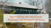
This morning I went down an Internet rabbit hole of looking for lesser-known historic places in Maine. That process started because I was looking for some geocaching activities to do in a coastal community about 60 miles from where I live. Before I knew it I was on the National Register of Historic Places hosted […]
An Easy Way to Overlay Historical Maps on Google Earth

Last fall I published a video about how to find historical maps and overlay them on Google Earth. That method works for any historical map that you have the rights to re-use whether because it’s in the public domain or because of Creative Commons licensing. There is another method that you can use. That method […]
Story Spheres – Create Audio Tours of Immersive Imagery
Story Spheres is a free tool for adding audio to 360 degree images that you own or have the rights to re-use (Creative Commons licensed or public domain). With Story Spheres you can add audio narration and ambient audio to your 360 images. Once you have a 360 image that you want to use, using […]
Explore the Royal Academy of Arts in Google’s Arts & Culture Apps

Google’s Arts & Culture site and corresponding apps make it possible for students of all ages to virtually explore thousands of fascinating landmarks and works of art. This morning Google announced a new collection with the Arts & Culture site. That collection features the Royal Academy of Arts. The highlight of the Royal Academy of […]
5 Things Students Can Do in Google Earth Without Google Accounts

Google Earth has many handy little features that your students can use even if they don’t have Google accounts. Without a Google account your students can customize the appearance of Google Earth, measure distances and areas, change the units of measurement, and share locations and Street Views with you. Of course, they can also use […]
A Handful of Video Lessons About Memorial Day

This is Memorial Day weekend here in the United States. Monday is actually Memorial Day. Students often confuse the origin and purpose of Memorial Day with those of Veterans Day. The following videos can help students understand the origins and meanings of Memorial Day and Veterans Day. The Meaning of Memorial Day is a two […]
Naraview – A Good Way to Challenge Students to Make Connections Between Topics

In last week’s episode of Two Ed Tech Guys Take Questions and Share Cool Stuff Rushton shared a neat site called Naraview. Those who stayed on for the “overtime” of the webinar got a detailed overview of the service from one of its designers. If you missed it, here’s my overview of Naraview and its […]
Two Great Sets of Historic Maps to Use and Reuse

The Library of Congress offers a collection of images that are free to use and reuse. The LOC blog recently featured a subset of that collection called Maps of Cities. Maps of Cities is one of two sets of historic maps available through the Free to Use and Reuse collection. The other set of maps […]
Homeschool History – A Podcast Series for the Family

About eight years ago there was a BBC podcast series called A History of the World in 100 Objects. It was a good series that featured short lessons about objects in The British Museum. New episodes haven’t been added in years, but the series is still available to listen to online. I mention that old […]
Free Historical Coloring Pages

If you’re looking for an offline activity that you can recommend to parents for their students to do at home, take a look at the New York Academy of Medicine’s Color Our Collections website. The site contains contributions from more than one hundred museums and libraries around the world. The participating museums and libraries offered […]
How to Measure, Share, and Download 3D Models from the Smithsonian

Last week the Smithsonian launched a new collection of nearly three million digital artifacts that you can download and reuse for free. I published a video about how to access and search through that new collection. For the sake of brevity I didn’t include everything that you can do with the artifacts in the Smithsonian’s […]
A Conversation With Tom Richey – History Teacher & YouTube Star

During winter break I caught up with my friend Tom Richey to record an episode of The Practical Ed Tech Podcast. Tom is a high school history teacher (AP Euro) and the producer of fantastic YouTube videos covering lots of topics in AP Euro, World, and U.S. History. He has more than 150,00 subscribers to […]
A Comparison of Multimedia Timeline Creation Tools – Updated
Making a timeline is a “classic” history class assignment. When I started my teaching career my students made timelines on big sheets of paper. Later I had them use some online programs that let them include some pictures and links. Eventually, we got to a place where true multimedia timeline creation tools were readily available. […]
How to Find, View, and Download Thousands of Historical Maps

There are some good historical map collections available in Google Earth. But you can also import your own historical maps into Google Earth. topoView is a good place to find historical maps that you can import into Google Earth. topoView is a USGS website that provides historical maps dating back to 1880. You can download […]
Spend July in Washington DC as a C-SPAN Fellow

Every year C-SPAN hosts an educators’ conference and hosts a summer fellowship program. A friend of mine was selected for the conference a couple of years ago and he said it was an amazing experience! Both the fellowship program and the conference are held at C-SPAN’s headquarters in Washington D.C. C-SPAN’s Summer Fellowship program is […]
The History of Comic Art
The Library of Congress currently has an exhibit on display called Comic Art – 120 Years of Panels and Pages. The exhibit is both a physical exhibit and an online exhibit. Comic Art – 120 Years of Panels and Pages has five sections. Those sections are Early Years, Mid-Twentieth Century, Late Twentieth Century, Web Comics, […]
Add Interactive Annotations to Images With a New Classtools Tool

Russel Tarr at Classtools has come up with another great little tool for teachers and students. The new Image Hotspot Generator on Classtools makes it easy to add interactive annotations to any picture that you upload to the site. The annotations that you add to your pictures can include text and links. Your annotated images […]
How to Find Historical Comics and Create Lessons With Them
A couple of weeks ago I got an email from Docs Teach that featured the idea of creating history lessons that incorporate historical comics. That email sent me to Docs Teach where there is a small collection of historical comics. Since Docs Teach is a project of the U.S. National Archives all of the comics […]
How to Create a Multimedia Map on Padlet

Last week I shared the news that Padlet now includes multimedia map creation options. Like all other Padlet layouts, the map option includes the capability to collaborate. The maps that you create on Padlet can have placemarkers that include pictures, videos, links, text, and audio files. You can even record audio and video within the […]
Collaboratively Create Maps on Padlet

Padlet has been in my list of top collaboration tools for nearly a decade. I started using it with my students back when it was still known as Wallwisher. There are many ways to use Padlet from simply providing a place to share text notes to using it as a place to collect video samples […]
How to Create a Multimedia Timeline Through Google Sheets

Timeline JS is one of my all-time favorite tools for use in history classes. It is always at the top of my list of tools for creating timelines. Timeline JS allows you to create a Google Sheet that then becomes a multimedia timeline. In your Google Sheet you can add links to pictures, maps, videos, […]
More Than 30,000 Historical Maps for Student Projects

This morning I was looking for a historical map of Mount Vernon to overlay onto Google Earth imagery. (I’m publishing a video about that later this week). I was able to find exactly what I was looking for in the historical map collection available through the Library of Congress. LOC’s online historical map collection has nearly […]
A Tool to Simulate Text Messages Between Historical Figures
One of my favorite tool on ClassTools.net is the Fake SMS Generator. The Classtools Fake SMS Generator is free to use and does not require students to register to use it. In the video below I demonstrate how to create a fictitious text message exchange between historical characters. As I mentioned in the video, the […]
My Top Twelve Tools for Social Studies Teachers and Students

Last week I published a list of my top five Google tools for social studies teachers and my top five non-Google tools for social studies teachers. If you missed either of those lists or you want all of them in one place, I’ve put together the following combined list and added two more items to […]
A New Crowdsourcing Project from the Library of Congress
Last year the Library of Congress introduced a new online project called Crowd. The project invites teachers, students, and anyone interested in history to contribute to the transcription of primary source documents. The documents are arranged in thematic collections that the LOC calls “campaigns.” This week the Library of Congress added a new campaign to […]
Crowdsourcing Civil War Document Transcription
Last fall the Library of Congress launched a new online initiative called Crowd. As the name implies, it’s a crowdsourcing project that anyone who registers on the LOC Crowd site can participate in. All of the documents in the Crowd project are documents in the LOC’s collection that need to be transcribed. The latest collection […]
NowComment – A Good Tool for Hosting Online Discussions

NowComment is an interesting tool for creating online conversations centered around shared documents. While you could do something similar in Google Docs, NowComment was designed for hosting threaded discussions and works with a wide variety of document types including PDFs and Word files. NowComment lets you upload a document then create a discussion about the […]
Multimedia Timelines as Book Summaries

A couple of weeks ago I read a fun history book titled Harry Truman’s Excellent Adventure. The book chronicles Truman’s road trip from Missouri to New York and back in the summer after he left the White House. The book strikes a nice balance between being a serious history book with being suitable for the […]
Lee’s Map of Gettysburg – And Tools for Making It Interactive

Today’s featured document featured by the National Archives is a copy of General Robert E. Lee’s map of the Battle of Gettysburg. If you download a copy of the map (which you can do as it is in the public domain) and then zoom-in on it, you will be able to see the notations about […]
Three Ways to Create a Virtual Tour of the Tour de France

Every July the Tour de France winds through the countryside before arriving in Paris. Every year the course takes a different route. One of the things that I always enjoy about watching the race is seeing all of the historic places the riders pass. NBC Sports is usually pretty good about sharing some history of […]
Quillionz – Get Quiz Questions Automatically Generated From Documents

Quillionz is a new supporter of FreeTech4Teachers.com Quillionz is a new service that makes it super easy to have a set of reading comprehension questions and quiz questions generated from a passage of text. There is a free version and pro (paid) version of Quillionz. This post is about the capabilities of the free version. […]
Teaching With Historical Newspapers – An LOC Webinar Recording

There are two sites that often refer people to when I’m asked about locating copies of old newspapers. The first is the Google Newspaper Archive. The second is the Chronicling America collection from the Library of Congress. The Chronicling America collection contains more than 2,600 digitized copies of newspapers printed in the United States between […]
DocsTeach Adds Good Artifacts for Teaching About the Transcontinental Railroad
DocsTeach has long been one of my go-to recommendations for teachers of U.S. History. DocsTeach provides a wealth of digitized primary source artifacts that can be incorporated into lessons for elementary school, middle school, and high school students. You can search for those artifacts according to era in U.S. History, according to artifact type (text, […]
How to Make an Animated Timeline in Google Slides

Eighteen months ago I published a video about how to use Google Slides to create a timeline. Yesterday, that video hit 50,000 views. I watched the video again and realized that I could use the animation tools in Google Slides to add animations to my timeline. So yesterday I made a video about how to […]
Ten Great Tech Tools for Social Studies Lessons

Over the last decade I’ve written about a lot of excellent resources for social studies lessons. Over time some of those tools have faded away and others have moved to the forefront of my top recommendations. Here’s my current list of ten top tools for social studies lessons. Timeline JS Timeline projects as as old […]
Woodrow Wilson’s Mother’s Day Proclamation and the History of Mother’s Day
According to President Woodrow Wilson’s proclamation in 1914, the second Sunday in May is Mother’s Day in the United States. As the second Sunday in May is approaching, the U.S. National Archives recently featured President Wilson’s proclamation in the daily documents feed. That document can be used as part of the Emergence of Modern America […]
An Interactive Map of English Myths and Legends

Thanks to the Maps Mania blog I just learned about English Heritage’s Map of Myth, Legend, & Folklore. The interactive map feature a couple of dozen historical sites that under the care of English Heritage. As the name of the map implies, each of the sites on the map is basis for a myth or […]
5 Google Earth Pro Tips for Teachers and Students
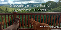
Google Earth is currently available in a few different versions. There is the web browser version that was built for use in Chrome and Chromebooks. There is an iOS version and an Android version for use on tablets and phones. And then there is the original version made for use as desktop software on Windows, […]
5 Tips for New Google Expeditions Users

Image copyright: Richard Byrne Google Expeditions is often the first educational virtual reality tool that I introduce to teachers who come to one of my workshops. Here are five tips that I frequently pass along to teachers who are preparing to use Google Expeditions for the first time. If you have never used Expeditions, you […]
Langscape – An Interactive Map of Languages

Langscape is an interactive map created at the Maryland Language Science Center. The Langscape interactive map displays more than 6,000 markers representing more than 6,000 languages. Each marker represents the native language of that location. Zoom-in and click on a marker to learn more about the language. When you click on the marker you will […]
Make Trading Cards for Historical and Fictional Characters
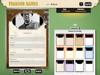
Read Write Think Trading Cards is a free tool that students can use to create trading cards about people, places, and events both real and fictional. You can use it in your web browser, as an Android app, or as an iOS app. In this video I demonstrate how to use Read Write Think Trading Cards in […]
The Story of the United States Told in 141 Interactive Maps
Manifest Destiny – The Story of The U.S. Told in 141 Maps is a great website developed by Michael Porath. As you probably guessed from the title of this blog post, the site features 141 interactive maps chronicling the expansion of the United States from March 1789 to August 1959. When you click on any of the […]
Tom Richey Explains Tariffs

Tom Richey’s YouTube channel is a must-subscribe for AP history (European and U.S.) students and their teachers. He regularly posts engaging lectures about a wide variety of topics in that are integral to developing an advanced understanding of European and U.S. History. He also hosts live review sessions on his YouTube channel. Tom’s latest video […]
Getting Started With the Smithsonian Learning Lab
The Smithsonian Learning Lab allows teachers to create and search for documents, images, videos, interactive animations, and lesson plans from a wide range of Smithsonian-hosted resources. It also lets you create collections to share with others as well as create assignments to give to your students. The video playlist embedded below teaches you how to […]
Students Can Create Their Own Tours to Share in Google Expeditions
Googles’ Tour Creator launched last spring and since then has become one of my favorite tools for history and geography classes. One of my few complaints about it was that while students could easily build virtual reality tours, it wasn’t always easy to share those tours with their teachers and classmates. That is about to […]
5 Good Tools for Creating Timelines
The video I posted earlier this week that demonstrated how to use Canva to create timelines sparked a couple of reader emails about other options for making timelines. Specifically, one reader was looking for tools that would support video playback and one was looking for a tool that didn’t require students to have email accounts. […]
Picture Yourself in Front of Any Landmark With Remove.BG and Google Slides

Last weekend I published a video about Remove.bg and it has certainly been a hit with many readers. I’ve received a lot of comments and questions about it in my email, Facebook pages, and on Twitter. This morning a reader named Marni sent me a question that was typical of what I’ve been seeing this […]
How to Use Canva to Create a Timeline
Canva is one of those great tools that the more time you spend with it the more cool features you discover in it. One of those features is the ability to create timelines to save as images and PDFs. Canva has about a dozen timeline templates that you can modify by altering the text size […]
Introduction to Using Google Expeditions in Your Classroom

Google Expeditions is one of my favorite virtual reality apps for students and teachers. The app provides hundreds of virtual reality experiences for students. There are VR experiences that can be used in social studies, science, and art classes. The guide mode in Expeditions is fantastic for pacing activities inside of the app. Rather than […]
17 Lessons in Teaching History With Technology

This coming Monday evening (7pm ET) I am hosting Teaching History With Technology on PracticalEdTech.com. This course meets five times (once per week). There are seventeen concepts that are covered in the course. Each concept can be applied to the creation of technology-infused history lessons. The concepts covered in the course are listed below. Using […]
A Handful of Resources for Learning About Veterans Day

This Sunday is Veterans Day (many places will observe it on Monday). The following resources can help students understand the origins and meaning of Veterans Day including how it is different from Memorial Day. Bet You Didn’t Know: Veterans Day. The video explains the origins of the holiday and why its date of celebration has […]
Two Online Primary Source Document Activities for High School Students
Earlier this week the Library of Congress launched a new crowdsourcing project called Crowd. The project seeks volunteers to transcribe primary source documents that are available online through the Library of Congress. Crowd is similar to the Smithsonian’s Digital Volunteers program. Both programs provide an opportunity for high school students and some middle school students […]
LOC Crowd – Crowdsourcing the Transcription of Primary Sources

The Library of Congress has launched a new crowdsourcing initiative to transcribe primary source documents. The new initiative simply called Crowd has contains collections of documents that the Library of Congress wants the public to help transcribe. Anyone can participate in the LOC’s Crowd project. To get started simply go to the site and click […]
ClassTools SMS Generator – Text Messages Between Historical Figures

Last week I wrote about three ways that students can create social media profiles for historical and literary characters. Writing that post reminded me of the Classtools Fake SMS Generator. You could have students use the Classtools SMS Generator to create simple conversations between historical characters as way to get them to think about those […]
A New LOC Online Collection – Theodore Roosevelt’s Papers

I have always found Theodore Roosevelt to be one of the most fascinating characters in U.S. History. That is why I was excited this morning when I saw an email from the Library of Congress announcing the online publication of Theodore Roosevelt’s papers. The LOC’s collection of Theodore Roosevelt’s papers is divided into sixteen sections. […]
Case Maker – Civics Lessons Built on Primary Sources

Case Maker is a free service designed for middle school social studies teachers and their students. Case Maker uses primary sources from the Library of Congress as the basis of activities in which students have to build a case in response to real civics scenarios. For example, the first cast that I tried was about […]
A Fantastic Virtual Tour of the Houses of Parliament

CNN recently published a fantastic virtual tour of the Houses of Parliament or the Palace of Westminster, to be more precise. The narrated, self-guided tour lets viewers explore ten aspects of the Houses of Parliament including the House of Commons, the Robing Room, and the Members’ Lobby. Within each of the ten parts of the […]
8 Tools for Making Multimedia Timelines

Creating timelines has been a go-to activity for history teachers since the beginning of history. When I made timelines as a student and in my first year or two of teaching, timelines were made on paper. Today, there are better ways to have students create timelines. In fact, in Teaching History With Technology I feature a couple […]
How to Make a Timeline Through Google Sheets
Earlier this week I wrote about Flippity’s new timeline creation template for use in Google Sheets. The template lets you create a multimedia timeline by simply entering information into a spreadsheet and then publishing it to the web. There are a couple of quirks to using the template that should be noted before you have […]
The Online Atlas of the Historical Geography of the United States

The Digital Scholarship Lab at the University of Richmond hosts the Atlas of the Historical Geography of the United States. This online atlas contains more than 700 historical maps of the United States. The maps within the atlas are arranged into eighteen sections. As a student and teacher of history I was drawn to the sections […]
5 Multimedia Projects for Social Studies Classes
If you teach social studies and you’re looking for a new project to engage your students this year, I have some suggestions for you. All of the following ideas can be modified for use in elementary school, middle school, or high school settings. Create Virtual Tours Services like Google Expeditions are great for locating virtual […]
Find & Read Old Newspapers Through the Google Newspaper Archive
Yesterday’s blog post about the Chronicling America collection of digitized newspapers prompted Daniel Bassill to ask me about options for newspapers printed after 1963. My suggestion was to try the Google Newspaper Archive. In that archive you will find hundreds of digitized copies of newspapers printed around the world. In the archive you fill find […]
Photo Roulette – A Library of Congress Game
Photo Roulette is a fun little game from Library of Congress. The game shows you a randomly selected pictures from the LOC’s digital collections and you have to guess the year in which the picture was taken. You have ten guesses before you’re out of luck. After the submission of each guess you’re given a […]
A Timeline JS Timeline of Wall Street

Timeline JS is one of my favorite tools for social studies teachers and students. It’s one of six excellent storytelling tools produced by Knight Lab at Northwestern University. Timeline JS lets anyone create a multimedia timeline by entering data into a Google Sheets template. It’s used by teachers, by students, and by media companies like […]
Discover Primary Sources by Browsing the World Digital Library Maps

The World Digital Library hosts more than 19,000 primary documents and images from dozens of libraries around the world. Hosted by the Library of Congress and sponsored in part by the United Nations Educational, Scientific and Cultural Organization, the mission of the World Digital Library is to promote the study and understanding of cultures. The WDL can be searched by date, […]
A Few Good Videos for Learning About Memorial Day

Memorial Day in the United States is ten days away. Many students associate the day with with barbecues, parades, and a day off from school. But that’s not what Memorial Day is about. As we know it’s a day to honor those who died in service to our country. Some students may confuse the day […]
Great Journeys and Explorations – Stories Told With Interactive Maps and Timelines

Ever since I was an elementary school student I have loved reading about great journeys and explorations like those of Lewis and Clark, James Cook, and Robert Peary. As an adult I still love those stories and recently started reading The River of Doubt for a second time. Picking up that book reminded me of […]
History and Literature Text Messages
ClassTools.net is one of my favorite places to find templates for online activities for middle school and high school students. One of the templates on ClassTools.net that I’ve recommended for years is the Fake SMS Generator. Watch my following video to learn how to use the SMS Generator on ClassTools. Applications for Education You could […]
Headlines and Heroes – A New Resource from the Library of Congress

The Library of Congress offers many excellent online resources for teachers and students. Even just following the LOC’s Twitter account will provide you with fun history facts. In fact, it was through that Twitter account that I learned about a new Library of Congress blog called Headline and Heroes: Newspaper, Comics & More Fine Print. […]
Sourcera for Google Slides – Historical Images to Use In Your Slides

Sourcera is an Add-on for Google Slides that lets you search for historical images and insert them directly into your slides. Sourcera pulls images from eleven sources including Flickr’s Commons, the British Library, and the Digital Public Library of America. To find an image through Sourcera you need to highlight a word on a slide […]
Docs Teach Adds New Primary Sources About WWI

Docs Teach is a fantastic resource for US History teachers that I have shared many times over the years. I like it so much that I include it in my Teaching History With Technology course. Docs Teach provides teachers with access tools for creating online lessons based on collections of primary source documents. Docs Teach […]
Find the Features of Digital Vaults in DocsTeach

The U.S. National Archives used to have a great feature called the National Archives Digital Vaults. The Digital Vaults site offered great tools for teaching with primary sources from the National Archives. One of the aspects that I particularly liked was called “pathways challenges” which allowed students to see the connections between events and primary […]
5 Good Resources for Teaching and Learning About the American Revolution
This coming Monday is Patriots’ Day. It is an official state holiday here in Maine, in Massachusetts, and in Wisconsin. The day commemorates the Battles of Lexington and Concord. As a New Englander this is a good day to review some good resources for teaching and learning about the American Revolution. History Animated has an […]
An Animated Map of the Rise and Fall of Communism

The Spread of Communism is an animated map that shows the rise and fall of communism from 1917 through 2017. When you visit the map you can press the play button in the lower, right corner to play the animation. When it plays the animation highlights each country according to the year in which a […]
How Inventions Change History
This evening I was looking back at some resources that I have for teaching about Eli Whitney and the cotton gin. Included in that list was a YouTube video that demonstrated how the cotton gin worked. Next to that video I found a TED-Ed lesson titled How Inventions Change History (For Better or Worse). The […]
7 Options for Creating Timelines Online – An Updated Comparison Chart
Making timelines is a go-to activity for many social studies teachers. When I made timelines as a student and in my first year or two of teaching, timelines were made on paper. Today, there are better ways to have students create timelines. In fact, in Teaching History With Technology I feature a couple of my […]
Three Tools for Combining Maps With Timelines

Creating timelines whose events are directly connected to a map display is a good way for students to see correlations between locations and events. Here are three tools that students can use to create mapped timeline stories. StoryMap JS comes from the same people that offer Timeline JS. On StoryMap JS you can create mapped stories. […]
Two Simple Timeline Creation Tools That Are Frequently Overlooked
This morning I answered an email from a reader who was looking for a suggestion for a timeline creation tool. My recommendation was to try Timeline JS which is my favorite tool and is featured in my Teaching History With Technology course. But there are many other ways to create timelines. Two of those ways […]
The History of the State of the Union Address

Tonight, President Trump delivered the State of the Union Address. This post is not about what he said or didn’t say tonight. Instead, it is intended to share some resources that could help you teach your students about the history of the State of the Union Address. The following two videos from CNN and Fox […]
Important News About Adobe Spark

Adobe Spark is a great tool for making videos, storytelling websites, and simple graphics. It has been popular since its launch a few years ago. Also since its launch there have been many questions about whether or not it can be used with students under the age of 13. For while Adobe’s guide for educators […]
An Updated Version of Google Earth Released

Thanks to the Google Earth Blog I just learned about the release of an updated version of Google Earth Pro. Google Earth Pro (it’s free despite the “pro” designation) is the desktop version or “classic” version of Google Earth. The latest version includes thirteen improvements to Google Earth Pro. You can see the full list […]
5 Ways to Use Comics in Social Studies Lessons

Creating cartoons and comic strips can be a fun way for students to show their understanding of events and concepts. For the student who is intimidated (or bored) by the idea of writing yet another essay or making another PowerPoint presentation, creating a comic strip is a welcome change. Here are five ideas for using […]
X Degrees of Separation – The Connections Between Artworks

The big news over the last few days about Google’s Arts & Culture app has focused on people using the app to find their doppelgangers in the museum collections digitized by Google. While it is a neat feature, there are other Google Arts & Culture experiments worth trying. One of those is called X Degrees […]
Virtual Tours of Ancient and Modern Greece

Google Earth, Google Maps, and Google Expeditions all provide good ways for students to see the sites of Greece. But if you would like your students to find a bit more detail about those sites, the National and Kapodistrian University of Athens has an excellent resource for you. The National and Kapodistrian University of Athens […]
Eight Lessons in Teaching History With Technology

A couple of month ago I launched an on-demand version of my popular Teaching History With Technology course. So far more than 50 people have completed the course. The question that almost everyone asks before they enroll in the course is, “what’s covered in the course?” That’s a fair question to ask so I published […]
5 Ed Tech Tools Social Studies Teachers Should Try This Year

On a regular basis I receive emails from teachers that go something like this, “we recently got new (insert hardware here) for our students and I was hoping you could tell me which tools I should try in my (academic area X) class.” To answer that request for social studies teachers I put together the […]
10 Ways to Use Google Earth in Your Classroom – Best of 2017

As I do during this week every year, I am taking some time off to relax and prepare for the new year. Every day this week I will be featuring the most popular blog posts of the year. This one of the most popular posts in May. A couple of weeks ago Google released the […]
Social Studies Teachers, This Is For You!

Back in November I released my popular Teaching History With Technology course in an on-demand format. It has proven to be a popular format as more people have participated in the on-demand course in December than in all of the combined live versions of the course offered earlier in the year. If you would like […]
VR Hangar – A VR App from the Smithsonian Air and Space Museum

VR Hangar is a new virtual reality app produced by the Smithsonian National Air and Space Museum. This free virtual reality app is available to use on Android phones and on iPhones. VR Hangar contains three virtual reality tours that feature landmark moments in aviation history. Those moments are the Wright Brothers’ first flight, Chuck […]
A Multimedia Timeline of WWII in Europe
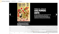
Last week I shared National Geographic’s excellent multimedia timeline of the Pacific Theater of WWII. National Geographic offers a similar timeline of the European Theater. While the title of the timeline is World War II in Europe, it does include include events that happened in Africa and some events in the United States. The timeline […]
Smithsonian Learning Lab Announces Most Popular Resources of 2017

The Smithsonian Learning Lab is a great tool for organizing collections of resources available through the Smithsonian. Through the Learning Lab you can search for and then gather together documents, images, videos, interactive animations, and lesson plans. This playlist of videos will show you everything that you need to know in order to use the […]
A Multimedia Timeline of WWII in the Pacific
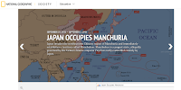
As any good student of history can tell you, the Pacific theater of World War II was just as complicated as the European theater. National Geographic has a multimedia timeline that can help students understand the sequence and significance of events in the Pacific theater. World War II in the Pacific is a timeline that […]
Free Wall Maps for Your Classroom
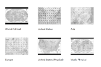
Like good manners and flannel shirts, wall maps never go out of style. If you need some new maps to put on the walls of your classroom, take a look at the free maps that National Geographic offers. Nat Geo Map Maker kits provide teachers with files for printing wall maps, table top maps, and […]
View the Evolution of Digital Technology
Thanks to Larry Ferlazzo’s recent Ed Tech Digest post I just took a little trip down memory lane. In his post Larry mentioned the Washington Post’s What Tech World Did You Grow Up In? timeline. Enter your birth year at the top of the timeline and it will display to you how digital technology has […]
Apply for a C-SPAN Fellowship

Next summer might feel like it is a long way away, but it’s not too early to start thinking about how you’ll spend your next summer break. Social Studies teachers in the United States might want to consider spending part of the 2018 summer as a C-SPAN fellow in Washington, D.C. The C-SPAN Teacher Fellowship […]
Three Puzzle Templates That Help Students See Content Connections
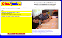
Russel Tarr publishes a lot of great educational games and instructional templates on ClassTools.net. Among those templates are three activities designed to help students see the connections between events, people, places, and ideas within a subject. The Class Tools Hexagons Generator lets you create an online hexagonal learning activity to share with your students. To use the […]
Two Good Tools for Creating Interactive Timelines

Earlier this week I received an email from a reader named Ashley who wrote, “My classes have been reading Girl in Hyacinth Blue, a reverse chronology of the history of an art work. I would like them to do an interactive timeline to show their understanding of the text. I have never done something like […]
Use the ClassTools Power Search to Find Educational Games
ClassTools.net is one of my favorite places to find free educational games and templates for creating educational games. Russel Tarr, a history teacher and developer of ClassTools, has made so many games that the site now needs a power search function. You can use this search function to find games and templates according to the […]
Play Your Dates Right – A Fun History Game

Play Your Dates Right is another great game template developed by Russel Tarr at ClassTools.net. The concept of Play Your Dates Right is that students have to pick the correct sequence of three historical events. The event in the middle of the game template is always the event that actually did come second. Students have […]
Built to Last – Bubbl.us Mind Mapping

Bubbl.us is the third entry into my Built to Last series. This is a weekly series featuring the educational technology products and concepts that have lasted as long as I have been writing Free Technology for Teachers which will be ten years in November. See the first two entries in the series here and here. […]
51 Resources for Constitution Day
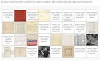
This coming Sunday is Constitution Day in the United States. That means that schools have to include some type of lesson related to the Constitution either today or Monday. Last week I shared a few resources for Constitution Day lessons. If you’re still looking for some Constitution Day resources, take a look at the collection […]
Membit – Augmented Reality Photo Maps
Membit is a neat augmented reality app for use on iPhones. The app lets you place view images superimposed over the current backdrop that you see through your phone’s camera. For example, you could open the app, point your camera at a building, and then see an image of what the building used to look […]
Share Your Sutori Timelines in Google Classroom

Sutori, formerly known as HSTRY, is a great tool for creating multimedia timelines. One of its best features is the option to include quiz questions within a timeline that you share with your students. For the new school year Sutori has added a Google Classroom integration. You can now import your Google Classroom rosters into […]
The Berlin Job – And the Rise and Fall of the Berlin Wall
The Rise and Fall of the Berlin Wall is a TED-Ed lesson that was released last week. It’s a fine primer on the basics of the Berlin Wall, but it is not anything that on its own is going to wow a history teacher. After watching the TED-Ed video I went back into my archives to […]
The History Project Has a New Name

The History Project is a great tool for creating multimedia timelines. This morning I went to use the service and noticed that it’s name has changed to Enwoven. I can still log-in using my credentials for The History Project. All of the tools for making and publishing multimedia timelines that were found in The History […]
Historical Patterns Animated
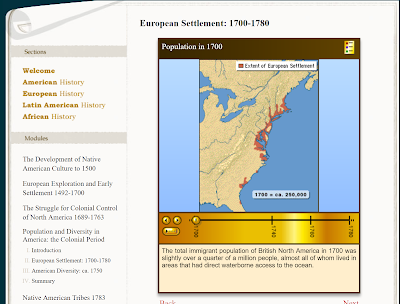
Some of my favorite social studies lesson plans included having students use maps to analyze data and identify patterns in history. Over the years I’ve done this with paper maps and digital maps. One neat digital map source is Mapping History which is produced by the University of Oregon that features animated maps illustrating problems, […]
View and Print in 3D More Than 200 Objects from The British Museum
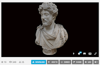
The British Museum collection on Sketchfab contains 252 3D models of artifacts in The British Museum’s collections. You can view these models in 3D in your web browser or in a virtual reality viewer. (To view the models in your browser your browser needs to support WebGL, you can test your browser here). If you […]
View and Print 3D Models of Smithsonian Artifacts
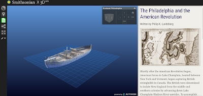
Smithsonian X 3D (SIx3D) offers a neat way for students to learn about artifacts from the Smithsonian museums. The site is the result of a collaboration between Autodesk and the Smithsonian Institution. More than artifacts are currently featured on Smithsonian X 3D. The artifacts can be viewed as 3D models that you can virtually manipulate. Many […]
Front Row Offers Differentiated Resources for Social Studies Instruction

Front Row has developed a great reputation over the last couple of years for the differentiated math and ELA resources that it offers to teachers and students. This week at ISTE 17 I sat down with the CEO of Front Row to take a look at the new social studies resources that Front Row is […]
A Comparison of Historic Journeys
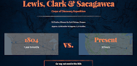
I’m writing this as I zoom through the air at 500+ miles per hour to get home after ISTE 17. Just 100 years ago this trip would have been on a train for days. And 100 years before that the journey would have be counted in weeks and months. That kind of comparison is what […]
7 Good Tools for Creating Timelines – From the Archive
Due to an injury and some pressing personal matters requiring my attention, posts for the rest of the week will be favorites from the archive. Timeline creation is a go-to project for many history teachers. When I made timelines as a student and in my first year or two of teaching, timelines were made on […]
The History of Mother’s Day

Happy 1st Mother’s Day to Jess. Isla’s awesome mom! Happy Mother’s Day to all of the moms reading my blog today! Hi Mom! (Yes, my mom reads my blog). Until today I never really wondered about the origin of Mother’s Day. So I did what most people do when they wonder about something now, I […]
How to Find Old Maps Online

In yesterday’s Practical Ed Tech Live episode I answered a question about where to find old maps to layer in Google Earth. One of the resources that I suggested was Old Maps Online. Old Maps Online is a map that you can browse and search to find historical maps to view online, to download, and […]
10 Ways to Use Google Earth in Your Classroom
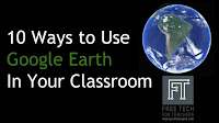
A couple of weeks ago Google released the new web-based version of Google Earth (take a tour of it here). The older desktop version of Google Earth is still available for free as well. The advantage of the web-based version is that anyone with a Chromebook or laptop can use it. The disadvantage to it […]
Learn How Venice Works – And Take a Virtual Tour Through It

The Amazing Race is one of the few television shows that I try to catch when new episodes air. This week the show was in Venice. Watching this week’s episode of The Amazing Race in Venice reminded me of a couple of neat resources for learning about the city. Venice Backstage is a seventeen minute […]
5 Good Resources for Teaching and Learning About World War II
This morning I went to the World War II museum in New Orleans. It is a fantastic museum. The museum does a masterful job of mixing artifacts and oral histories into the greater context of World War II. And for folks like me who are fascinated by aircraft the Boeing center is a great place […]
GE Teach Tour Builder – Create Google Earth Tours for the Web
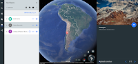
GE Teach is a fantastic project developed by Josh Williams. Josh and his students were some of the first to use the new version of Google Earth in a classroom. In fact they used it before it was available to the public. (Click here for a video overview of the new Google Earth). The new […]
Words of the World – Learn the Origin of Words
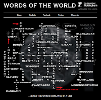
Words of the World is another excellent set of videos from the same people that brought us the popular Periodic Table of Videos. Words of the World is a collection of videos featuring historians and linguists explaining the origins of and history of the use of words in the English language. The videos attempt to put the […]
Lighthouses and Designs for Democracy
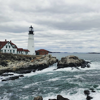
Earlier this week the featured document from the U.S. National Archives was a drawing of the Matinicus Rock Lighthouse on the coast of Maine. The drawing is one of many in the Designs for Democracy series published by the National Archives. Designs for Democracy is an online exhibit created by the National Archives and Records Administration. The […]
The Wayback Machine – Take a Look at the Evolution of the Web

The Internet Archive’s Wayback Machine is one of the resources that I have included in my presentation about search strategies and fake news. I include it because it is a tool that can be used to see how a website or a specific webpage has changed over time. As is demonstrated in my video embedded […]
Storymap JS – Tell Stories With Maps

The New York Times has a new feature called Harriet Tubman’s Path to Freedom. The feature is a presented in scrolling map format. The map is combined with a timeline format that shows the sequence of and locations of significant moments of Tubman’s work in freeing herself and helping other slaves escape. Harriet Tubman’s Path […]
Use Historical Images to Spark Discussions
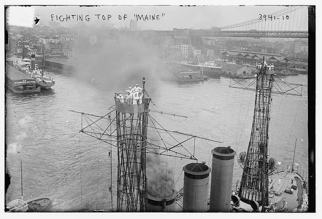
One of my favorite ways to spark students’ interest in a history lesson is to have them look for interesting historical images. I’ve found that interesting images can prompt good conversations which in turn lead to good questions for my students to research the answers to. One of the ways that I’ve carried out those […]
CommonLit Added a Guided Reading Mode for Students
CommonLit is a free service that offers a large collection of fiction and nonfiction texts paired to reading questions. You can create a classroom on CommonLit in which you can monitor your students’ progress through the texts that you assign to them. Recently, CommonLit added a new feature that they call Guided Reading Mode. When […]
Take a Virtual Tour of Petra In Google Cardboard or In Street View

Last year Google added a virtual tour of Petra to its collection of landmarks that you can see in-depth in Google Maps Street View. This week that tour was updated for viewing in Google Cardboard VR headsets. Much of the imagery used in the tour was captured by a Street View Trekker camera. Take a […]
15 Tools for Teaching History With Technology – Best of 2016
As I usually do during this week, I’m taking some time off to relax, ski, and work on some long-term projects for the next year. This week I will be re-publishing the most popular posts of 2016. One of the things that teachers often ask me for is a set of tools to get them […]
Explore Maps of Historical Sites in Every U.S. State
The Traveling Salesman Problem is a website developed by William Cook at the University of Waterloo. The site features interactive maps that chart the short distance between a series of places. One of those maps is of all of the places in the United States National Register of Historic Places, all 49,603 of them.You can […]
Online Activities for Teaching With Primary Sources
As a history teacher I have a natural attraction to old maps, dusty documents, and all manner of primary source media. While it is a passion for me, I fully recognize that learning to read, evaluate, and utilize primary sources can be long process for some students. The following are some of the online activities […]
One Image Inspires a Lesson
This is a guest post from Rushton Hurley. Rushton is the founder of Next Vista for Learning, a great place to find and share educational videos. Imagine starting class without saying anything. The students look at you, awaiting something. You wait long enough to catch their attention, and then project this image in front of […]
Two Good Sets of Animated Maps for U.S. History Students
Creating my earlier post about resources for learning about Pearl Harbor prompted me to revisit a couple of animated maps of U.S. History. History Animated is a resource that I first started using with students in 2009. History Animated provides animations of battles of the American Revolution, the War of 1812, the US Civil War, and US Campaign in […]
HSTRY is Now Sutori

Over the last couple of years HSTRY has become a popular multimedia timeline creation tool. One of its best features is the option to include quiz questions in the timelines that you share with your students. Over the weekend HSTRY rebranded itself as Sutori. Other than the name, nothing else has changed on the platform. […]
World Population History – An Interactive Map and Timeline
Last night on the Practical Ed Tech Facebook page I shared a post from Randy Krum that included a visualization of U.S. population growth. Watching that visualization led me to a related visualization about world population growth. World Population History is an interactive map and timeline of the world’s population growth from 1 C.E. to […]
Pic4Carto – Find Creative Commons Images Based on Location
There are plenty of places to find public domain and Creative Commons licensed pictures on the web. Some of my favorite places were featured in this post on Practical Ed Tech. Pic4Carto is an interesting site that I will probably add to that list in the future. Pic4Carto is a site that lets you browse […]
A Brief History of Timezones

When I signed into Facebook this morning I was greeted by a notice that on this day in 1883 the railroad industry in North America began using the four timezones that are still in use today. Upon reading that notice I immediately remembered a TED-Ed lesson on the topic. Where did timezones come from? What […]
5 Good Tools for Creating Multimedia Timelines
On Friday I shared a post about using HSTRY.co to create multimedia timelines that include quiz questions for students. HSTRY is just one of a handful of excellent tools that students can use to create multimedia timelines. In the playlist embedded below I provide directions for using HSTRY as well as five other timeline creation […]
How to Create Multimedia Timelines on HSTRY.co

HSTRY is a multimedia timeline creation tool that I’ve been a fan of since it launched a couple of years ago. One of the features that makes it different from other timeline tools is that you can build quiz questions into your timeline. HSTRY also offers a collaboration option for students and teachers to use […]
Avalon Project + Google Docs = Guided Introduction to Primary Sources
Last night in the #SSChat on Twitter I shared one of my go-to methods for introducing students to reading and analyzing primary source documents. That Tweet received a bunch of likes and other responses. What I shared was, “I use the Avalon Project + Google Docs with high school US history students for primary source […]
#TeacherDebate – A Live Lesson About the 2016 U.S. Presidential Election
Next week on Tuesday night Keith Hughes, Tom Richey, and Nicholas Ferroni will be conducting a mock Presidential debate on Google Hangouts. Keith will represent Clinton’s positions. Tom will represent the positions of Trump. And Nicholas will be the moderator. The event will be streamed and recorded on Keith’s Hip Hughes History channel. Learn more […]
Harvest of History – The History of Farming in North America
Harvest of History is a website produced by the Farmers’ Museum in Cooperstown, New York (also the site of the Baseball Hall of Fame). Harvest of History is designed to help students and teachers explore the origins and development of modern farming practices. The basis for Harvest of History is to explore the question, “where […]
How to Use Google Scholar to Track Product Developments

Last week I wrote about how students can use Google Scholar to track product developments and innovations over time. In the video embedded below I provide more details on how students can use Google Scholar and Google Patents to trace the history of a product’s development. We’ll cover topics like this one and many more […]
A Brief History of the Cuban Missile Crisis
No unit of study about the Cold War is complete without including the Cuban Missile Crisis. The latest TED-Ed lesson provides students with a five minute overview of the moments of the Cuban Missile Crisis. The History of the Cuban Missile Crisis explains why the Soviet Union wanted to place nuclear weapons in Cuba, the […]
Trace Product Developments Through Google Scholar Patent Search

Last week I was on Facebook chatting with an old friend about an older friend of ours who passed away almost a decade ago now. His name was Steve Gibbs and he owned a successful business that manufactured archery products. Steve’s company sponsored me when I was attempting to make the 2000 U.S. Olympic Archery […]
View 3500+ Art Exhibitions Online
Thanks to Open Culture I have just learned about the Museum of Modern Art’s new website that showcases artwork from the more than 3500 exhibitions that have been held at MoMA since its founding in 1929. MoMA’s Exhibition History site lets you browse through the highlights of every exhibition that has ever been on display […]
7 Good Tools for Creating Timelines
Timeline creation is a go-to project for many history teachers. When I made timelines as a student and in my first year or two of teaching, timelines were made on paper. Today, there are better ways to have students create timelines. In their web browsers and in stand-alone iPad and Android apps students can create […]
Students Can Collaboratively Create Timelines on HSTRY
HSTRY is a neat timeline creation tool that I’ve been a fan of since it launched a couple of years ago. One of the features that makes it different from other timeline tools is that you can build quiz questions into your timeline. This week HSTRY added another nice feature in the form of collaboration. […]
A Couple of Short Lessons About Labor Day
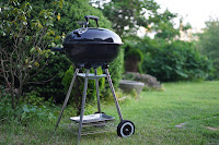
Labor Day marks the unofficial end of summer in North America. Schools that started in August had a long weekend and the rest will start this week. If you’re looking for a short explanation of Labor Day to share with students, take a look at the two videos below. History of the Holidays is a […]
How to Create a Map and Timeline Mashup

myHistro is a free multimedia timeline creation tool. When you create a timeline on myHistro each event that you add can be simultaneously displayed on a map on the same screen. Every event that you add to your myHistro timelines can include pictures and videos. On myHistro you can build a personal timeline or build […]
Running Reality – Mapping the Rise and Fall of Nations
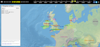
Running Reality is an ambitious project that is attempting to build an interactive map and timeline of the rise and fall of nations throughout history. Currently, you can visit Running Reality and choose a date or range of dates on the timeline to see a map of nations around the world at that time. Alternatively, […]
7 Free Timeline Tools Compared In One Chart
Earlier this year I published a chart in which I compared the core features of six online timeline creation tools. The History Project is a new tool that I’ve featured twice in the last week so I updated my comparison chart to include it. My complete chart of comparisons of seven timeline creation tools for […]
How to Create Multimedia Timelines
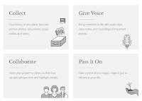
Late last week I wrote a blog post about The History Project which is a site for collaboratively creating multimedia timelines. The History Project includes an audio recording tool that you can use to talk about events in the timelines that you create. I received a couple of questions about that recording feature so I […]
Collect, Customize, and Share Resources from Smithsonian Learning Labs
Late last year I wrote a post about The Smithsonian Learning Lab which is a fantastic tool for organizing the thousands of digital resources available through the various Smithsonian museums. The Smithsonian Learning Lab allows teachers to create and search for documents, images, videos, interactive animations, and lesson plans. In June the Smithsonian put forth a revamped version […]
The History Project – Like Storycorps With Timelines

The History Project is a new multimedia timeline tool funded in part by The New York Times. Larry Ferlazzo tipped me off to The History Project and I gave it a try this afternoon. The History Project lets you upload your own pictures or import pictures from social networks to add to your timeline. Each […]
Recording History With Students – Tools & Ideas

Over the weekend at the Native Innovation Education conference I facilitated a short workshop titled Recording History With Students. The focus of the workshop was on helping students record interviews with their elders. We started out by looking at the great questions list offered by StoryCorps. We then moved on to using the StoryCorps.me app, […]
10 Resources for Teaching With Primary Sources – Best of 2015-16 School Year
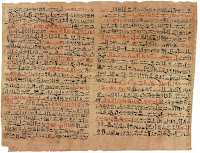
All of this week I am on the road working with teachers in Texas, Kansas, and Arizona. Rather than scrambling to write blog posts at the end of each day, I’m taking this time to feature some of the most popular posts and new tools of the 2015-2016 school year. I’m looking forward to next […]
The Origin and Meaning of Memorial Day

Memorial Day is on Monday. Here are a couple of quick resources that you may want to include in a lesson about Memorial Day. The Meaning of Memorial Day is a two minute video covering the origins of the holiday in the United States. The video is embedded below. The U.S. Department of Veterans Affairs offers […]
More Than 100 Sets of Primary Source Documents for Students
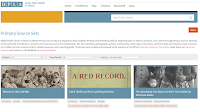
A few years ago I wrote a post about searching through the Digital Public Library of America to locate primary source documents to use with students. At that point the DPLA had relatively few, loosely organized collections. Yesterday, I received an email from DPLA informing me that they now have more than 100 primary source […]
Four Ways to Explore the News Through Maps
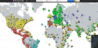
One of the things that I like about CNN Student News is that it almost always includes a map to show students where a story is taking place in the world. I try to do the same whenever I teach current events by showing students a map of where a story takes place. It can […]
Teaching History With Technology – An Online Course Starting Monday
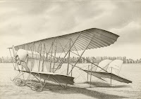
Next week I’m starting a new version of an online course that I’ve offered a few times in the past. Teaching History With Technology is an online course designed to help you learn and develop new ideas for using technology in your history, civics, or geography lessons. Some of the things that you can learn […]
5 Online Activities for Teaching With Primary Sources
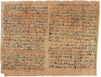
As a history teacher one of my favorite yet challenging things to do was introduce my students to primary sources. It’s great because it reveals to them a whole new world of research opportunities. There’s nothing better than a student saying, “wow! Mr. Byrne, look at this!” At the same time learning to read, evaluate, […]
Try the Google Newspaper Archive to Locate Old Articles and Images
Earlier this week I shared the U.S. News Map which is a database of newspapers that displays search results on a map of the United States. The U.S. News Map is limited to the years of 1836 to 1925 and is limited to U.S. newspapers. The Google News Newspaper archive offers a larger selection of newspapers […]
A Mapped & Searchable Archive of American Newspapers
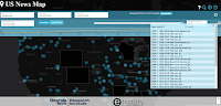
The U.S. News Map is a great resource produced by Georgia Tech and the University of Georgia. The U.S. New Map is an archive of American newspapers printed between 1836 and 1925. You can search the archive by entering a keyword or phrase. The results of your search will be displayed on an interactive map. […]
Mapping the Emerald Isle – An Interactive Map of Surnames in Ireland

Happy St. Patrick’s Day! Today, is a perfect day to share a neat interactive story map produced by ESRI. Mapping the Emerald Isle: a geo-genealogy of Irish surnames is an interactive map depicting the distribution of Irish surnames across Ireland according to the 1890 census. To use the same simply select a name from a […]
The Contest for Human Flight – Interactive Timeline
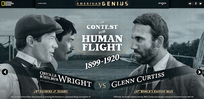
Last night I started watching American Genius on Netflix. American Genius, produced by National Geographic, features the stories of American inventors and innovators who were competing in the same field. The first episode that I watched was The Contest for Human Flight about the competition between the Wright brothers and Glenn Curtiss. National Geographic has […]
How to Use Google’s My Maps in Your Classroom
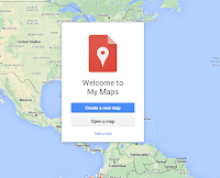
This morning at the NCTIES 2016 conference I facilitated a short workshop on using Google Maps and Google Earth in the classroom. Both tools are so robust that it is hard to cover everything you can or could do with them in just 90 minutes. To support the workshop I have a bunch of additional […]
Six Timeline Creation Tools for Students Compared In an Updated Chart
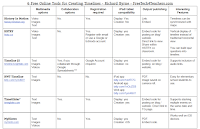
Last August I published a chart in which I compared the core features of six online timeline creation tools. Since then one of the tools, Dipity, seems to have gone offline. In its place I now feature History In Motion which allows students to create timelines that are synchronized with placemarks on a map. My […]
5 Good Google Tools for Social Studies Students
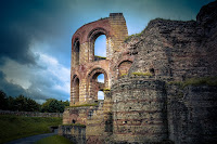
This evening I gave a short webinar presentation on my five favorite Google tools for social studies teachers and students. The webinar was hosted by the New England ISTE group. The content of key elements of the webinar are outlined below. Besides what you see featured below we also looked at Google’s Ngram Viewer. 1. […]
How to Clip & Share Sections of Google Books

Earlier this week at the TCEA conference in Austin, Texas I ran a short workshop about Google Books. One of the things that we did in that session was clip and share sections of free Google ebooks. In the video embedded below I demonstrate how to clip and share sections of free Google ebooks. Applications […]
Gojimo – A Great App for Self-paced Test Prep

Earlier today I had the opportunity to test out a study app called Gojimo. Gojimo was initially developed by a student for students. Gojimo offers thousands of free practice tests for students of high school age. Students can find practice tests for topics in science, math, history, geography, economics, and language arts. The app was […]
ReadWorks Offers Articles, Question Sets, and Videos About Martin Luther King, Jr.

Next Monday is Martin Luther King, Jr. Day. ReadWorks has put together a collection of articles, videos, and question sets for teaching about Martin Luther King, Jr. Like all articles and question sets found on ReadWorks this one is indexed by reading ability. The videos in the collection were provided by History. Applications for Education […]
PBS World Explorers – The Lives & Journeys of Famous Explorers

PBS World Explorers is a new collection of videos from PBS Learning Media. The PBS World Explorers collection includes sixteen short videos about famous explorers throughout history. Some of the explorers featured in PBS World Explorers include Leif Ericson, John Cabot, and Zheng He. You’ll also find the usual suspects in the collection including Marco […]
Dozens of Great PowerPoints for AP History Students & Teachers
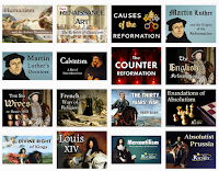
As I do every year, I am taking this week to relax, recharge, and ski with friends. While I’m away I will be re-running the most popular posts of the year. This was one of the most popular posts in November, 2015. As I’ve mentioned in the past, Tom Richey produces great instructional videos for […]